

Storms are likely today. Even more than yesterday! Rainfall amounts will be spread unequally and without reliable ETAs. Looks like most if not all of us will get something. It’s a Wattery, with many more winning numbers than usual.
- Best guess is storms forming after lunch and getting here late afternoon. Maybe earlier!
- They’ll be strongest during the evening rush hour as cells respond to peak heating along a sagging front dropping from the Ohio Valley.
- Sunset will weaken storms with the loss of daytime heating propping them up.
- Lightning likely.
- Occasional gusty / straight line damaging wind possible. Hail? Meh-be. But no tornadoes.
- Localized flash flooding possible.
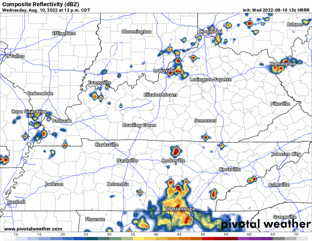
Below is the 13z run of the HRRR, time stamps upper left. This model hasn’t had a great week, but it’s doing a good job of illustrating the general pattern.
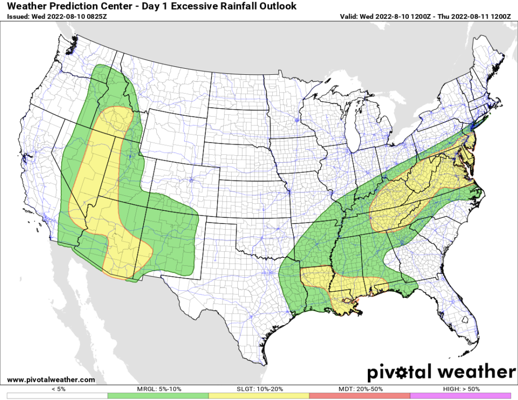
Rainfall may be excessive. WPC says 10% to 20% probability of a flash flooding event within 25 miles of you today.
I know some of you want to know if your outdoor event will be cancelled. No one wants to know the answer to that question more than I do. I suppose I could lie to you and guess at it but that would be unvaluable conjecture. We’re all going to have to live with the frustration of uncertainty.
Rain/Storms are possible Thursday but think those will be south of I-40 and probably south of Williamson County.
No rain Friday through the Weekend. On Friday, humidity starts to drop. Saturday and Sunday will be low-humidity, glorious summer days.
Quick References:
Weather changes constantly.
Follow @NashSevereWx on Twitter for any changes to this forecast.
Live coverage during tornado and severe thunderstorm warnings.

Look good.
Support the mission.

We are 100% community supported. No ads. No subscription fees. Keep it free for everyone.


Categories: Forecast Blogs (Legacy)
You must be logged in to post a comment.