
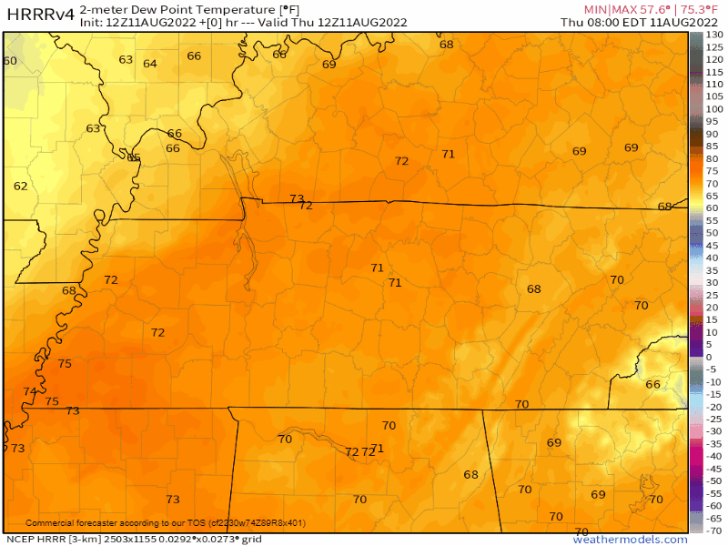
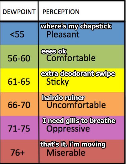
70°+ dewpoints are oppressive and we’ve been stuck swamping in them for weeks. Including this morning.
SOON, THEY GONE!
First, we have to dodge a few mid-day downpours:
- HRRR model has more showers (see below).
- NAM3 and other convective models have fewer showers covering less of us.
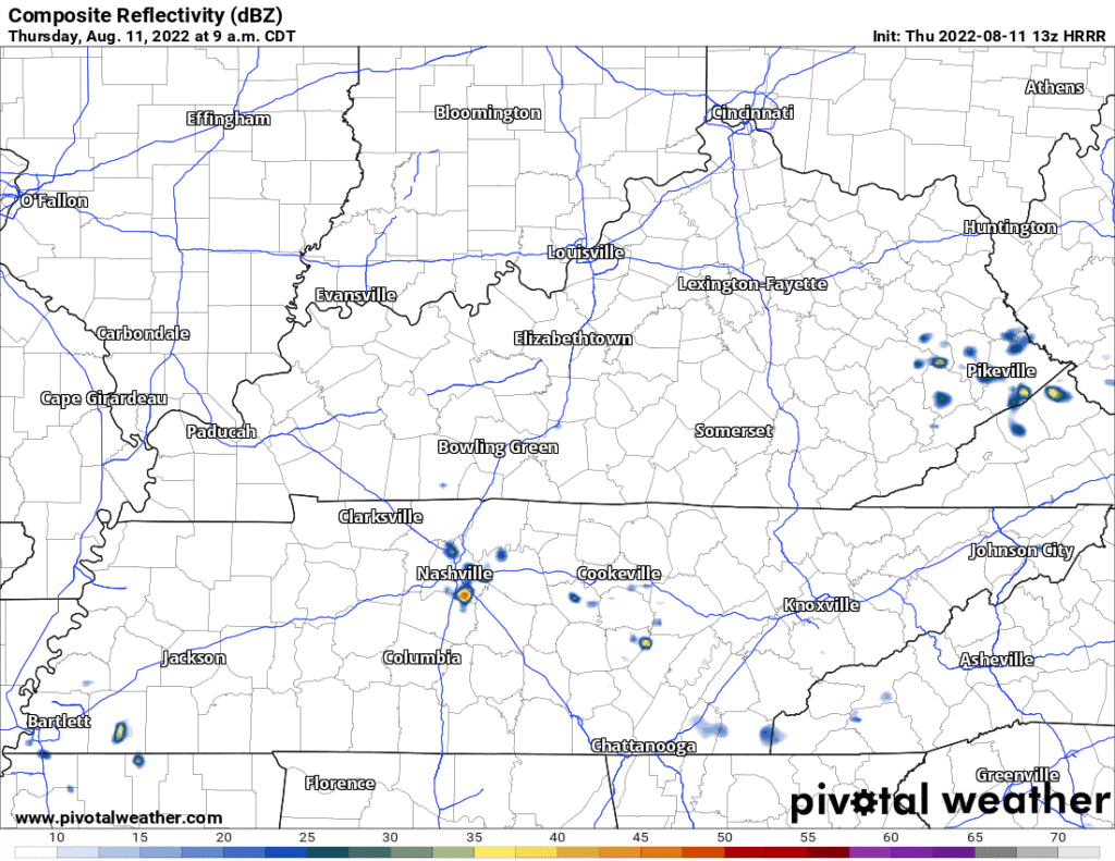
- Cannot totally rule out a few lightning strikes but think this is mostly a rain event, and only for some of us.
After today, it won’t rain much for a while.
- Humidity will drop. It’ll take a while for north winds to deliver that crisp(er) air from Indiana and Ohio.
- By Saturday you’re going to be doing popular tik-tok things with your friends.
- Watch the swamp get pushed out:
- We go from Oppressive to Comfortable/Sticky for at least about a week or so.
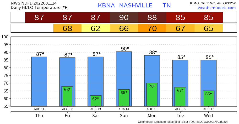
Check out those cool low temps:
Humidity will jump to Sticky on Monday ahead of a few incoming disturbances.
- This will make a few showers possible each day, but look meh.
- The disturbances will deliver another front that will reinforce the low-humidity summer days.
- Techy explanation:
A couple weak disturbances will ride along the flow which could help trigger some isolated to scattered storms on Monday and Tuesday. The Tuesday disturbance will drag another surface cold front with it giving us another brief shot of slightly cooler and drier air for Wednesday and Thursday.
NWS-Nashville, AM Forecast Discussion, 8/11/22.
Long range everything looks chill. Even the tropics appear quiet, let’s keep it that way.
Sure, a second, third, and fourth Summer of ’22 will be along down the road, but for now let’s just look down at our shoes.
Quick References:
Weather changes constantly.
Follow @NashSevereWx on Twitter for any changes to this forecast.
Live coverage during tornado and severe thunderstorm warnings.

Look good.
Support the mission.

We are 100% community supported. No ads. No subscription fees. Keep it free for everyone.


Categories: Forecast Blogs (Legacy)
You must be logged in to post a comment.