
Humidity is a up a bit today but nothing like it was last week.
Models have a few inconsequential showers around Middle Tennessee today but none here locally and nothing that would impact outdoor plans.
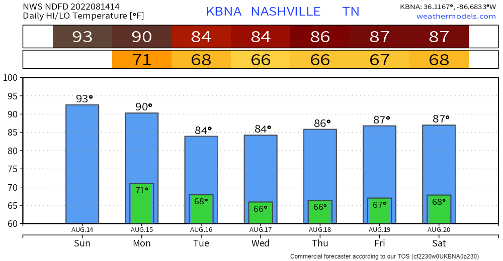
We will cook under 90°s for another two days. On Monday night a north wind blows in cooler, drier air.
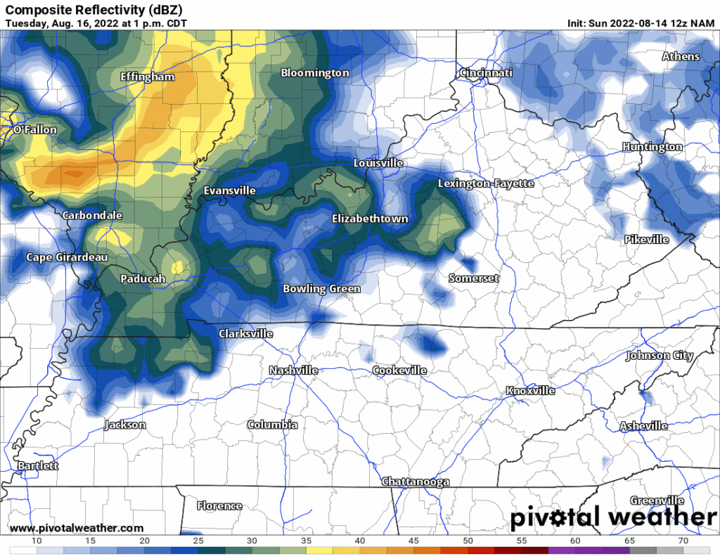
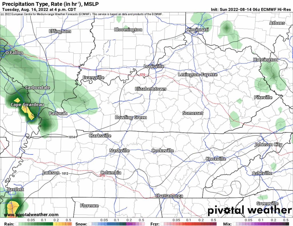
Tuesday through at the least the end of the week, models show disturbances aloft riding overhead that could cause a few downpours and thunderstorms. These wouldn’t be the typical summertime pop ups. They’ll be seen in the models, but the problem is the models disagree where the rain will go. For example:
- The NAM model loves our rain chances late Tuesday into Wednesday morning:
- But the Euro does not:
We will be looking toward the W/NW for upper level disturbances riding various waves to see if they’ll ride over us. There are no ETAs, but, generally speaking: our rain chances increase later in each day.
Quick References:
Weather changes constantly.
Follow @NashSevereWx on Twitter for any changes to this forecast.
Live coverage during tornado and severe thunderstorm warnings:

Look good.
Support the mission.

We are 100% community supported. No ads. No subscription fees. Keep it free for everyone.


Categories: Forecast Blogs (Legacy)
You must be logged in to post a comment.