

Rain and storms are likely today but the question is when?
- The overnight models were all convinced storms would form mid/late afternoon and last into early evening.
- Latest NAM/HRRR models have the afternoon quiet with storms forming after dark.
- It makes more sense that they would form late afternoon to dark, say like around 4 PM to 8 PM. We’ll see.
Storm hazards today/tonight:
- Heavy rain in spots, with flash flooding possible; WPC has a 10% to 20% probability of flash flooding within 25 miles of you
- CG (cloud to ground) lightning
- Low probability of damaging straight line winds in a few isolated spots
- I suppose we could see some small hail but that’s also unlikely
- Not worried about tornadoes.
Rainfall should be heavy in spots but unevenly spread, like what happened yesterday thanks to @SoccerMoses:
Everyone on the interstate was winning the Wattery in that moment. Thank you Soccer Moses!
Wednesday
Same as Tuesday:
- Unequally distributed storms forming late afternoon and extending into the evening
- Heavy rain (10% to 20% probability of flash flooding within 25 miles of you), lightning main hazards
- Can’t rule out isolated damaging winds and small hail
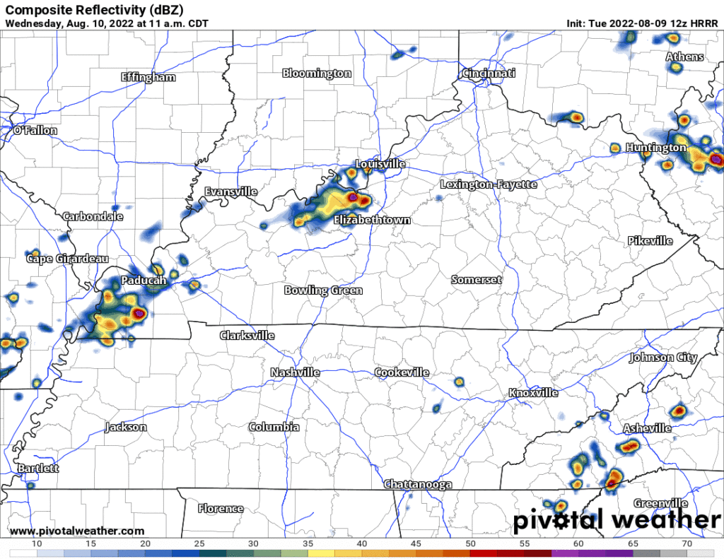
- Below you see the 12z run of the HRRR laying it all out (time stamp upper left):
Glorious Summer Weekend
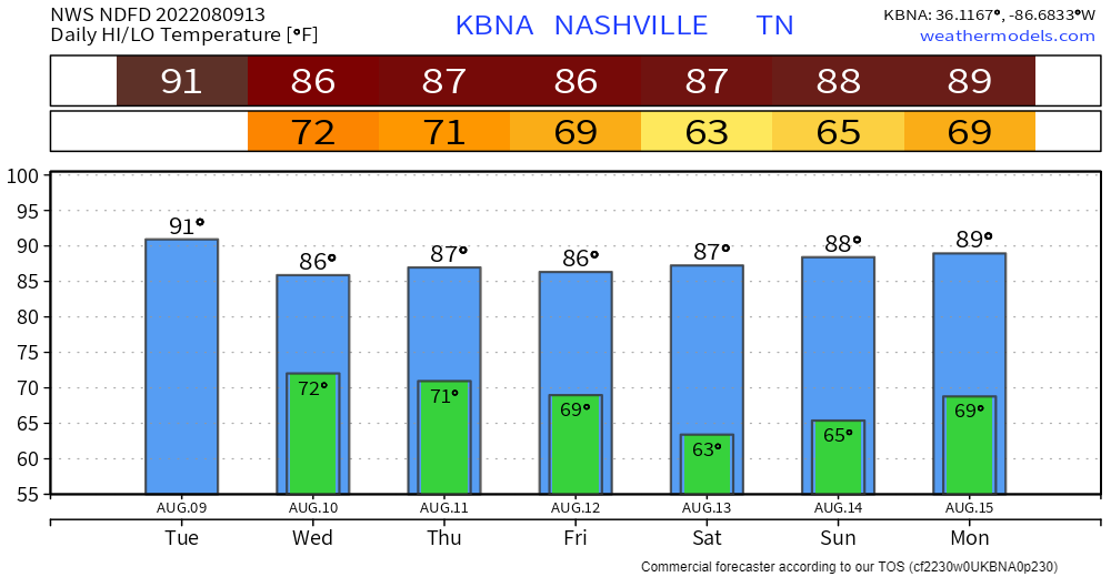
Rain chances end mid-day Thursday. Humidity starts to slowly drop Friday. Still going upper 80°s for temps but dewpoints will drop into the lower 60°s creating a near perfect summertime weekend.
Humidity and rain chances return next week.
Quick References:
Weather changes constantly.
Follow @NashSevereWx on Twitter for any changes to this forecast.
Live coverage during tornado and severe thunderstorm warnings.

Look good.
Support the mission.

We are 100% community supported. No ads. No subscription fees. Keep it free for everyone.


Categories: Forecast Blogs (Legacy)
You must be logged in to post a comment.