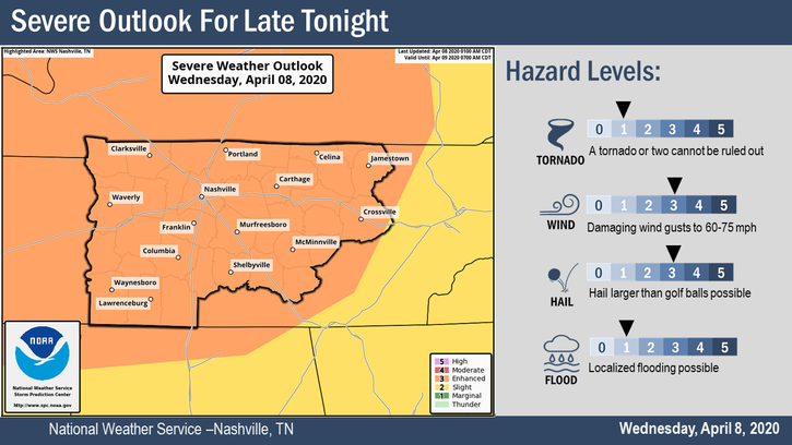
Our severe weather risk has been upgraded and could very well be upgraded again later today by the Storm Prediction Center. We are looking at a damaging wind and large hail event for tonight through the early morning hours. A tornado is less likely, but possible. read more
We’ve got a few spotty showers making their way across Middle Tennessee this morning and into the afternoon. Some of us may see some wet pavement in a few spots, but barely registering in any rain buckets.read more
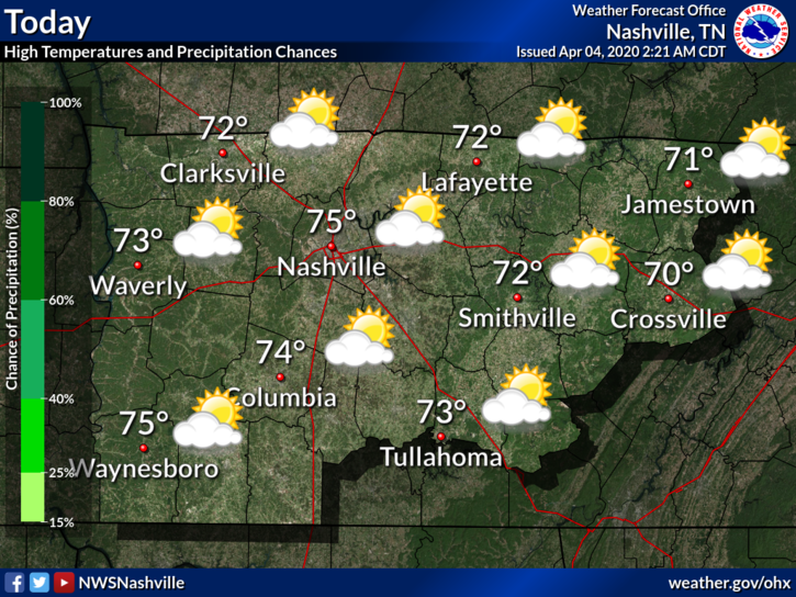
Mostly sunny, highs Sunday (today) 77°, and 79° Monday.
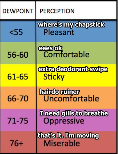
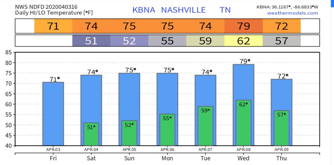
Humidity will rise each day this week. Dewpoints in the low 60s Tuesday and Wednesday.
Rain, Potential Storms Return Tuesday
Models believe it’ll rain Tuesday.
A specific ETA is unknown because although models agree it’ll rain, they aren’t sure when. Rain could begin as early as Tuesday morning or as late as Tuesday afternoon, and should clear out by Wednesday morning. The rain should come in short waves with no expected rainouts, but, on Tuesday night . . . read more
We have a few light showers to our northwest. A sprinkle or two that may or may not reach us before noon. Other than that, expect clouds and a high near 75°F.
Cloudy for Sunday, Low Rain Chances
The warm trend continues. High temperature is about the same for Sunday. Chance of showers will linger but will be low.read more
Plenty of sun today, 71° the afternoon high. If you look at radar you’ll see showers in west Tennessee moving east, but models do not think they’ll get here.
Saturday is almost the exact same, a little warmer at 74°. read more
Thursday’s high reaches 66° with mostly sunny skies. Copy and paste this for Friday, but with a high temp of 77°.
This was me reading this forecast.
Weekend Showers?
Saturday starts partly sunny, then a light rain system moves close by Saturday night and Sunday. It may or may not produce local rain. Models think the system is weak, lacking rainmaking and storm-making ingredients. Some of us may get a little rain, no washout.read more
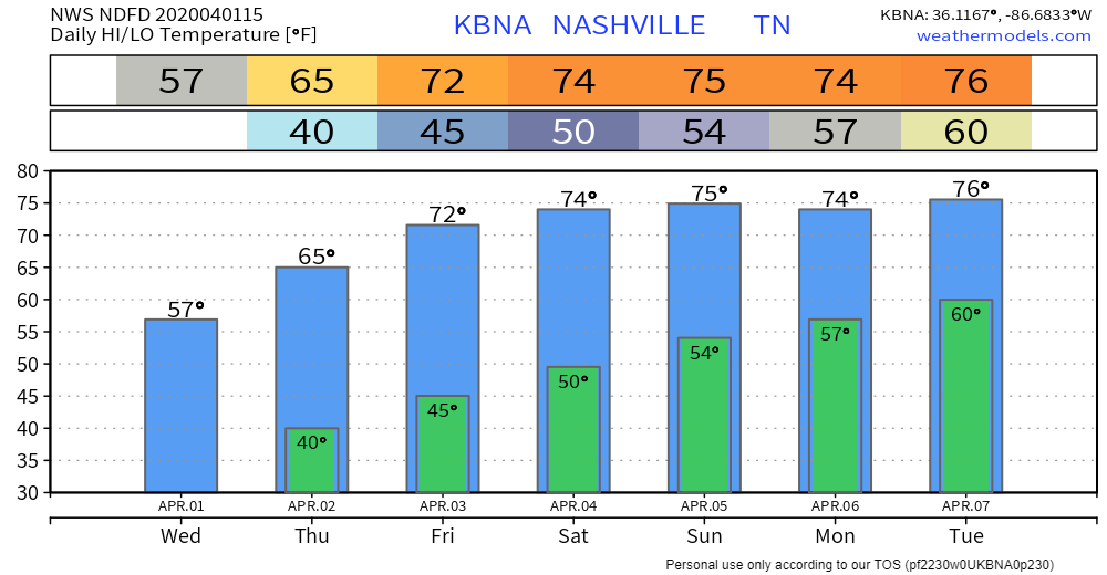
Today, after a chilly morning, the sun will warm us up to 57° as north winds attempt to keep things relatively cool.
The main story is a gradual increase in temperatures under a mix of clouds and sun. No rain in expected until this weekend. More on that in a bit.read more
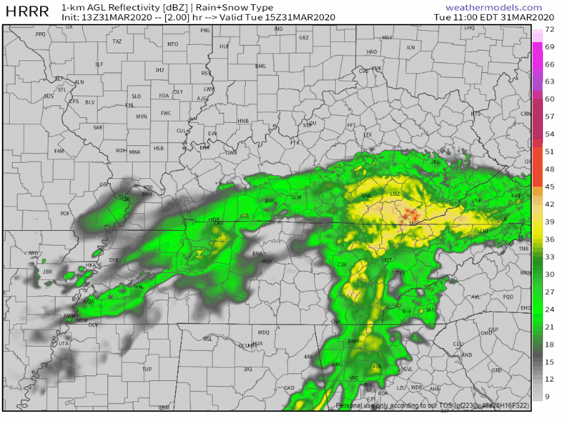
Our early morning round of rain dropped about a half inch of rain across our counties leaving us with a soggy feel to the day. At the time of this writing, another round of mainly light rain is incoming from the west. HRRR thinks this will be the last blob of the day with mainly scattered showers after that. HRRR through 1:00 a.m.:read more
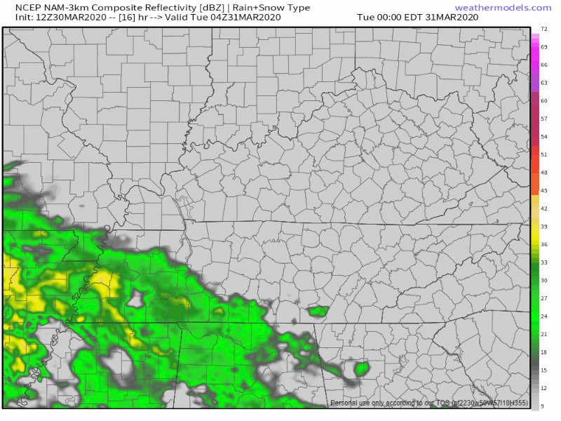
Rain begins to push in from the West and South early Tuesday morning hours. The NAM3 model thinks rain will last all day. Nothing severe, just gloomy and soggy.read more
Subscribe to Blog via Email
Privacy & Cookies: This site uses cookies. By continuing to use this website, you agree to their use.
To find out more, including how to control cookies, see here:
Privacy Policy


You must be logged in to post a comment.