
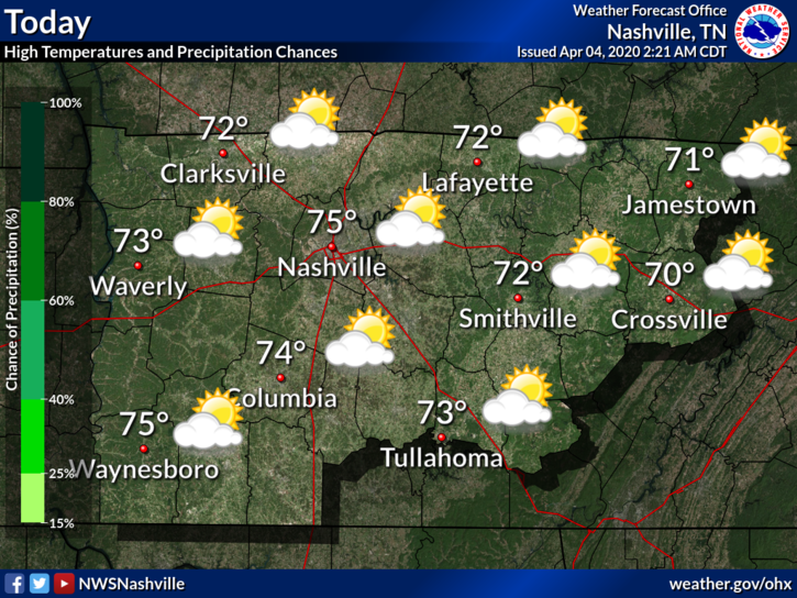
AM Showers Dissipate, Cloudy but Pleasant
We have a few light showers to our northwest. A sprinkle or two that may or may not reach us before noon. Other than that, expect clouds and a high near 75°F.
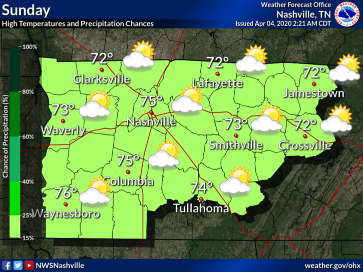
Cloudy for Sunday, Low Rain Chances
The warm trend continues. High temperature is about the same for Sunday. Chance of showers will linger but will be low.
A Look at Next Week
Monday looks to be a wet start to next week. This will be accompanied by an approaching warm front. High temperatures next week should begin to climb into the upper 70°s and possibly low 80°s.
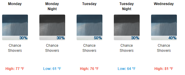
Tuesday is still looking to be the best chance of rain.
In spite of weak upper ridging, Tuesday will give us our best opportunity for convection. Still, in the absence of any sharp features that would help focus some of this moisture, QPF`s associated with this system are relatively low. Model soundings do suggest modest amounts of instability, but probably not enough to produce more than isolated thunderstorms amongst more widespread showers.
NWS Nashville Forecast Discussion, 04/04/2020
Despite warm temperatures and model suggestions of instability, severe weather is not expected. The most we might see is a few isolated thunderstorms within the more widespread showers.
Remember to check back here for updates to the forecast and be sure to follow us on Twitter @NashSevereWx!

Categories: Forecast Blogs (Legacy)
You must be logged in to post a comment.