
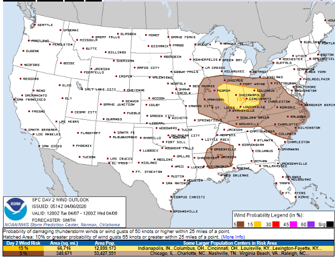
Storms are more likely Wednesday, less likely Tuesday.
Tuesday’s “Meh” Storm Risk
No/few storms Tuesday thru 7 PM per HRRR model:
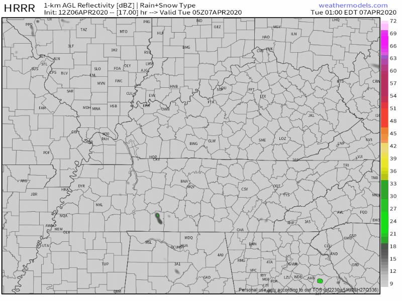
Models are quiet Tuesday night. Storms show up on the NAM3 model around sunrise Wednesday morning but those look weak.
Tuesday’s 5% risk is there in case storms can get going. But it doesn’t look like storms can get going. No front will arrive to kick off storms. There should be a strong “cap” (a layer of warm air aloft) preventing storm formation.
Concern level: we’ll watch it, you should check back, but I’m not concerned.
Late Wednesday & Wednesday Night
A front will cross Middle Tennessee, setting off storms Wednesday night. Not exactly sure what time. Best total guess midnight.
By Wednesday night, the table will be set for severe thunderstorms: shear up and down the atmosphere, sufficient helicities, robust lapse rates, and dry air aloft. These ingredients fuel and mature severe thunderstorms. (Dry Air Monster too far aloft is bad).
The good news is a “cap” will have to be overcome to get storms at all, but we think the cap will be overcome. The airmass isn’t going to be superhumid which may limit storm power.
The Storm Prediction Center’s probability of severe weather within 25 miles of us Wednesday night is 15%:
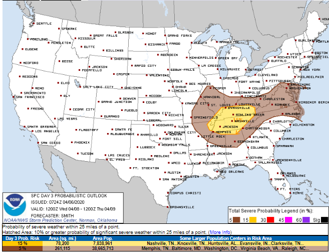
15% is a pretty high percentage from SPC for three days away.
Damaging winds and large hail are the primary threats.
Below is the Euro model’s best guess about our atmosphere Wednesday night, and, if this model is right, it is not alarming for tornado formation.
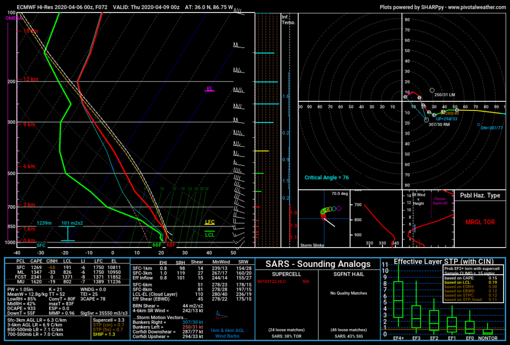
Tornadoes may form in this environment, but this isn’t sending my concern level very high.
Damaging winds and large hail are more likely.
Remember, a 15% probability of something happening is an 85% probability it won’t.
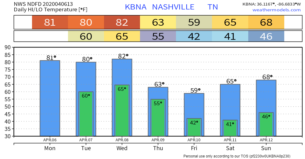
Then Cooler Temps
Much cooler after Wednesday night storms.
Saturday could be pretty wet, but that rain may wait until Sunday.
Categories: Forecast Blogs (Legacy)
You must be logged in to post a comment.