
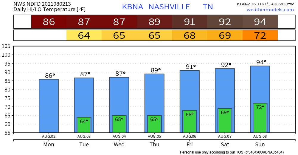
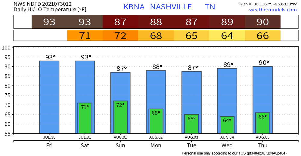
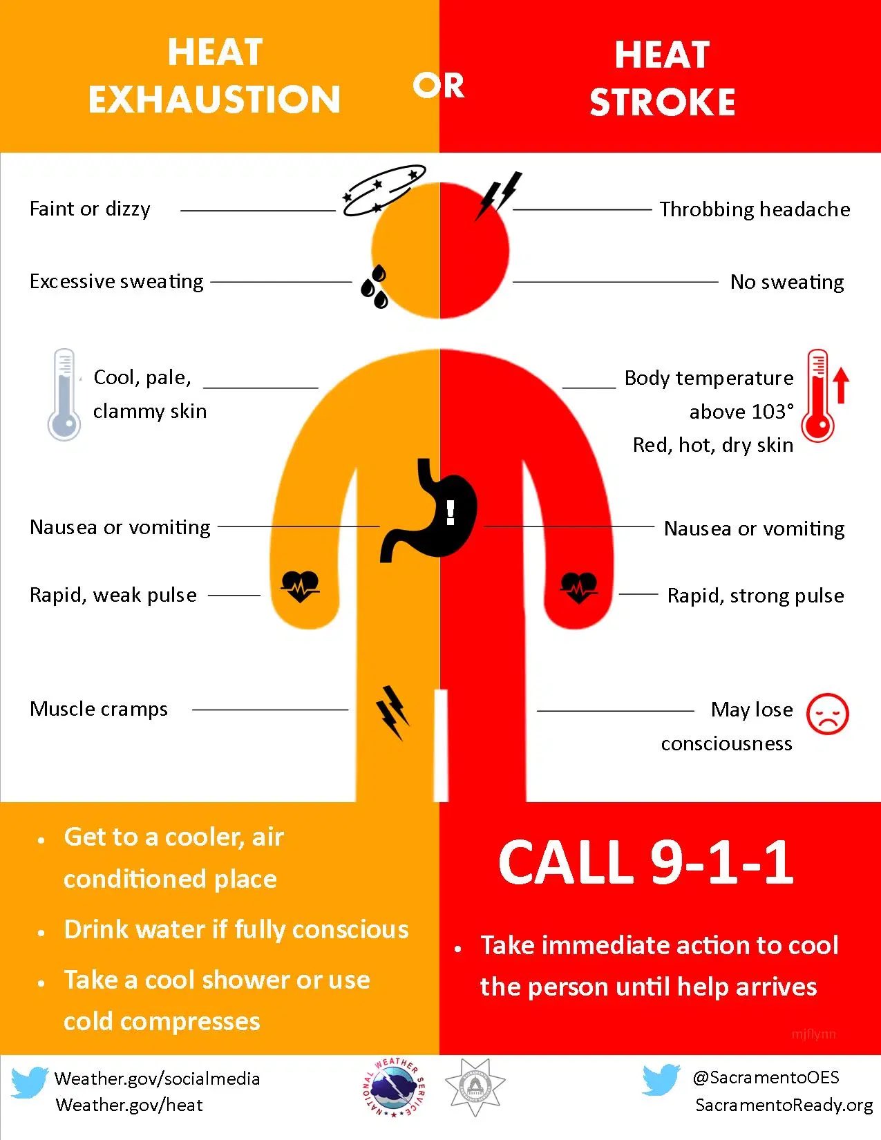
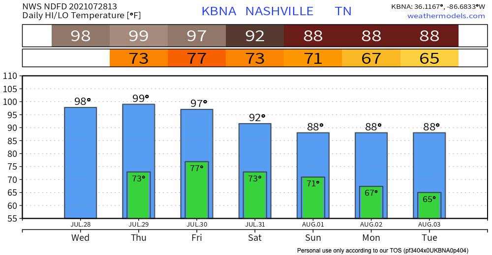
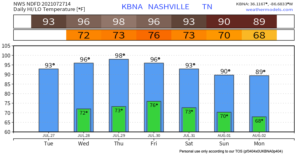
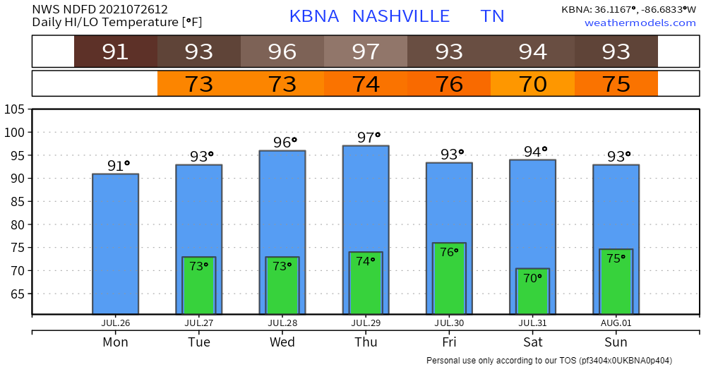
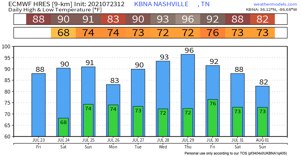
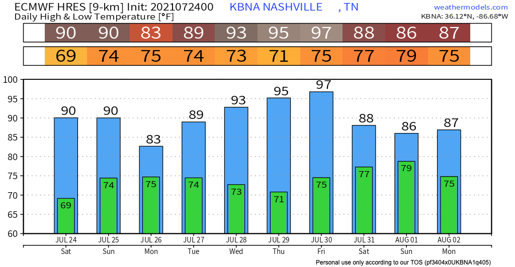
Humidity dropped. Temps not close to 90° (normal August 2 high is 91°). No rain.

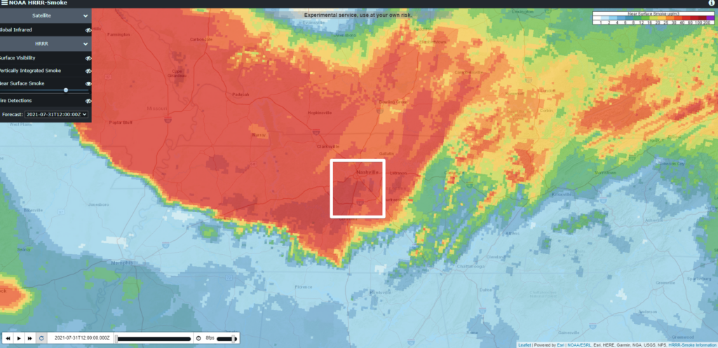
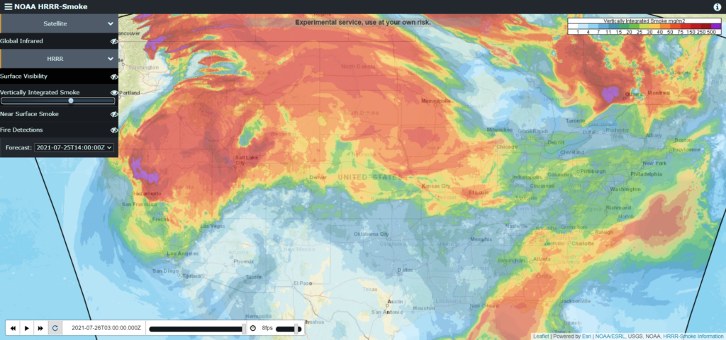
Wildfire smoke is back. That’s what’s causing the haze in the air.
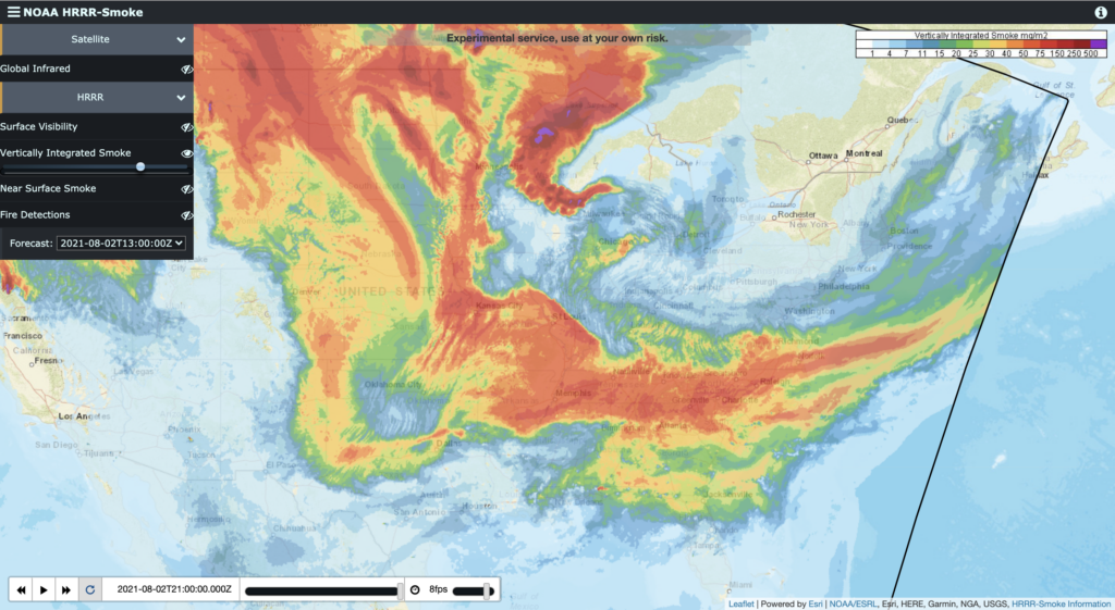
Smoke levels drop over the next two days. By Wednesday morning (see below) things will be better, but not smoke-free.
You must be logged in to post a comment.