
The NWS Blend of Models thinks our heat index will get to 101° this afternoon. That’s in the shade!
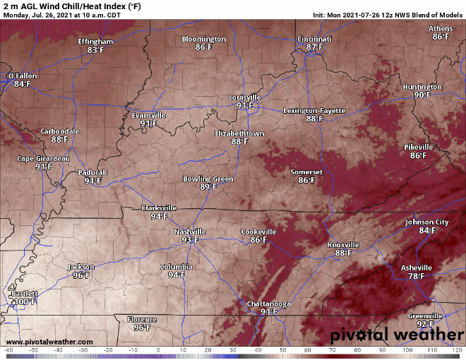
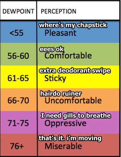
Dewpoint around 73° to 74° this afternoon.
Models thought we would see a line of storms here mid afternoon. That was yesterday’s models. Today it shows that line south of us. Some of us will probably see a few showers/storms pop off this morning (we have one already in Brentwood/Nolensville) and/or this afternoon from a weak upper level boundary, but the meat of the system should be south of us if the HRRR is right.
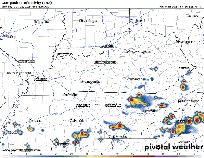
Like yesterday, these storms will be holding lots of water. Localized flooding is a possibility again today (5%-10% risk of flash flooding, per WPC). Looking at up to another quarter to half inch if one inches over you. Good news is these storms will probably actually move, unlike that one yesterday in Antioch/BNA/Donelson.
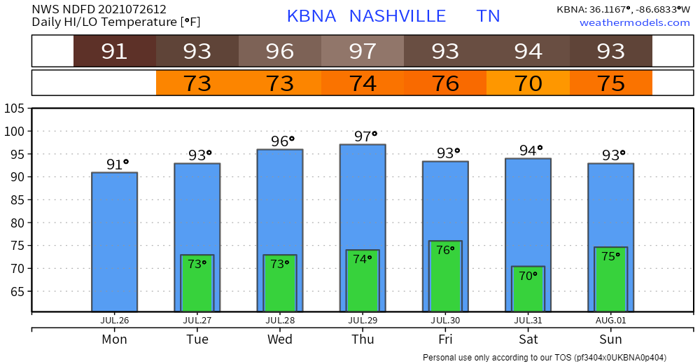
Drying Out Mid Week, Temps Climbing
Rain chances fall a good bit Tuesday. Much less widespread. You could still see a shower/storm here and there, but probably not. Any action would likely take place in the afternoon.
Then we dry out Wednesday and Thursday. Good for lowering dewps some (still very humid). But temps will start to rise. Heat index is into the 100s for those days. Just when you thought it couldn’t get hotter.

Hot, humid, afternoon storms possible — typical late July weekend ahead.
Categories: Forecast Blogs (Legacy)
You must be logged in to post a comment.