Snow should, this afternoon, fall atop the rainy, slushy, mixyfrizzy precip we got this morning. Will Co got way more of the frozen stuff than Nashville. Will Co was colder at the surface and aloft, and Will Co got the heaviest precip bands.

Snow should, this afternoon, fall atop the rainy, slushy, mixyfrizzy precip we got this morning. Will Co got way more of the frozen stuff than Nashville. Will Co was colder at the surface and aloft, and Will Co got the heaviest precip bands.
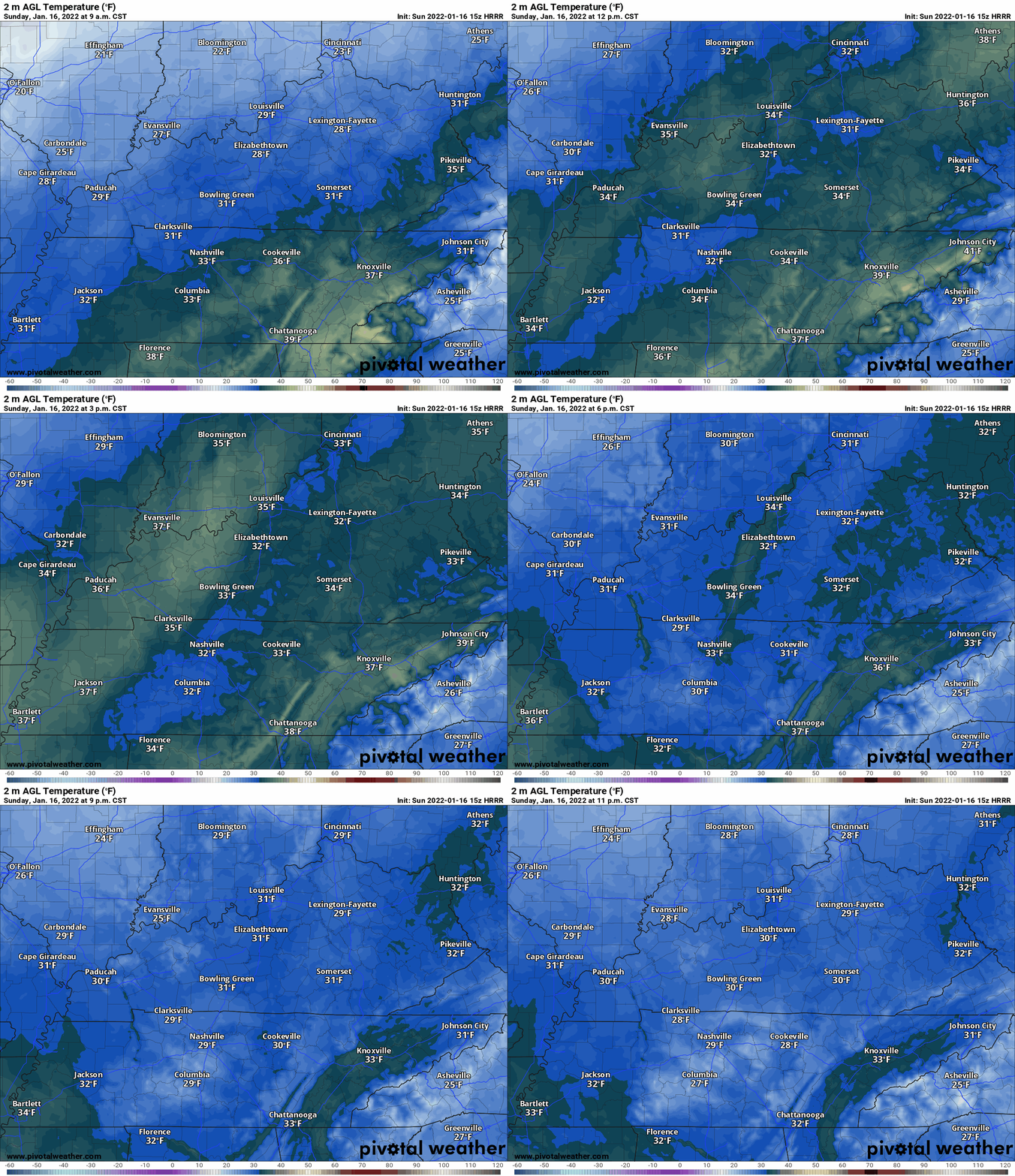
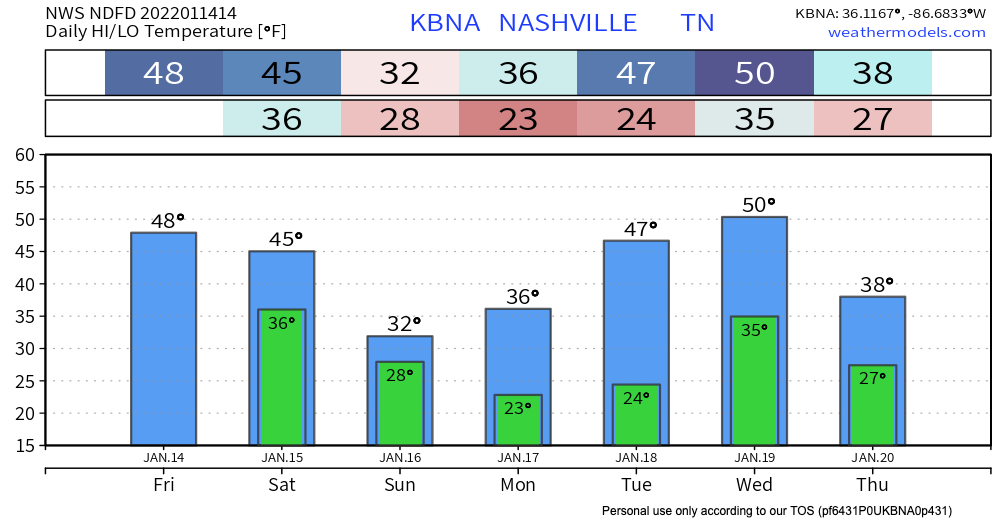
Rain should change to snow Sunday right around sunrise, or a few+ hours after sunrise, and when it does surface temps are probably going to be at or above freezing. HRRR thinks the temp’ll be around 34° to 35° as the snow is falling.
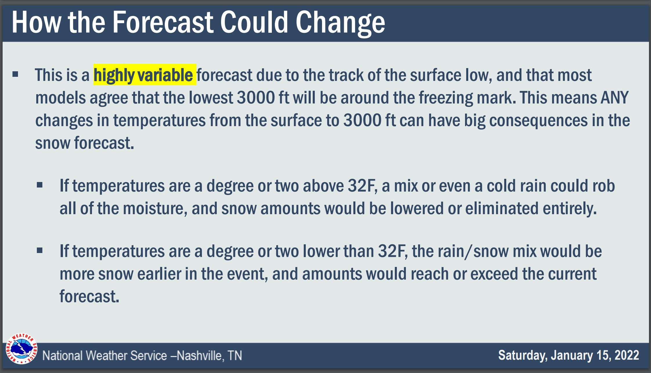
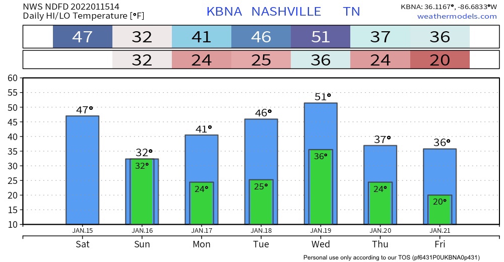
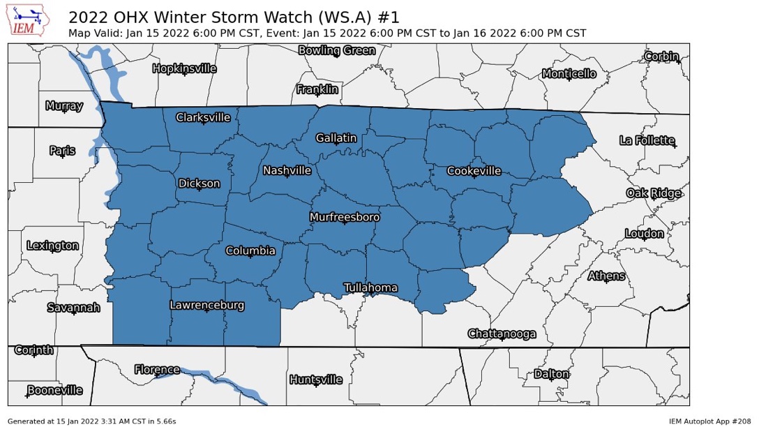
The Winter Storm Watch begins for all of Middle Tennessee tonight at 6 PM and ends Sunday at 6 PM.
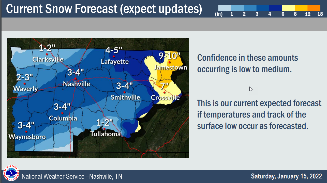
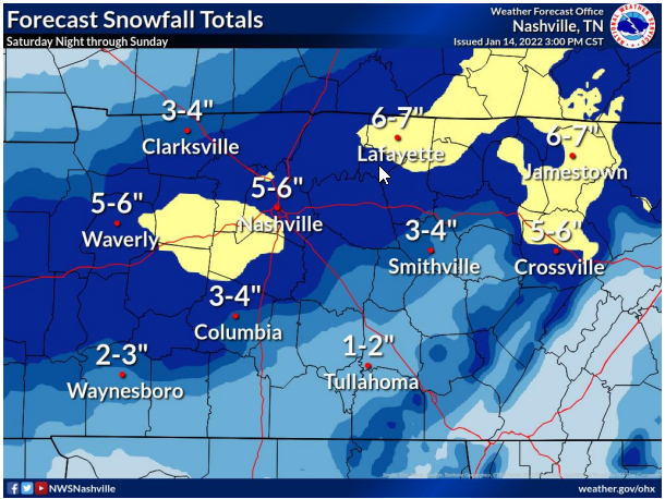
Looks like rain today will pause for a few hours then resume tonight. Overnight into early Sunday morning it should changeover to a wintry mix, then snow. The snow will be a wet, heavy snow. Somewhere in Middle Tennessee it could lay down snowfall rates around 1″ to 2” an hour.
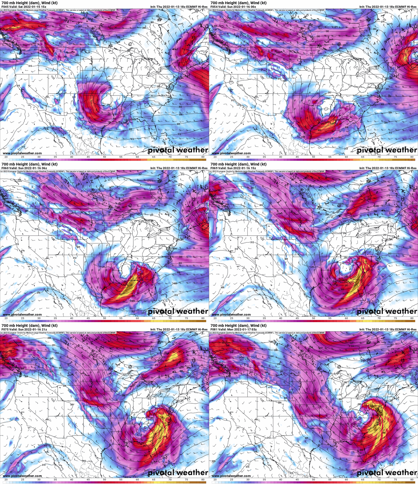
By the time all the good model data comes out it’ll be way past midnight. So much so I considered not writing this blog. But obviously I went ahead with it because we have some new, good models in, most notably the Was Causing Forecast Problems Earlier But Has Straightened Out HRRR.
Computer models are lacking consistency. Cold stuff will definitely be falling from the sky but we don’t know exactly what, where or how much. But, we have a forecast. Here we go:
A winter storm watch was issued this morning starting Saturday at 6 pm through Sunday at 6pm.
on presnow days like this I spend a few hours looking at models and reading forecast discussions. i do one other thing, and that’s trying to keep my brain brew cold, which means i’ll spend 15 minutes beating up my somehow iced over fridge icemaker, picking up the ice pieces that fall on the floor from all the pounding. i don’t mind admitting to you that when i am beating up the machine i am sometimes definitely cursing at it. the forecast and the ice machine are a mess.
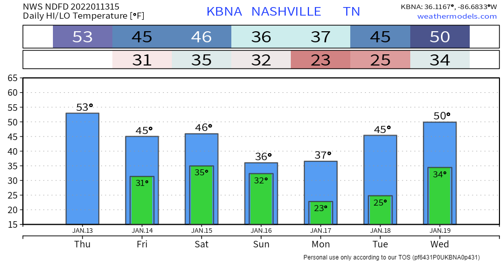
Not much change to the forecast for today. More cloud coverage throughout the day plus some scattered sprinklers. Timing: this afternoon. Cooler and dry tomorrow with highs in the mid 40s. Look for wind chills to hang out below 40.
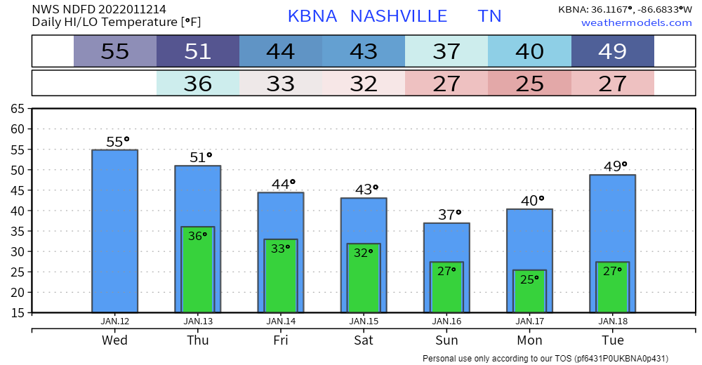
A bit warmer today than yesterday… highs generally 5-10 degrees higher. Staying dry until at least tomorrow.
Overcast skies and maybe rain for some folks tomorrow. Likely just sprinkles; nothing to write home about. A slight cool off starting tomorrow ahead of a possible winter weather event this weekend.
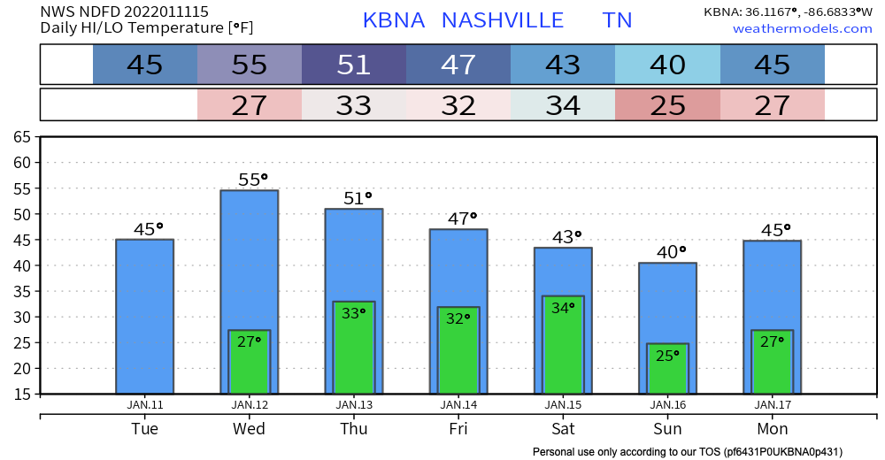
Normal January temps are really sticking. Today and tomorrow will stay dry and cool with overnight lows dancing around the freezing mark.
Our area could see some showers Thursday. Euro model below shows some of us getting sprinkles in the afternoon time. GFS has any precipitation staying clear of our area. If this system lingers and ends up in our area later that night, a flurry may be in the mix. Chances aren’t high, so for now expect some sprinkles.
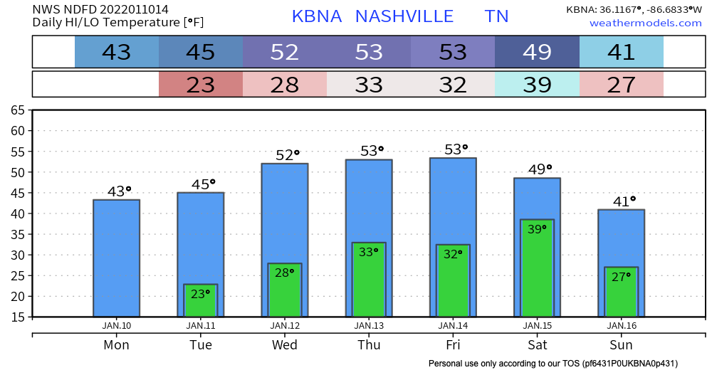
Not much weather going on the next couple days except sunny skies and right around average temperatures. High temps stay in the mid 40’s eventually getting up to the low 50’s by Wednesday and Thursday.
You must be logged in to post a comment.