Our local National Weather Service office has completed surveys in Davidson County following the storms early Saturday morning. See the map below for the survey results on the four tornadoes that impacted parts of Davidson County Saturday morning.

Our local National Weather Service office has completed surveys in Davidson County following the storms early Saturday morning. See the map below for the survey results on the four tornadoes that impacted parts of Davidson County Saturday morning.
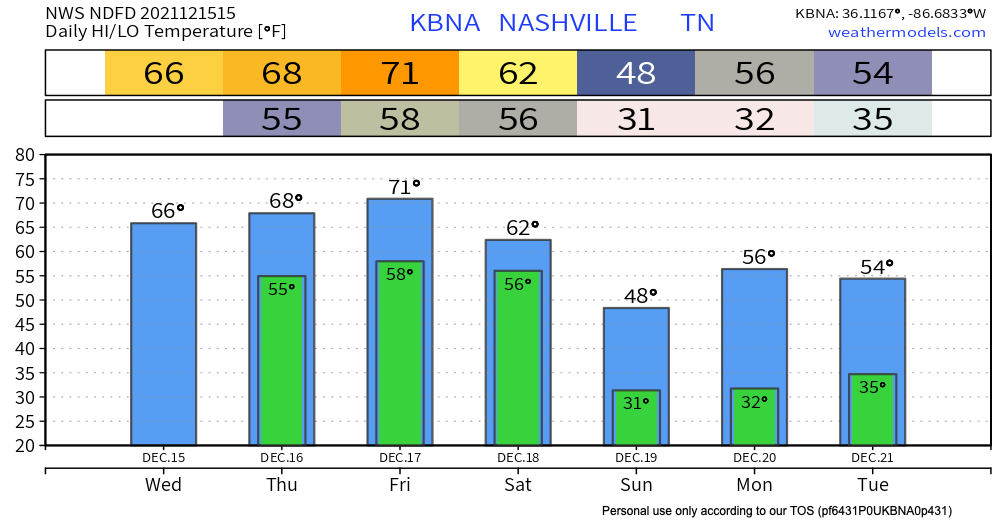
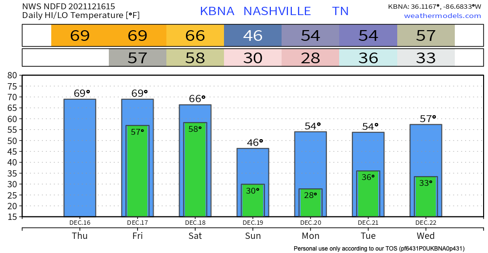
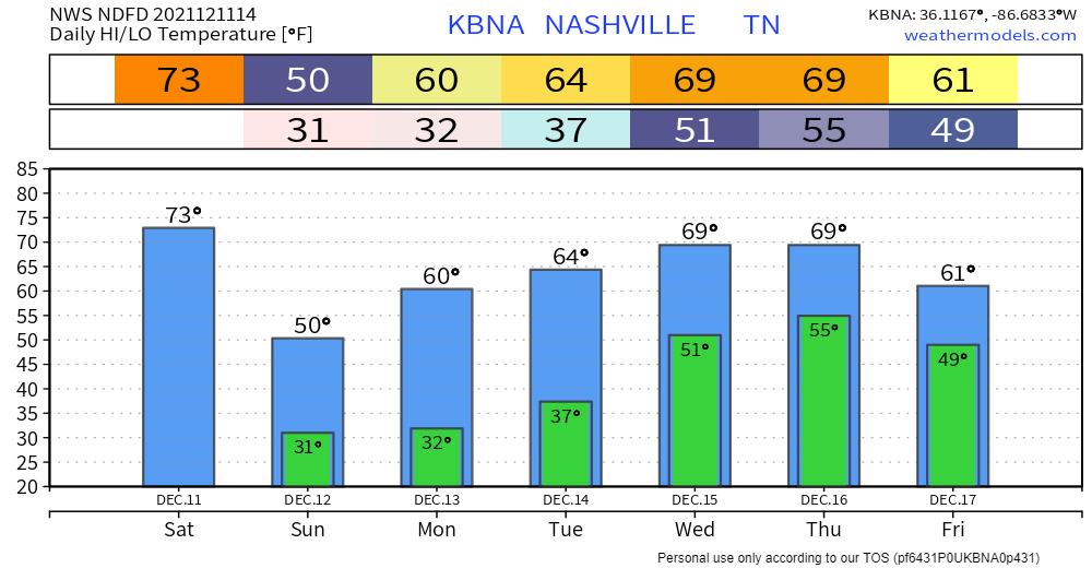
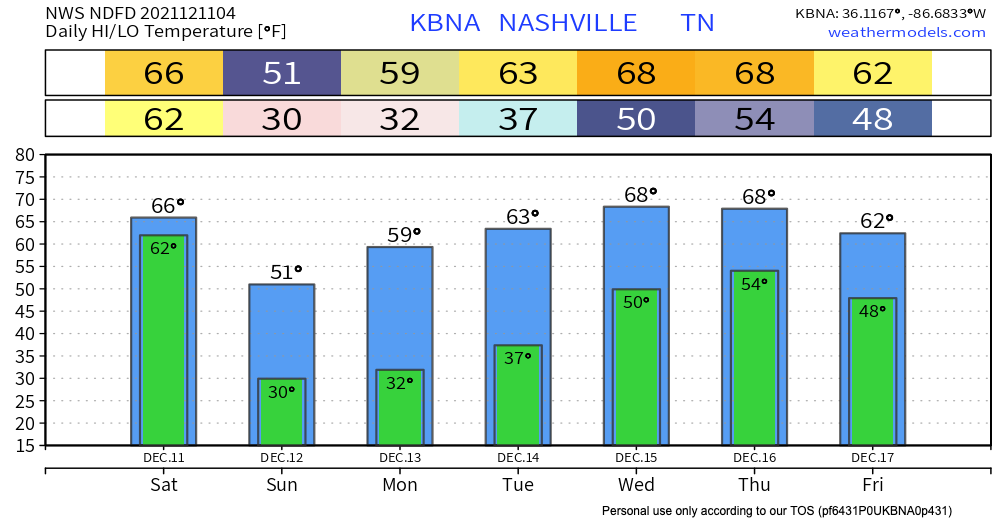
We stay dry and experience above average temps today getting into the upper 60’s. A wet couple of days are ahead, although we don’t think everyone will get rain non-stop all weekend. Thursday scattered showers and possible thunderstorms start in the afternoon. These are not expected to bring severe weather. Quick downpours can cause some potential flash flooding. WPC is forecasting a 5-10% chance of flash flooding occurring within 25 miles of you. So, keep an eye on the possibility of flash flooding becoming a problem if you live in a flood prone area.
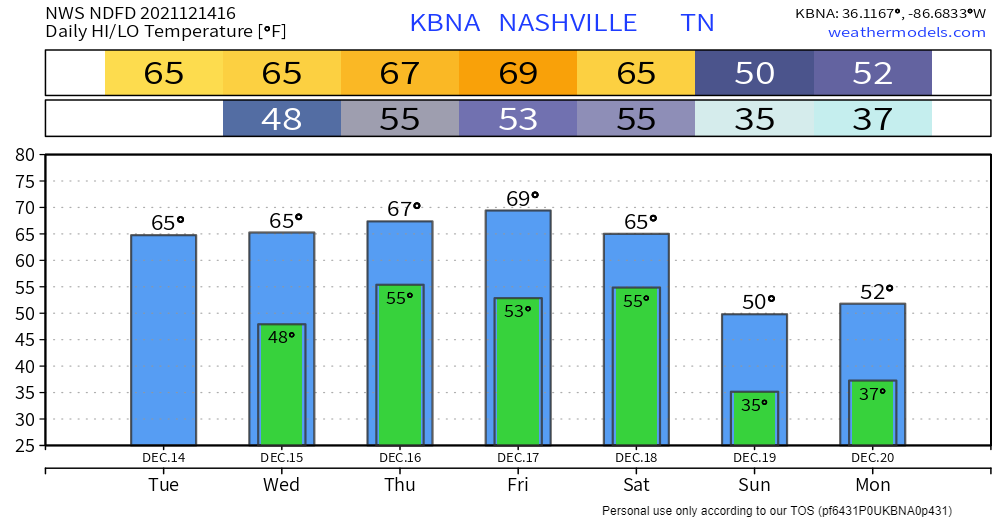
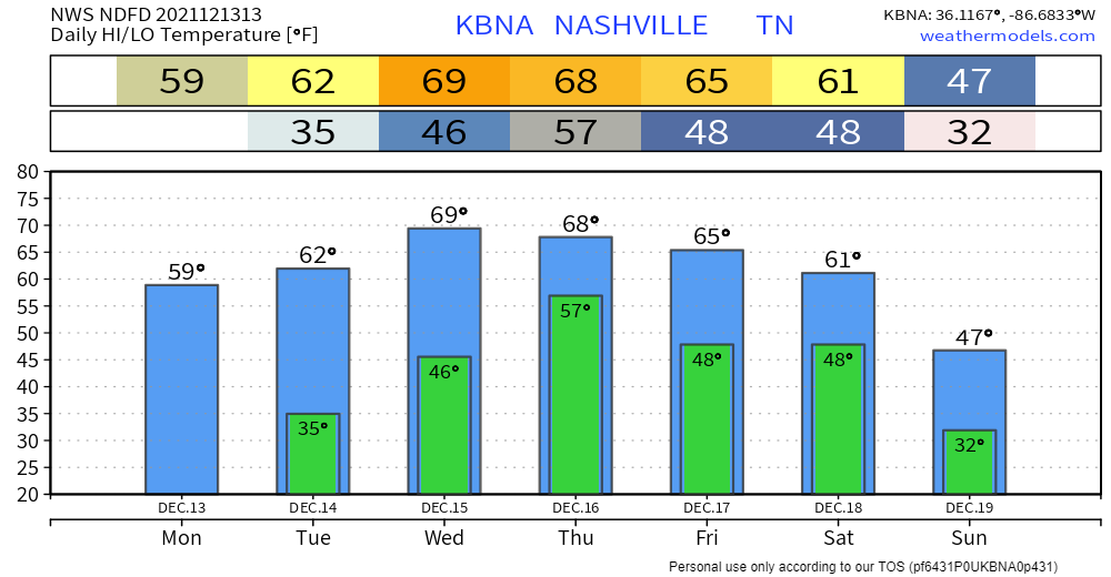
Clear skies today with temps about 15° above average. Not much different tomorrow. Cloud cover tomorrow will keep temps much the same.
It’s going to get even warmer later this week.
Showers still in the forecast beginning Thursday. Euro model likes our chances of on/off rain showers starting Thursday afternoon through Friday morning.
NWS-Nashville has teams in the field again today. They are surveying damage, distinguishing straight line wind events from tornadoes, and rating tornadoes on the EF scale. They’ve counted 7 tornadoes in Middle Tennessee from Saturday morning. We think that number will probably be higher. Tornado surveys will probably not conclude until Tuesday. We will bring you that information as it comes in.

NWS-Nashville is out surveying storm damage. Yesterday they rated the Dickson tornado EF-2, entire path length not yet determined. Early this morning they rated the Kingston Springs tornado EF-2, 125 MPH maximum wind, 400 yards wide, 10.5 miles long, 1 injury. Surveys will continue today. We will tweet updated information.
We are all done with rain and severe weather. If you are waking up to any damage, tweet a picture of it with the location using #tspotter. Storm surveys will be conducted again today to determine where we had tornadoes vs. where we had straight line wind damage. We will tweet updates as that information comes in.
We’re writing this at 5 AM, with the leading edge of the storm out of Davidson and Williamson Counties, and along with it, the damaging straight line wind and tornado danger. Heavy rain will continue in S/SE Will Co, but that should remain below flash flood levels. Lightning will continue, too.
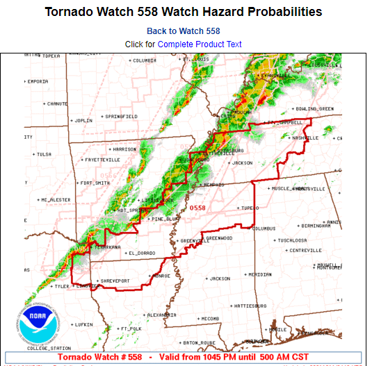
Tonight’s second Tornado Watch has been issued.
The first Tornado Watch was issued earlier tonight. It had an expiration of 2 AM.
The tornado threat will extend after 2 AM. So a second Tornado Watch has been issued. This one expires at 5 AM. That does not mean the tornado threat will be over at 5 AM. Do not interpret this as an all clear after 5 AM. It’s possible a third Tornado Watch will be needed. Watches typically only go on for 6 hours.
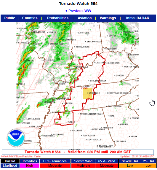
The Storm Prediction Center, in coordination with NWS-Nashville, has issued a Tornado Watch for Davidson and Williamson Counties.
This Watch will continue until 2 AM.
Important! A second Watch (Severe Thunderstorm or Tornado) may be (probably will be) needed after 2 AM. We will not be clear of the straight line wind or tornado danger until probably 9 AM or so. (SPC doesn’t issue 12 hour long Watches for anything; too much can change.).

This blog describes to you, fellow neighbor, a low probability of a high impact event. Basic precautions are necessary.
Now Until Dark
Windy, 15-25 sustained, with gusts to 40 MPH. A Wind Advisory is in effect today (expiring at midnight).
You must be logged in to post a comment.