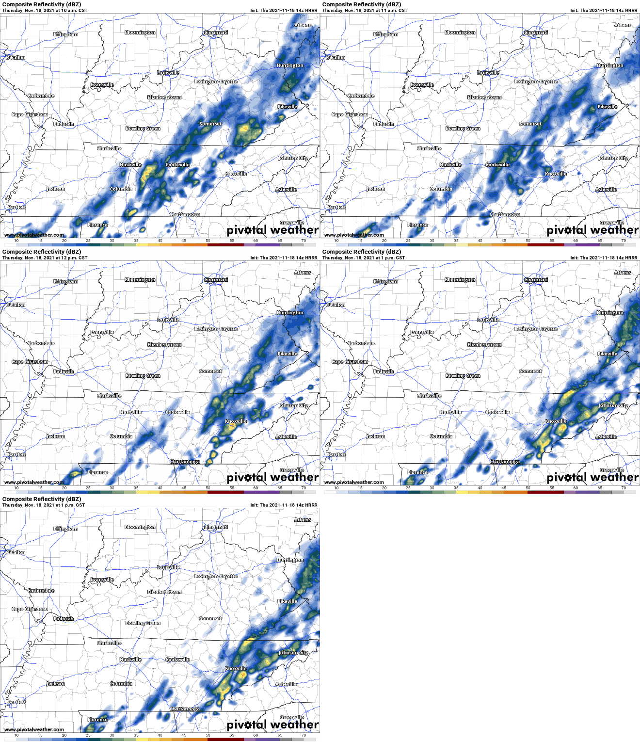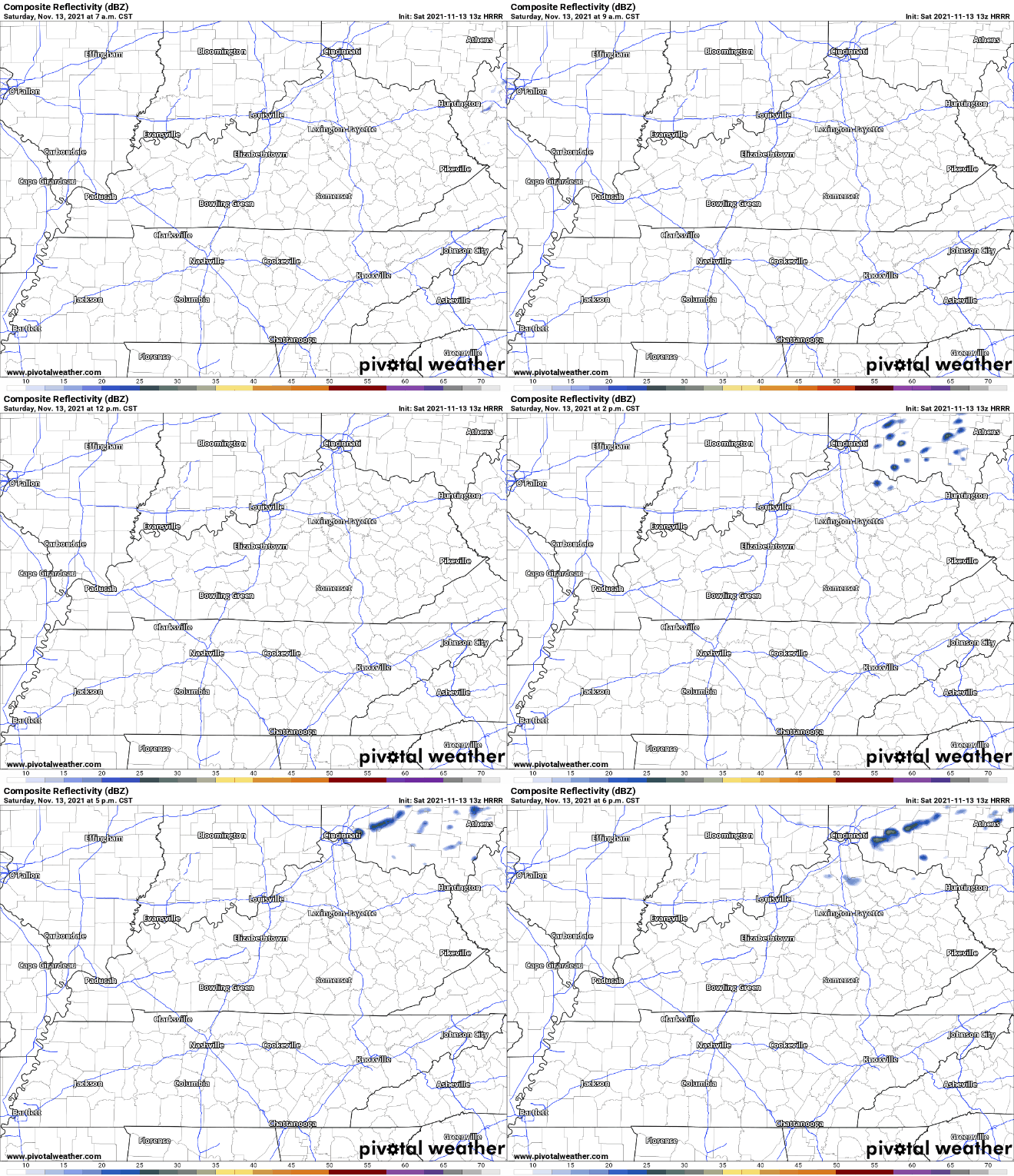
The heaviest rain today is on its way out. HRRR has scattered showers for the rest of today. A thunderstorm or two is possible mid-afternoon to evening. These will just bring wind gusts and quick downpours, no severe weather.
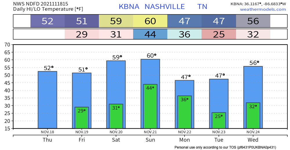
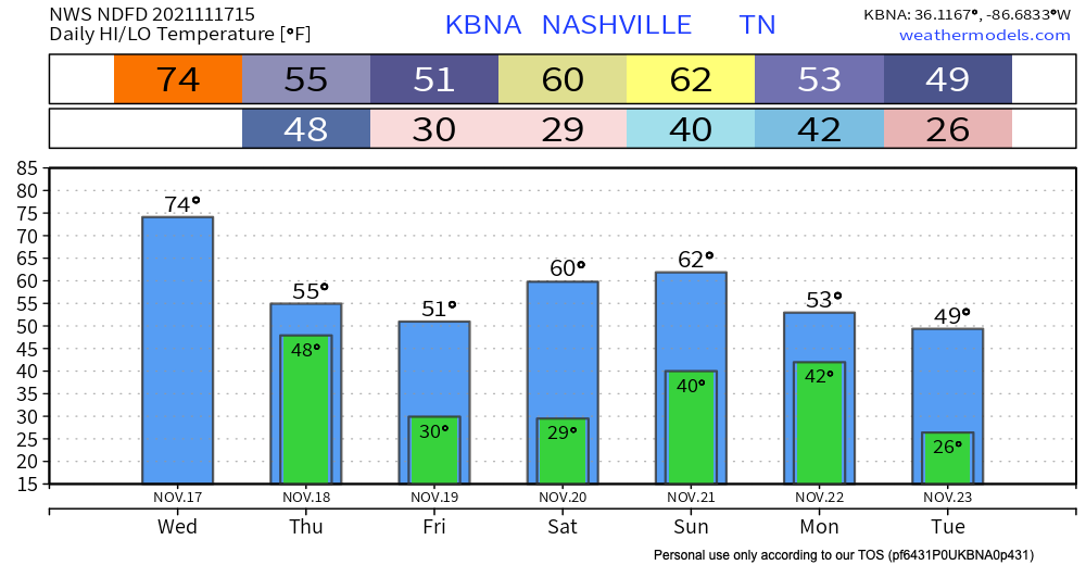
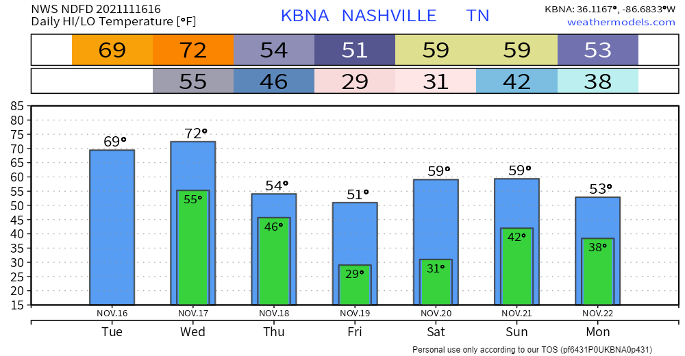
Today is the last dry day of the work week. A low pressure system is heading our way, bringing in showers and storms from overnight tonight, running off and on to Saturday.
HRRR loop below shows rain arriving just around midnight tonight with another round of heavier rain in the morning.
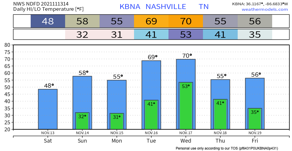
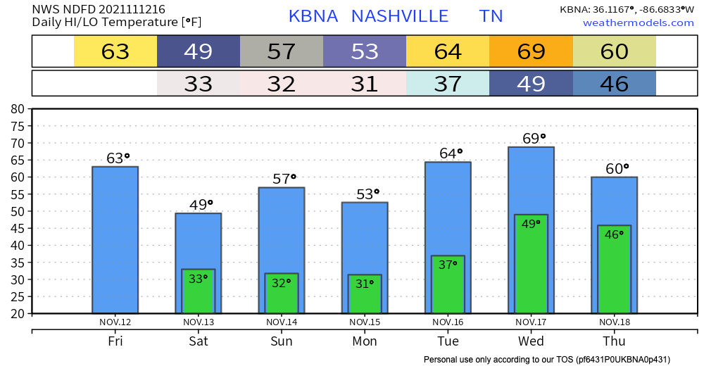
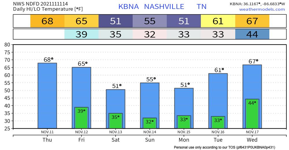
Cold front yesterday means jacket/sweater kinda day with the high in the low 60’s and the low right around 40.

Wednesday night into Thursday. HRRR thinks showers and maybe/low probability few lightning strikes get to us late Wednesday night and linger into Thursday morning. See below:
Pretty much all the action from this morning is out over the Plateau now. Didn’t turn out to be much more than lots of rain and the occasional rumble of thunder. Many of you probably slept right through it.
We close out the weekend dry. No rain in sight today. Temps peak in the 80’s today and dewpoints hang in the 50’s. It’ll be warm, but not humid. This will save the Titans game from being a sweat fest. If you’re wearing a hat to the game, keep it on tight because it’ll be windy out there. Gusts could be around 30 mph today and be even stronger tonight.

Another nice weekend is in store, with no rain forecasted. Sunday temps warm up to the low 80’s, but with dewpoints in the upper 40’s, it should save you from sweating. It also might be the last time we see 80° for a while, so enjoy. Perfect weather for Titans football.
Thanks to the cold front that moved through yesterday, our temperatures are dropping today. Highs in the mid 60s and lows in the 40s mean you can wear some of those fall sweaters. Today is the day to go to a pumpkin patch, or do any other fall activity your heart desires. Unfortunately, these temps will rise back up starting Saturday, but still will remain mild.
Radar is quiet right now (mid morning). Showers and storms are expected to develop during, or shortly after, lunch, and we won’t see them coming on radar. They should form right on top of us.
The HRRR model below illustrates.
Today is going to feel a lot like the past few days – temps in the upper 70s, sunny with a handful of clouds, and comfy dewpoints in the 40s. Models look clear for today, but starting early tomorrow morning, some rain is possible.
Today is basically a photocopy of yesterday… Clear skies, no rain. Should be another beautiful day, just bump temps up a couple degrees. Highs today will be in the mid 70s.
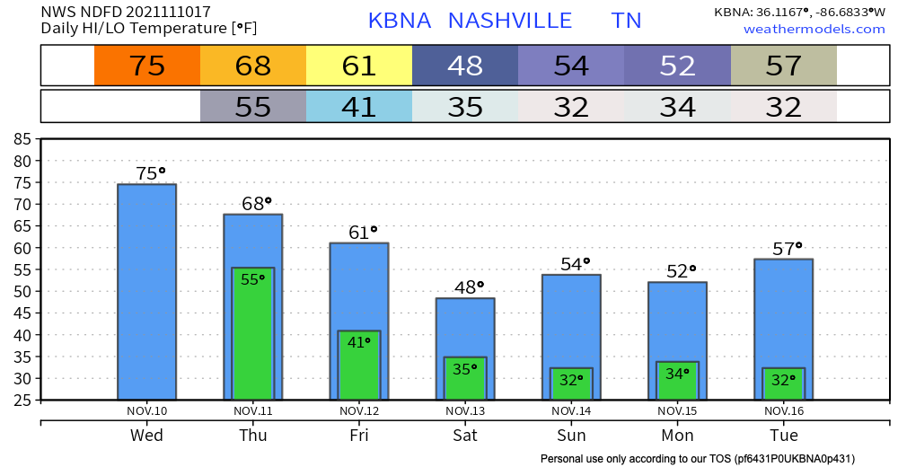
Tomorrow will bring us the highest temps of the week with highs in the upper 70s to near 80. It’s only fitting that rain follows soon after. Still looking like the incoming cold front will bring us action on Thursday, though minimal. Not looking like anything severe, but T-storms are a possibility. Mostly the annoying, scattered light rain. The Nam 3km model illustrates what it thinks this will look like on radar. Take exact timing with a grain of salt.
You must be logged in to post a comment.