
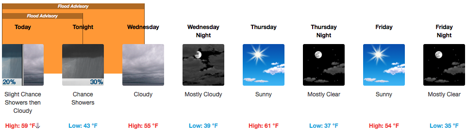
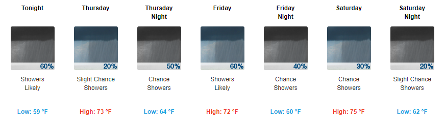
Cloudy, Falling Temps, Chance of Showers This Evening
UPDATED Latest HRRR Loop
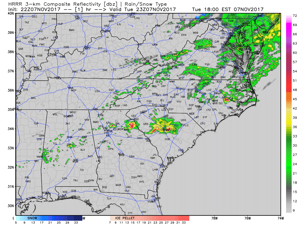
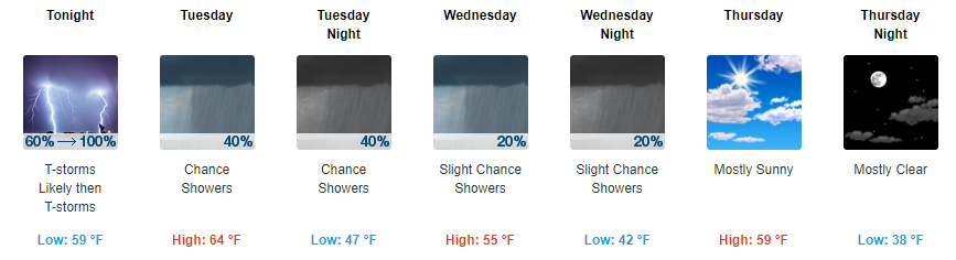
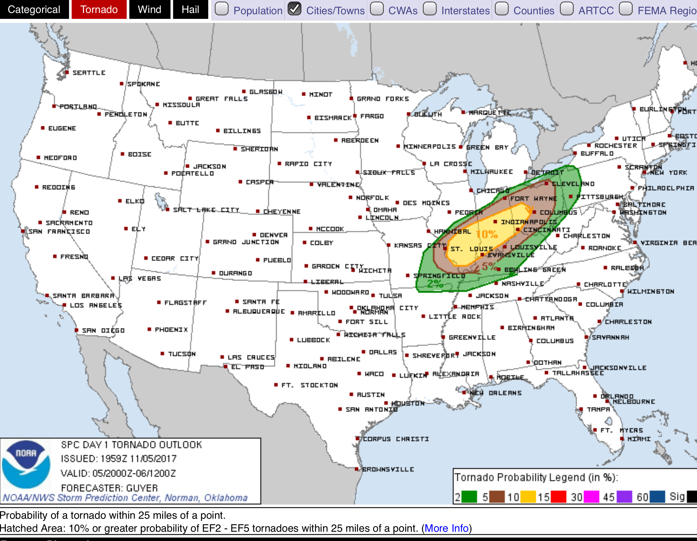
After a 1.0″-4.5″ overnight last night, more rain chances return tonight thanks to a shortwave traversing the Tennessee Valley. Light-moderate rain will be possible, but nothing like what we saw 12 hours ago.

You must be logged in to post a comment.