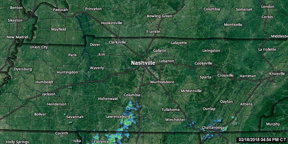
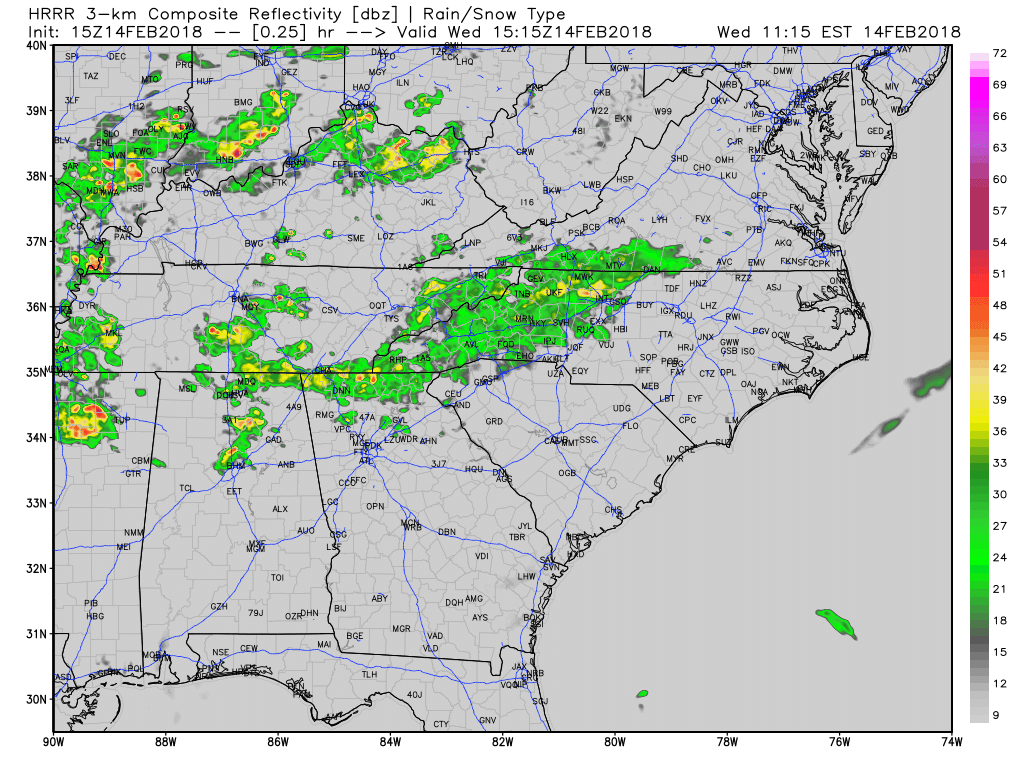
A few raindrops are trying to roll in from the southwest tonight and overnight, but mostly we’re dodging it, and I think it’ll mostly be a non-event for us. As of 5:32 PM, the radar looked like this:

A few raindrops are trying to roll in from the southwest tonight and overnight, but mostly we’re dodging it, and I think it’ll mostly be a non-event for us. As of 5:32 PM, the radar looked like this:
60° this afternoon, a bit higher under direct sunshine.
Clouds will roll in this afternoon, staging a few brief drizzlers Monday morning.
Off and on rain, amounting to under 0.10″, mostly (and probably exclusively) happening before lunch. It’s possible some of us won’t see any.
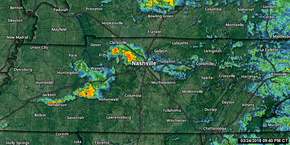
Bands of showers continue to move across much of Middle Tennessee. If you have any plans today, grab the umbrella before you head out the door.
Current Radar as of 11 AM
While we may see periods of heavier downpours, which could lead to some ponding of water in low-lying areas, we are not expecting any flooding issues with these showers.
The Friday cold front has passed and we are quickly seeing its effects! Temperatures are already down into the middle 40s at 11:00AM, and we are expected to bottom out in the mid to upper 30s overnight tonight. A northwest wind will keep things gusty…20-25mph winds are possible, so keep those loose outdoor items tied down.
First things first, it is going to feel kinda gross outside today. Highs expected to reach the mid-70s (the record for Nashville is 77°) with dew point temps into the low-60s. Today will feel more like a spring to early summer day than the middle of February.
Off and on showers will continue through the evening, and even a rumble of thunder cannot be discounted. Temperatures will be relatively mild, hovering in the middle 60s.
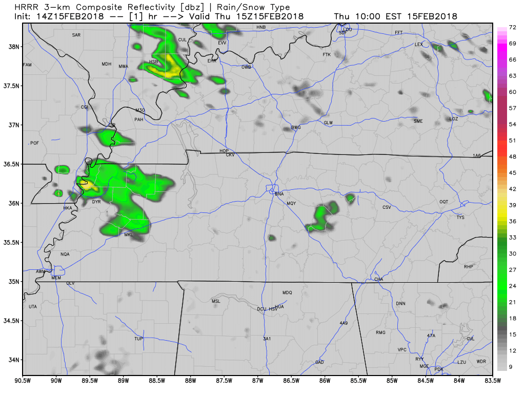
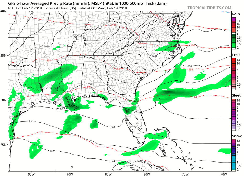
HRRR Model Loop
Additionally, we still have a Flood Advisory out in Davidson County:
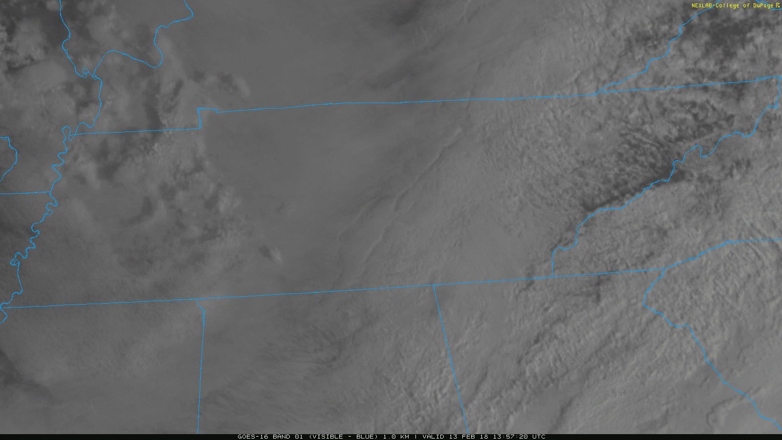
Today will be another one of those gloomy days with clouds hanging around throughout the day. Satellite imagery already shows this blanket of clouds draped across our area.
Current Satellite Imagery
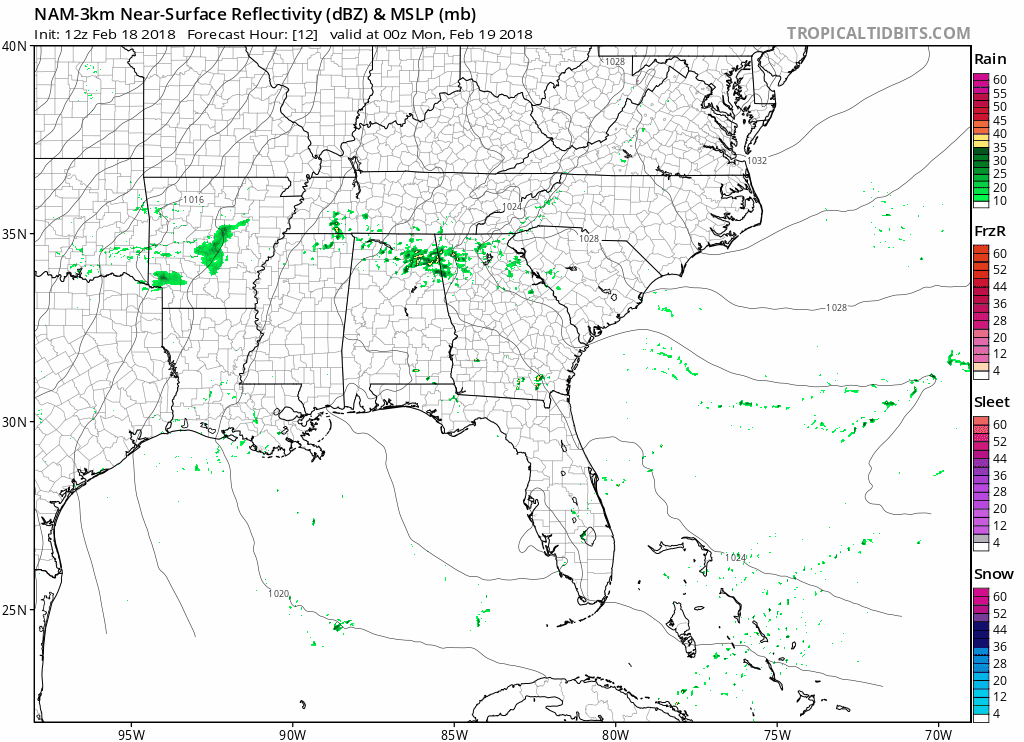
Starting tomorrow night, rain is in the forecast all the way through Sunday. Several pieces of energy are expected to traverse the Tennessee Valley, bringing us a marked increase in rain opportunities.
Very light freezing rain is possible tonight and overnight.
Be wary of black ice on elevated surfaces (including bridges and overpasses) tonight, overnight, and during the morning commute.
We are updating this through the evening on Twitter.
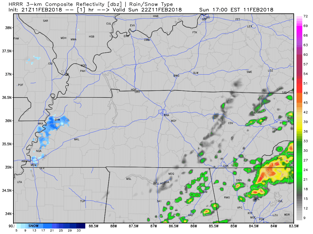
Around midnight, rain will come racing in from the west, with near-freezing temps on its tail. The HRRR model illustrates it. Notice how it turns the precip into frozen precip:
As it passes us, it should fall as rain, with a low probability of sleet mixing in.
You must be logged in to post a comment.