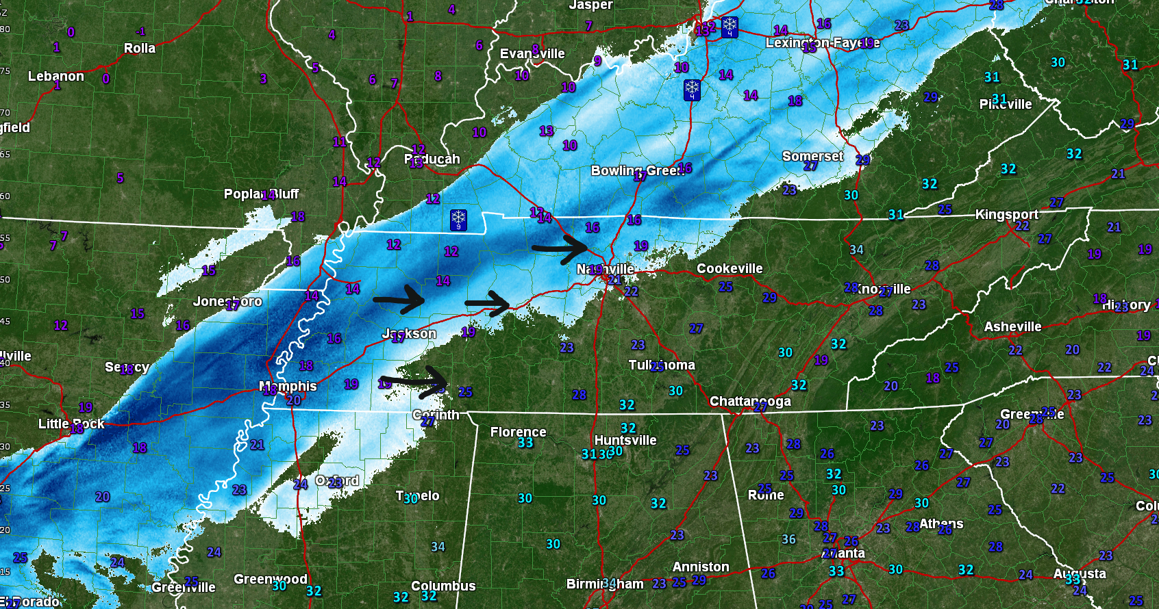
Some may have woken up thinking “Where’s the snow?”
It’s coming. Recall last night this was going to be a slowly-falling snow over a 9 to 12 hour period. We’re not even halfway through that window right now.

Some may have woken up thinking “Where’s the snow?”
It’s coming. Recall last night this was going to be a slowly-falling snow over a 9 to 12 hour period. We’re not even halfway through that window right now.
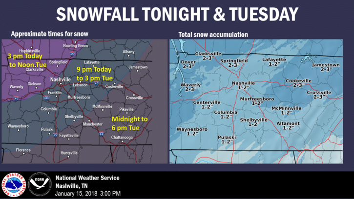
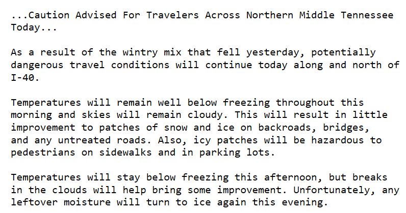
We are under a Winter Weather Advisory.
NWS Nashville has bumped up snowfall totals slightly for our area, taking into account any heavier pockets of snow that may develop overnight and tomorrow morning. We’ve already seen this system over-perform in portions of north Arkansas and southeast Missouri today, so higher amounts cannot be discounted.
As I write, radar indicates a weak clipper system producing flurries in Missouri and north Arkansas. As it creeps east into Middle Tennessee, it should encounter low moisture content. Therefore, at most only flurries are expected here. NWS-Nashville wrote: “There should be no impacts from this quick-hitting clipper.”
Below freezing again today. Tonight, clouds arrive. Flurries may break out. NWS-Nashville thinks flurries could develop into snow showers heavy enough to cause slick spots near the Kentucky border. We’ll watch that, but think it’ll be too far north to cause issues for us.
A few snow showers have developed across mainly northern portions of middle TN this morning. Think of someone randomly picking up a snow globe and shaking it for a minute…this is what the forecast for the afternoon will be. Random flurries, with sometimes a little more intense snow shower mixed in. Accumulations will not be of concern, but any heavier burst that develops could lightly cover the grass/elevated surfaces. Snow showers such as these are difficult to detect on radar at times, so if you get any fluffy stuff, send us your images or reports!
Current Radar Loop 3:00 PM to 3:40 PM
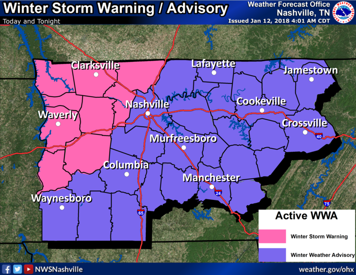
Snow showers have already arrived to our northwest and continue to move towards us. We are still looking at 1″ to 2″ of total accumulation for those north of I-40 and less than an 1″ expected for those south of I-40.
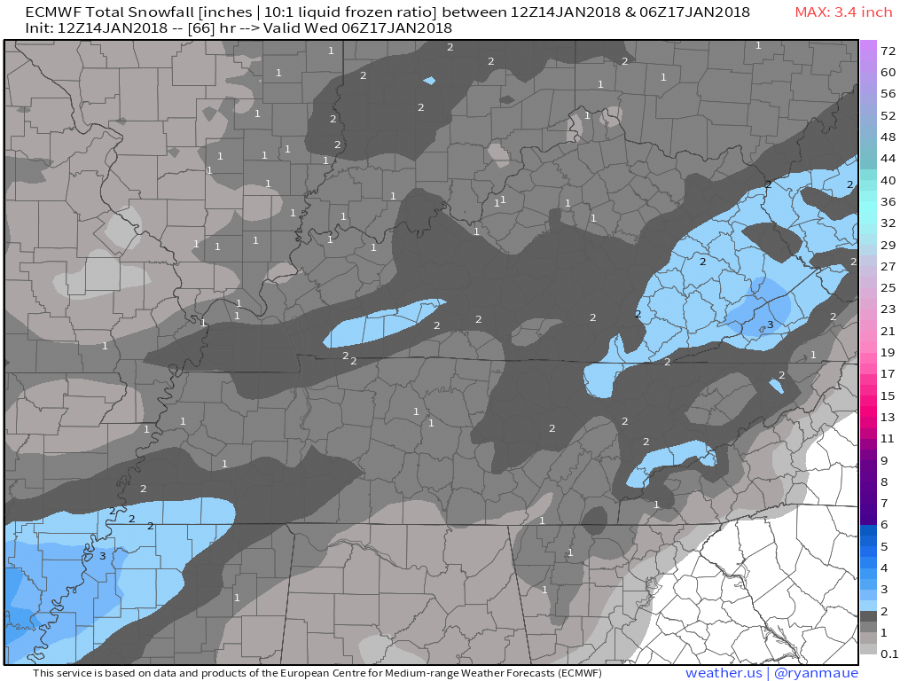
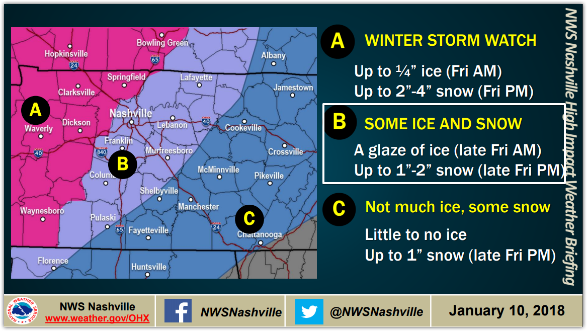
Note: models are showing different things. Some show more ice and/or snow, while others do not. These are just very rough estimates.
Already this morning we have see plenty of rainfall. The freezing line is currently knocking on our doorstep, which will turn our rain showers into a wintry mix very shortly. Expect for the wintry mix to arrive in the next hour or two.
First let me acknowledge and thank our Intern, Brendan Schaper, for his help with this update.
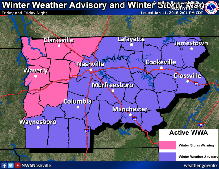
We remain under a Winter Weather Advisory, beginning Friday at 8 AM, ending midnight Friday night.
Rain will transition to freezing rain and sleet in the morning, then to snow late morning or early afternoon. Ice accumulation of one to two tenths of an inch will occur along with the possibility for 1-2 inches of snow.
Updated: We are under a Winter Weather Advisory, beginning Friday at 8 AM, ending at MIDNIGHT Friday night.
Rain will transition to freezing rain and sleet in the morning, then to snow late morning or early afternoon. Ice accumulation of one to two tenths of an inch will occur along with the possibility for 1-2 inches of snow.
Consult multiple, reliable sources of weather information.
“Friday snow” will be hard to believe Thursday afternoon when it starts raining off and on and we are in the mid 60°s. Rain will be heavy at times, and last into Friday morning. Sometime Friday, rain should transition to sleet and/or freezing rain, and eventually snow.
You must be logged in to post a comment.