As Alberto passes by tonight, we should see light rain and briefly strong winds, but the main tornado concern should end by 8 PM.
Here’s the last good look at Alberto before the sun goes down:

As Alberto passes by tonight, we should see light rain and briefly strong winds, but the main tornado concern should end by 8 PM.
Here’s the last good look at Alberto before the sun goes down:
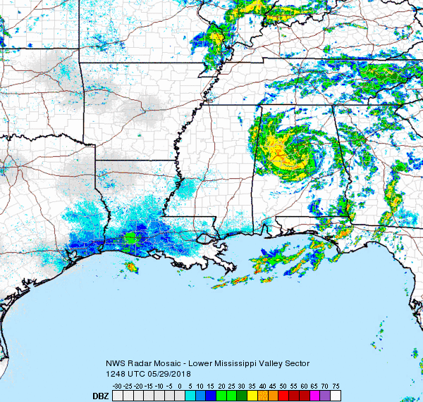
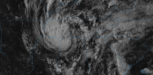
Tropical Depression Alberto is near Birmingham at 9 AM Tuesday (see below).
Alberto is moving toward Middle Tennessee.
Its center will pass west of us tonight.
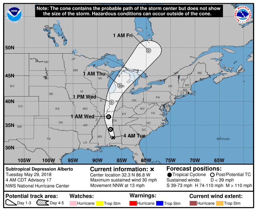
Expect off and on rain today as rain bands from Alberto’s north, northeast, and east sides rotate through.

Memorial Day isn’t Veterans Day. Memorial Day remembers those who died in defense of our country.
Alongside many of you I paused my Saturday on a warm day in 2012 to stand along Columbia Avenue in Franklin as the processional of Army Spc. Jason K. Edens passed by. I didn’t know him or his wife or his family and I still don’t know his family. But I decided as long as I have an audience – and I don’t hear from his family otherwise – that he would be the soldier we remember on Memorial Day.
Any showers and storms are drifting to the NW thanks to Tropical Storm Alberto. Satellite as of 4:05 PM: pic.twitter.com/fMWk7eA0Wa
— NashSevereWx (@NashSevereWx) May 27, 2018

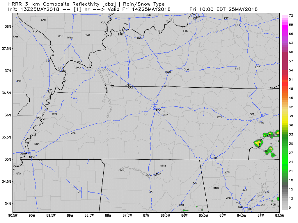
The rain lottery returns this afternoon:
Rain and storms are expected to randomly pop up around mid-afternoon. Exactly when and where is unknown. Once they pop up, they won’t move much. They should end by early evening. Here’s the HRRR model’s illustration through 11 PM tonight:
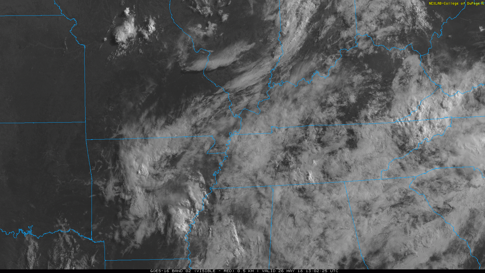
This morning we had some showers hanging around our area. This widespread cloud coverage is what’s going to keep our temps from getting too high today.
Dewpoints are still relatively high today, they’ve crept into the upper 60s. Today is going to be humid!
Good morning Nashville! We are moving back into the summertime pattern with hit or miss showers and storms all day. It looks like coverage will be fairly good for the daytime hours, dying out by sunset. HRRR illustrates. A couple of these storms could be on the strong side, so stay aware if you have plans outside today. The good news is that these should be “pulse” storms, and organized severe weather is not expected.

High pressure has built into Tennessee, keeping the clouds away.
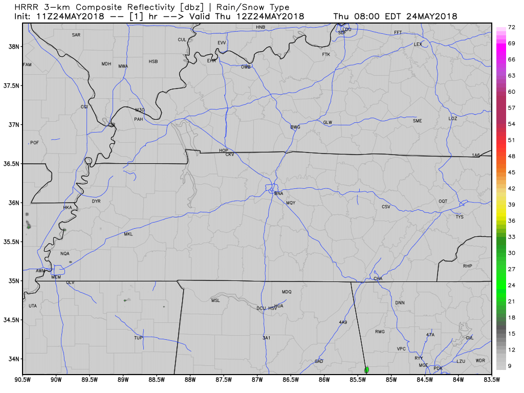
The HRRR model, below, shows some rain forming all around us, but nothing in Davidson or Williamson Counties.
Without clouds to shade us, temps are going to hang around in the 80s for much of the day, topping around 90, and although it’ll still be humid, it won’t be as humid as it was yesterday.
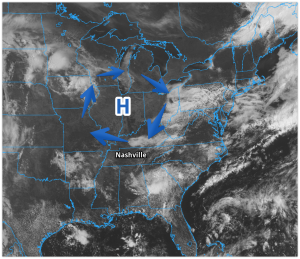
A high-pressure system has moved into the Ohio River Valley. It’s working to suppress our rain chances. We suppose a shower or two today is remotely possible, but we think that’s really unlikely. We remain hot, with temperatures in the upper 80s, and humid, with dewpoints in the mid to upper 60s.

Hot, sticky, and sweaty is the theme for the day. High temps aren’t expected to creep out of the low 80s and dewpoints will be stationed in the mid 60s.
Again, by the early afternoon we are looking at widespread showers throughout our area.
You must be logged in to post a comment.