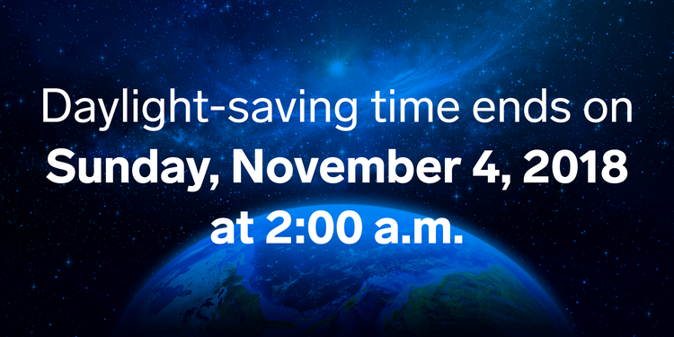
(If you read this morning’s blog, the text in blue is new)
Saturday was our last day of regular daylight because:
Your 25 Hour Sunday Looks Shabby
Sunup at 6:12 AM. Temp 48°. Afternoon high 65°.
Sundown at 4:48 PM. Four forty eight.

(If you read this morning’s blog, the text in blue is new)
Saturday was our last day of regular daylight because:
Sunup at 6:12 AM. Temp 48°. Afternoon high 65°.
Sundown at 4:48 PM. Four forty eight.
I don’t want to bury the lead about Monday night’s severe weather concern, but I will, because chronology prevents confusion.
Fog has been a pre-dawn problem in spots. It should lift around sunrise.
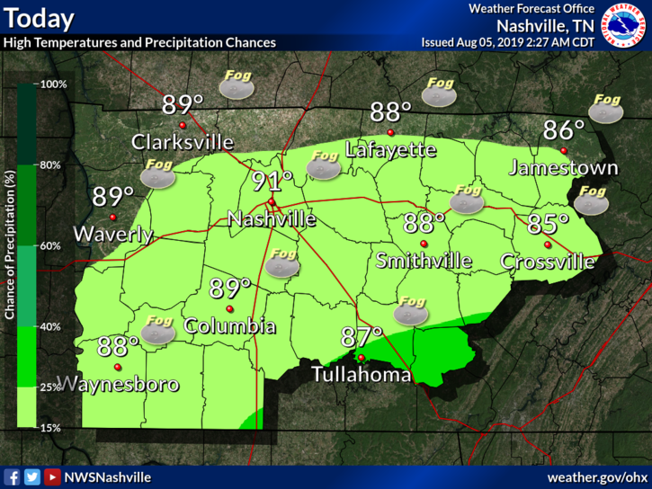
With clouds around, our afternoon high is only going to reach 54º here in Nashville.
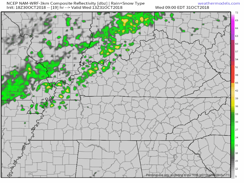
Rain is approaching from the west, but should mostly break up before arrival. Still, the HRRR model thinks there’s a chance of a passing shower tonight:
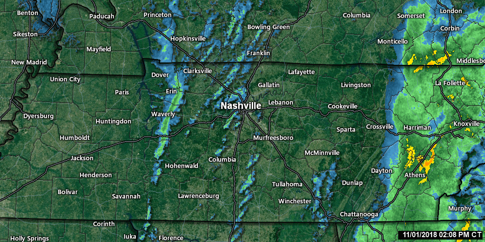
The cold front is pushing through this late afternoon, and with it, some light showers.
That green line of light rain to our west, seen below through 2:48 PM, marks the cold front.
Behind that, colder temps! The HRRR model illustrates the arrival of colder air through the night and overnight.
The cold front causing all this rain still has not yet pushed through. Only 0.36″ so far in BNA’s official rain. This system is underperforming model data. Only about 0.5″ total expected.
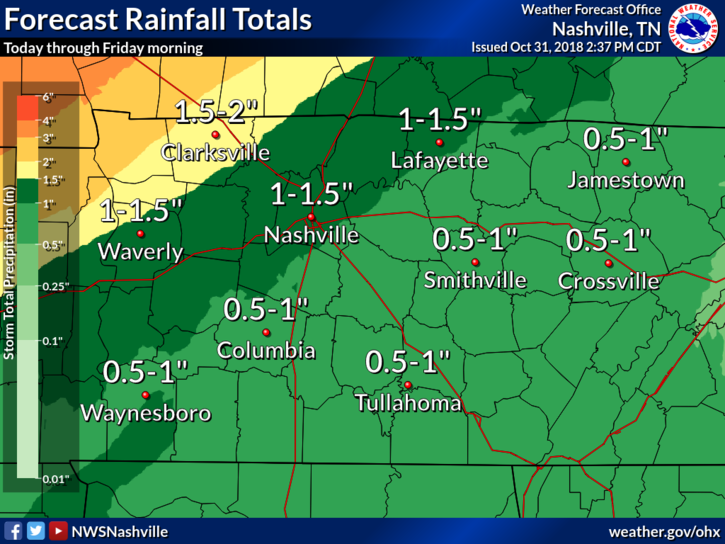
Rain is expected Thursday morning. There’s a very low possibility of a tornado.
Storm Prediction Center just introduced a 2% probability of a tornado occurring within 25 miles of us overnight or in the morning. Expect a rainy morning commute with about 1" of rain. pic.twitter.com/xpXFdMMXry
Winds out of the south are nice and breezy, could see some gusts at 15 to 20 mph. Overnight temps in the low 60s.
No rain.
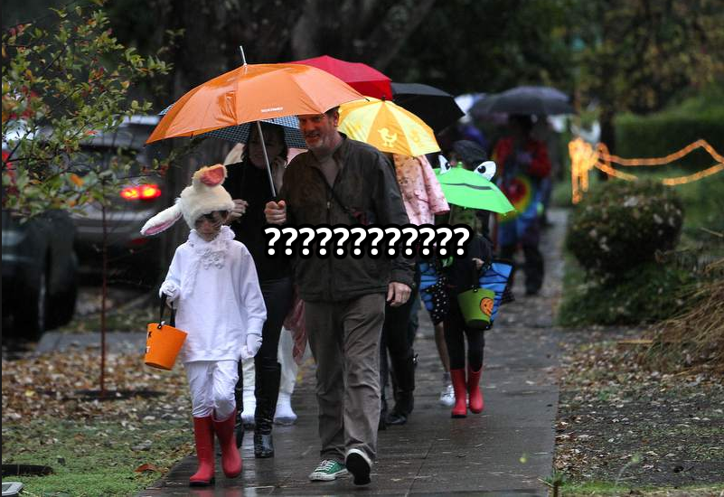
Models continue the trend of slowing down this cold front’s passage. Trick-or-treat hours now look mostly rainless, though a few quick showers could push through.
No weather concerns today and Tuesday. Yesterday’s front made today’s weather tranquil, with high-pressure dominating the pattern. Clear skies today and tomorrow with temps approaching 70º today and 80º tomorrow.
Monday and Tuesday will be great. Low 40°s early, warming to 66° Monday and 75° Tuesday. No rain either day. Tuesday night will be breezy and mild, a fact you may find important by the time you get to the bottom of this page.

Sunday looks picture perfect. Get outside! Temps will fall back to the 60’s tomorrow, but before they do, they’ll get to 75º+ today. One other note about today: the wind. We could see winds gust up to 30 mph, but no damage is expected.
You must be logged in to post a comment.