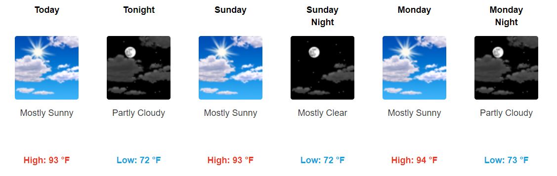
Clearing Saturday through Monday
We should have some clearing for the next few days.
We can’t completely rule out any pop-up showers. Some of you may get wet. But we aren’t concerned with any rain-outs or outdoor plan ruiners.

We should have some clearing for the next few days.
We can’t completely rule out any pop-up showers. Some of you may get wet. But we aren’t concerned with any rain-outs or outdoor plan ruiners.

Hot and humid with highs in the lower 90s and dew points in the upper 60s and lower 70s. This will allow for heat indexes to climb into the mid and upper 90s.
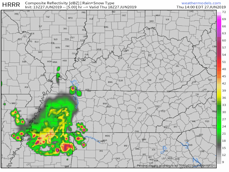
A few isolated showers and thunderstorms can’t be ruled out Friday through Sunday due to the instability in the atmosphere from the heat and humidity, but we do not expect widespread storms like we saw the past couple of days. The latest run of the NAM3 model shows just a few pop up storms Friday through Sunday:
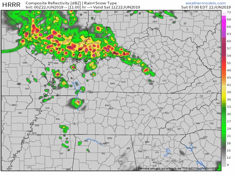
Yesterday was an eventful day weather-wise as storms bubbled up over I-65. They exceeded our expectations both in how many there were and how long they lasted. The expectation was that a few isolated cells would develop in the heat of the day, rain themselves out as the sun began to set, and leave us with a quiet night. Instead, we had numerous storms develop that were very electrically active and dropped some small hail.
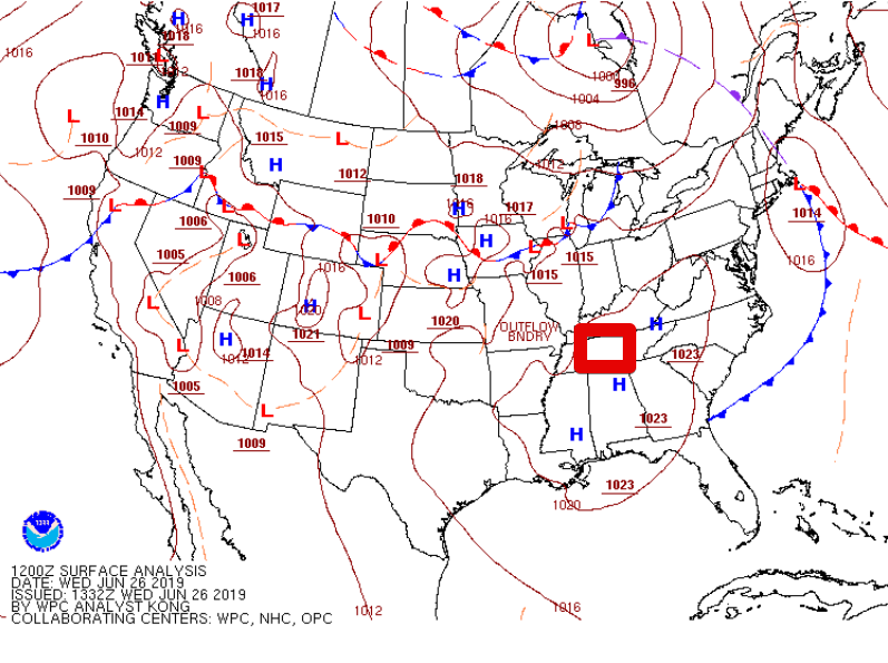
Notice the H’s near us on the map. High pressure is in control today. This typically puts a lid on the atmosphere’s willingness to storm. While it’s possible the western half of the state could see a brief storm, the odds are against any one place receiving rain. Temperatures will be slightly above average with a forecast high of 91°. There won’t be much of a breeze to provide relief, so take frequent water breaks!

Temperatures will be topping out at 87° for the high, remaining mostly sunny.
No rain today. Any precipitation should stay south this afternoon.
Dewpoint values will be a bit lower as well, so it won’t feel as sticky out there.

We think so.
Morning rain is sliding out of our area. It used up available storm energy.
Those east of Nashville may see strong/severe storms today, but for us additional afternoon rain and storms appear unlikely. We lack storm fuel and forcing needed for another event.
NWS-Nashville says:
“During the afternoon, short-range guidance depicts a few hit and miss thunderstorms, but nothing terribly organized. Instability, lapse rates, and moisture will be in place for thunderstorm development…however, low shear and weak mid-level ridging will work to keep storm coverage to a minimum. Any storms that do get going have the potential of becoming strong/severe with damaging winds and hail being the main concerns.”

I’d rather have a storm on radar than a storm on a model. I just would.
Seeing storms on models is like being a skinny 8th grade kid wondering if I’m going to get a date to the 8th grade dance. (Spoiler: it did not go well, many years ago).

More storms
are incoming this morning; we’re live tweeting them again.
Damaging winds are the main concern. Storms should intensify at least a little as they cross into Tennessee from Kentucky.
At 853 PM.
No more severe weather expected tonight.
Just some light rain.
My fave photo of the night:
@NashSevereWx @NWSNashville @FOXNashville @WKRN pic.twitter.com/CgtEwG5Bq9
— David Howe (@DHdeeder) June 22, 2019
You must be logged in to post a comment.