Read this entire post to be well informed. If you don’t want to read the whole thing, probably better off not reading it at all.

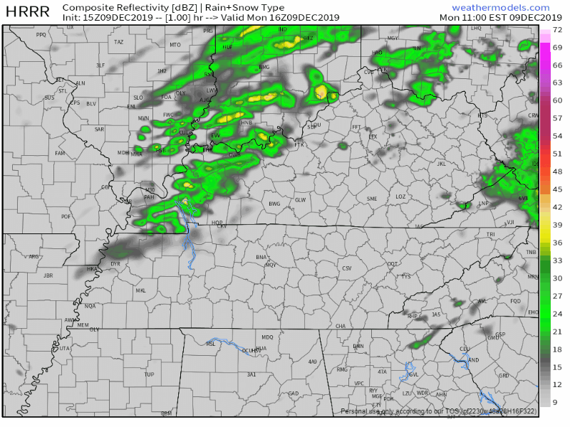
It starts as off and on rain Tuesday morning.
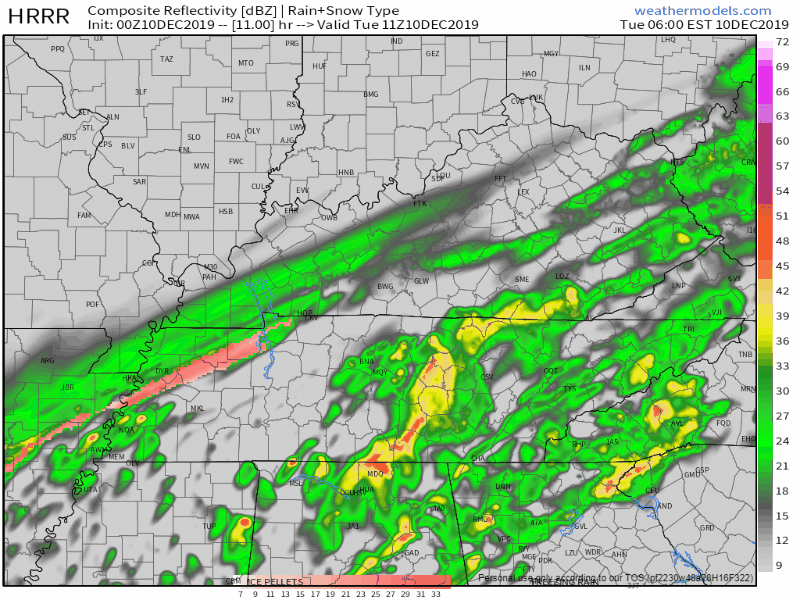
HRRR model, 0z run.
Rain, sleet, and snow mix in Tuesday morning.

Read this entire post to be well informed. If you don’t want to read the whole thing, probably better off not reading it at all.
It starts as off and on rain Tuesday morning.
Rain, sleet, and snow mix in Tuesday morning.
It’s not a “minor” travel impact to you if you slide into an overpass wall, so be smart out there. Fortunately we have a traffic problem and no one goes more than 25 MPH anymore.
But first:
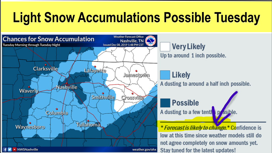
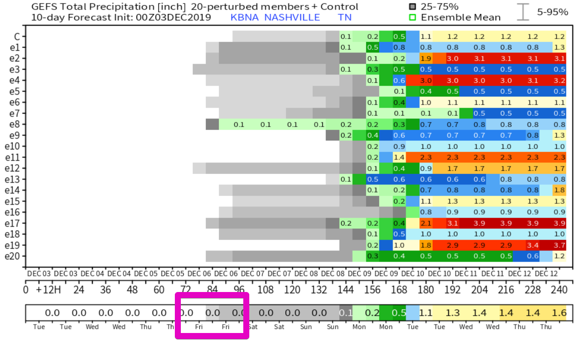
New model data arrived. NWS-Nashville made maps you need to see for Tuesday. Forecast is evolving. Snow forecast is trending upwards but forecast confidence remains low.
All quotes from NWS-Nashville.
Meh.

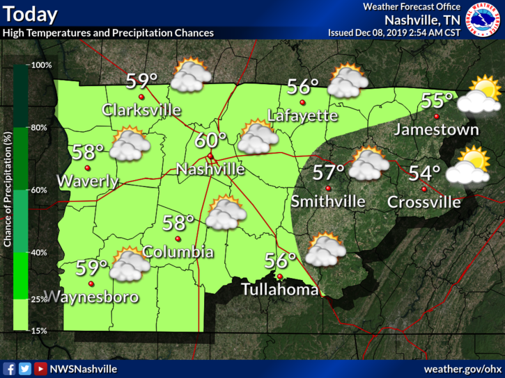
High temperature: 60°.
Skies: starting great, getting cloudy later.
Winds: 5-15 MPH with gusts as high as 20 MPH.
Showers possible very late Sunday night, light and brief, probably while most sleep, maybe lingering into the AM rush hour. So thinks the NAM3 model:
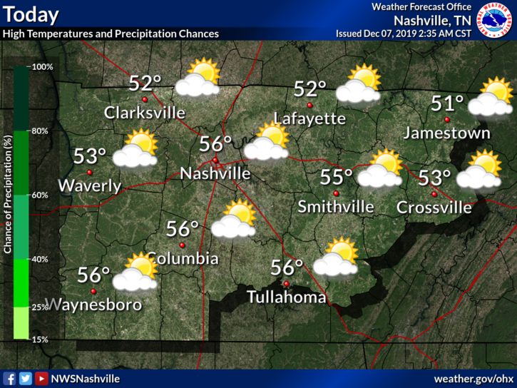
We will hit a high near 56°F today, with some clouds hanging around.
Saturday is leading us with an excellent start to the weekend. If you have any outdoor activities or need to decorate for Christmas, today is the best of the best.
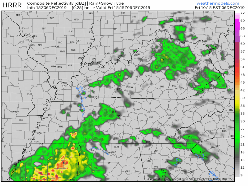
We’ve dealt with scattered showers throughout the morning, but those will quickly be on their way out. The latest HRRR model has these showers fizzling out for much of us no later than 5PM-6PM:
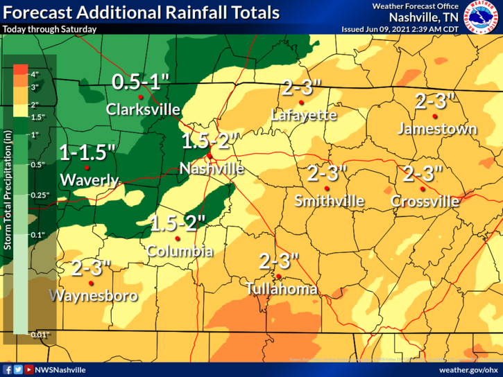
HOW MUCH RAIN?
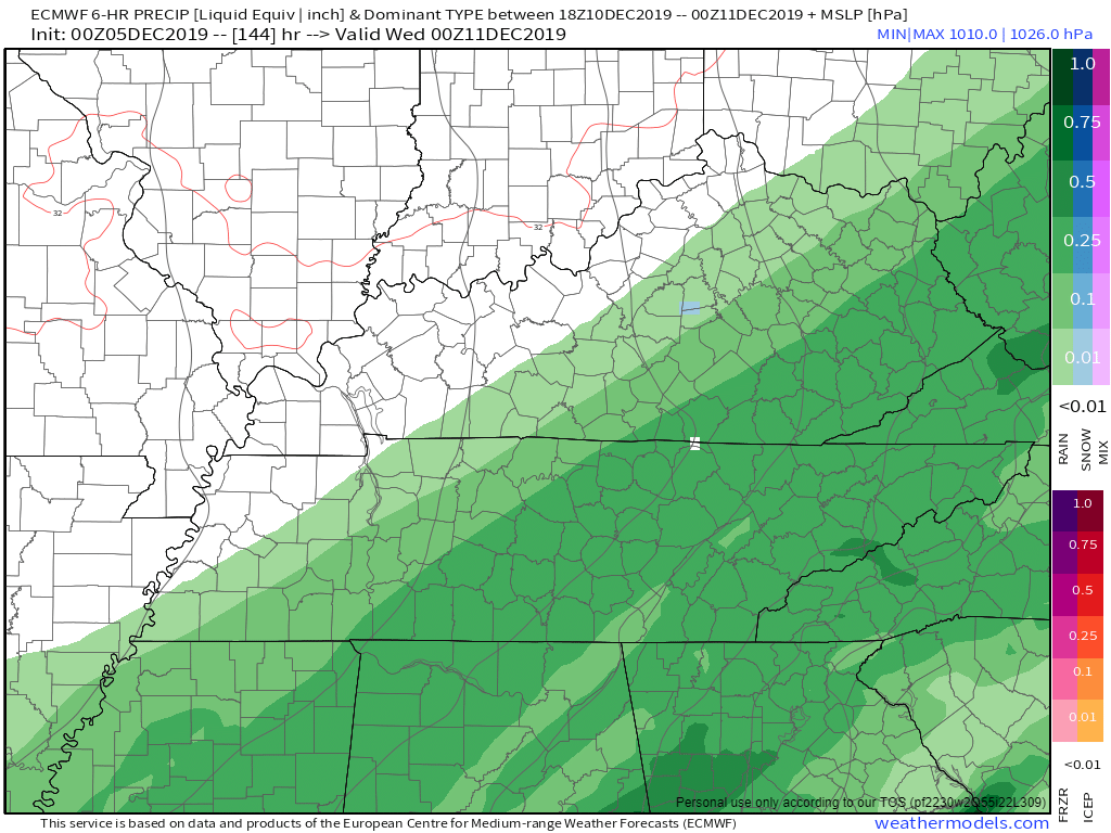
Today:

It may start as soon as late tonight: a few scattered showers.
The majority of the rain will move through Friday.
TIMING
The NAM3 model shows the heaviest rain passing through in the afternoon, and fizzling out Friday night.
We have some fall weather on tap until the next disturbance moves NE into our area Thursday late. Temps in the mid 50s both today and tomorrow. Really great days for outdoor activities. But it doesn’t last…
After the soaking we’ve had over the past few days, we have a chance to dry out beginning today. Plenty of sunshine and a high temp of 47°. Not very warm, but the sun will help. Temps continue to climb over the next few days.
Our friends off to our East are seeing some snow accumulation this morning. Some areas will get a measly dusting while others in the Plateau could get up to 2″.
For us though, we’re not going to see any of that. We’ll have to wait a little longer.
You must be logged in to post a comment.