Chilly + Dry Today; Some Christmas (Eve?) Rain (maybe)

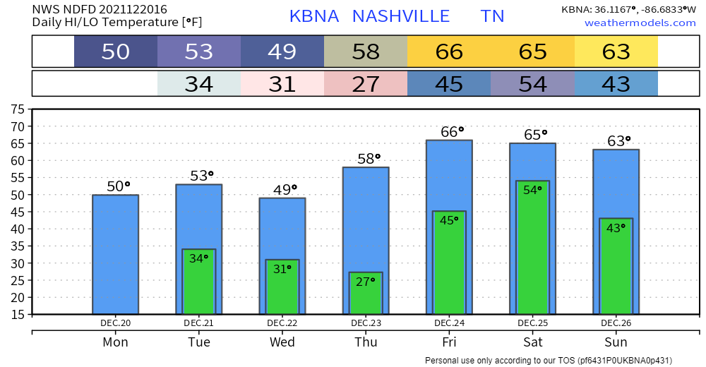
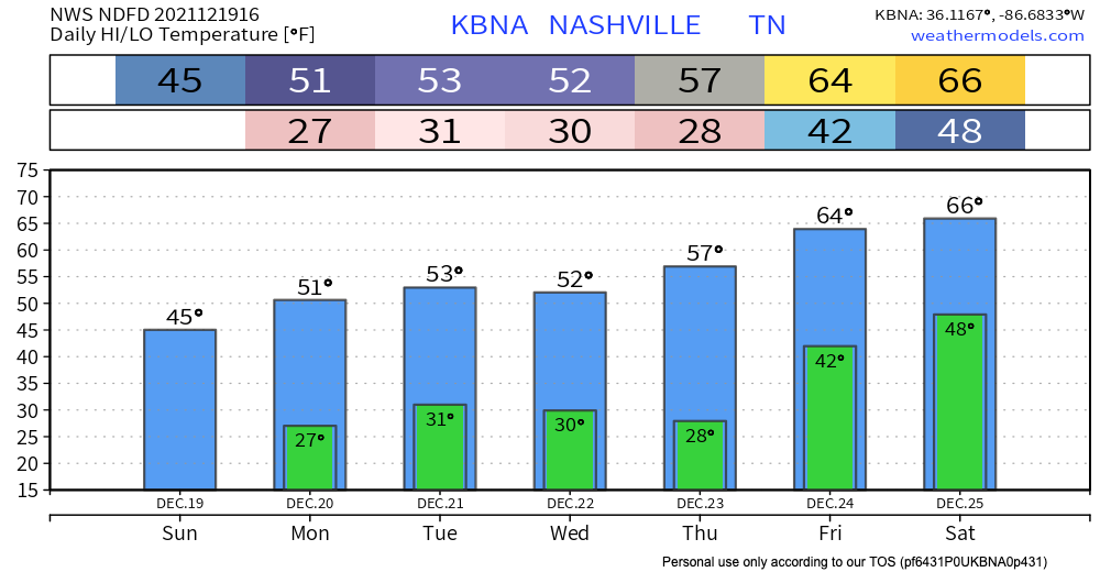
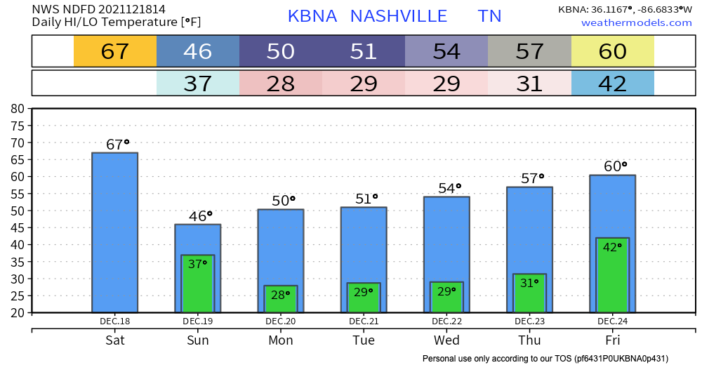
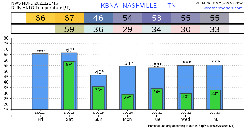
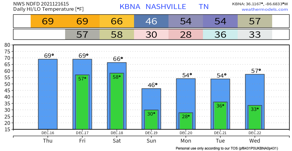
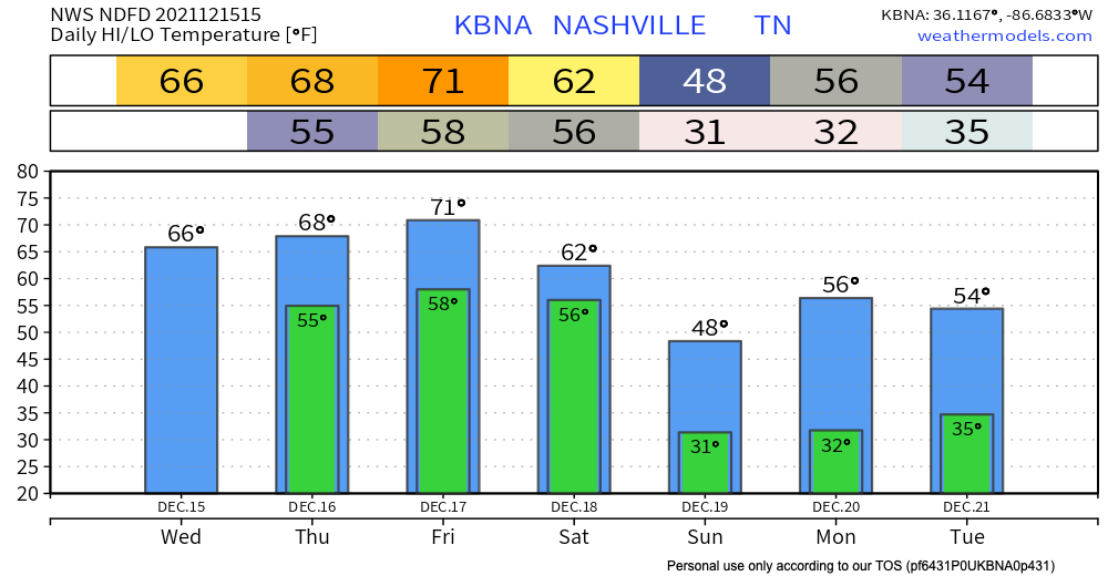
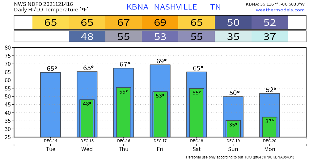
Normal temps, some sun. Wind chills drop tonight, time stamp upper left:

NWS Blend of Models Wind Chill values, valid Mon. 10am – Wed. 12am

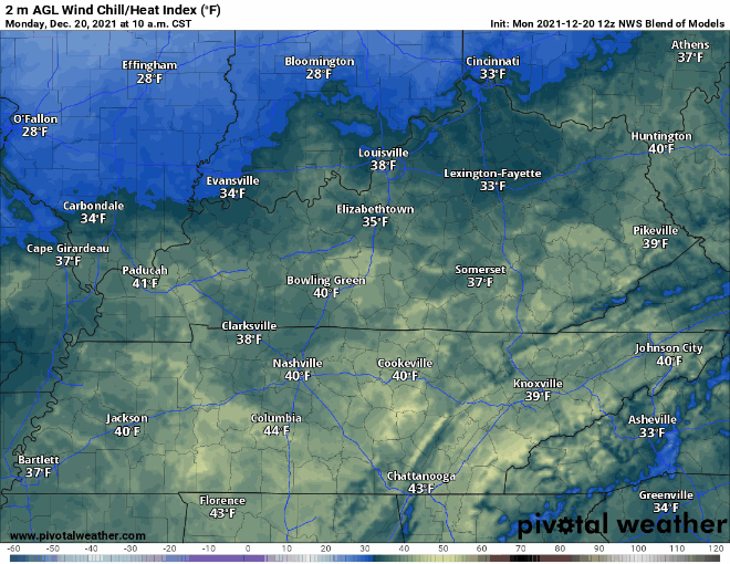
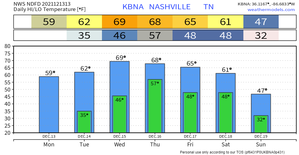
Additional moisture rolling in tonight plus near freezing temps equals a low probability chance of freezing fog early tomorrow morning. If you are out really early and see fog on the road ahead – especially on bridges and overpasses – a thin layer of ice may have formed on the road. The potential hazard will be brief. Just be aware. It’s freezing fog szn. read more

Dry Today, but A Wet Couple of Days Ahead

We stay dry and experience above average temps today getting into the upper 60’s. A wet couple of days are ahead, although we don’t think everyone will get rain non-stop all weekend. Thursday scattered showers and possible thunderstorms start in the afternoon. These are not expected to bring severe weather. Quick downpours can cause some potential flash flooding. WPC is forecasting a 5-10% chance of flash flooding occurring within 25 miles of you. So, keep an eye on the possibility of flash flooding becoming a problem if you live in a flood prone area. read more

Rain Begins Thursday

Clear skies today with temps about 15° above average. Not much different tomorrow. Cloud cover tomorrow will keep temps much the same.

It’s going to get even warmer later this week.

Showers still in the forecast beginning Thursday. Euro model likes our chances of on/off rain showers starting Thursday afternoon through Friday morning. read more

Warm-up Starting Today; Rain Thursday

NWS-Nashville has teams in the field again today. They are surveying damage, distinguishing straight line wind events from tornadoes, and rating tornadoes on the EF scale. They’ve counted 7 tornadoes in Middle Tennessee from Saturday morning. We think that number will probably be higher. Tornado surveys will probably not conclude until Tuesday. We will bring you that information as it comes in. read more

Much Needed Calm Weather

We are all done with rain and severe weather. If you are waking up to any damage, tweet a picture of it with the location using #tspotter. Storm surveys will be conducted again today to determine where we had tornadoes vs. where we had straight line wind damage. We will tweet updates as that information comes in. read more