
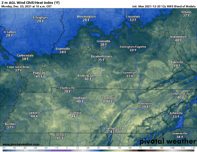
Normal temps, some sun. Wind chills drop tonight, time stamp upper left:
Additional moisture rolling in tonight plus near freezing temps equals a low probability chance of freezing fog early tomorrow morning. If you are out really early and see fog on the road ahead – especially on bridges and overpasses – a thin layer of ice may have formed on the road. The potential hazard will be brief. Just be aware. It’s freezing fog szn.
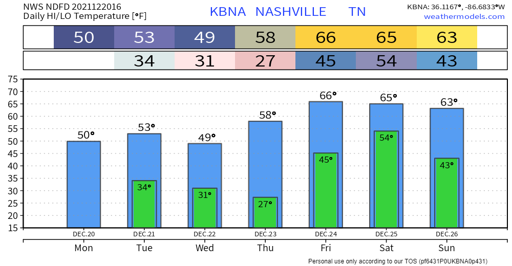
Slight cooldown Wednesday because a weak cold front should cross us. Temps will only drop a few degrees, nothing drastic. After that, a warming trend starting Thursday, lasting through the weekend. Highs in the 60s and lows nowhere near freezing. Hopes for a Snowy Christmas are gone.
Christmasy Showers
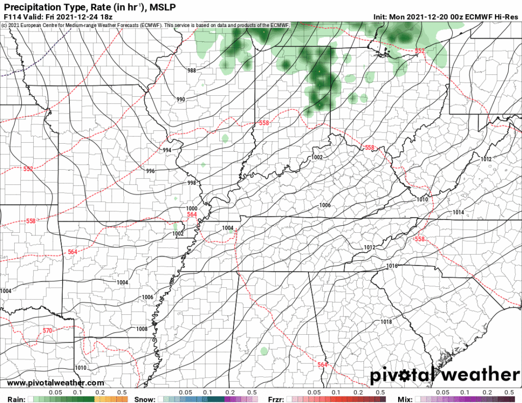
Best chance of rain comes Christmas Eve and Day! Models are coming into better agreement.
Here’s the Euro, it shows rain (no storms, no snow) Christmas Eve. Not a washout.
Categories: Forecast Blogs (Legacy)
You must be logged in to post a comment.