
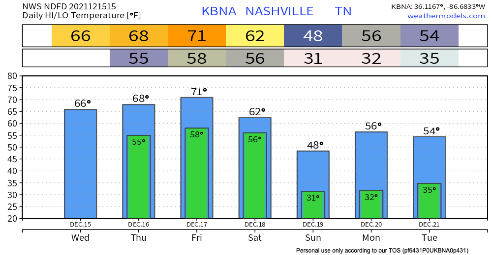
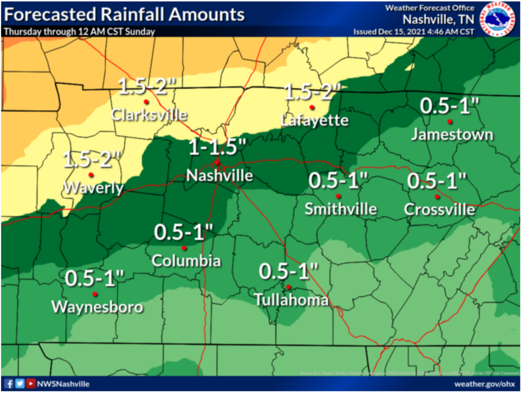
We stay dry and experience above average temps today getting into the upper 60’s. A wet couple of days are ahead, although we don’t think everyone will get rain non-stop all weekend. Thursday scattered showers and possible thunderstorms start in the afternoon. These are not expected to bring severe weather. Quick downpours can cause some potential flash flooding. WPC is forecasting a 5-10% chance of flash flooding occurring within 25 miles of you. So, keep an eye on the possibility of flash flooding becoming a problem if you live in a flood prone area.
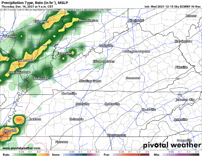
This Thursday rain continues overnight into Friday morning. The Euro model above shows rain sticking around Friday until mid afternoon/evening time where it stays mainly to our north. Rain resumes early Saturday morning, Euro says 6am ish. Scattered showers persist all day until after dinner time. The models agree on this general timeline. Saturday ETA clarity will come with model updates in the next couple days.
Threats with this rain starting off our weekend are quick downpours and a possible thunderstorm or two. So when thunder roars, stay indoors.
Our temperatures heat up to the low 70’s by Friday. The sun starts to come back Sunday and so do the average temperatures for this time of year. Looks like highs are averaging in the low 50’s by the beginning of next week!
Categories: Forecast Blogs (Legacy)
You must be logged in to post a comment.