
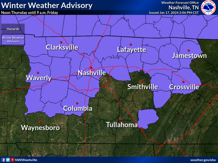
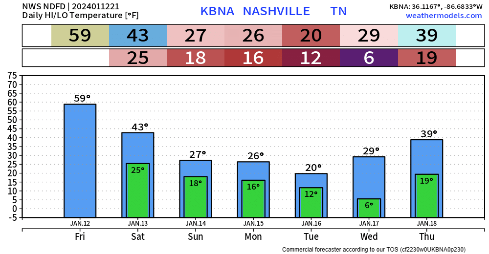
We have a Winter Weather Advisory for both of our counties from noon Thursday – 9am Friday.
- Ice accumulations up to 0.1″ possible…
- “Travel conditions remains treacherous in some locations owing to lingering snow cover” – NWS Nashville
- “…additional ice and snow accumulations will exacerbate these conditions.” – NWS Nashville
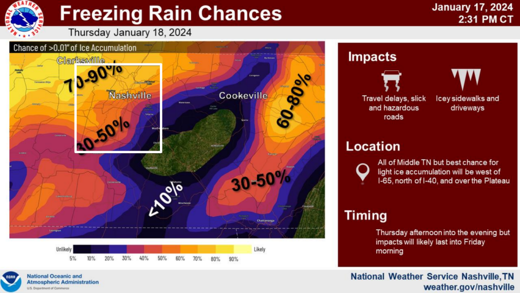
Across our counties, probabilities for >0.01″ of ice accumulation range from 30 – 70%.
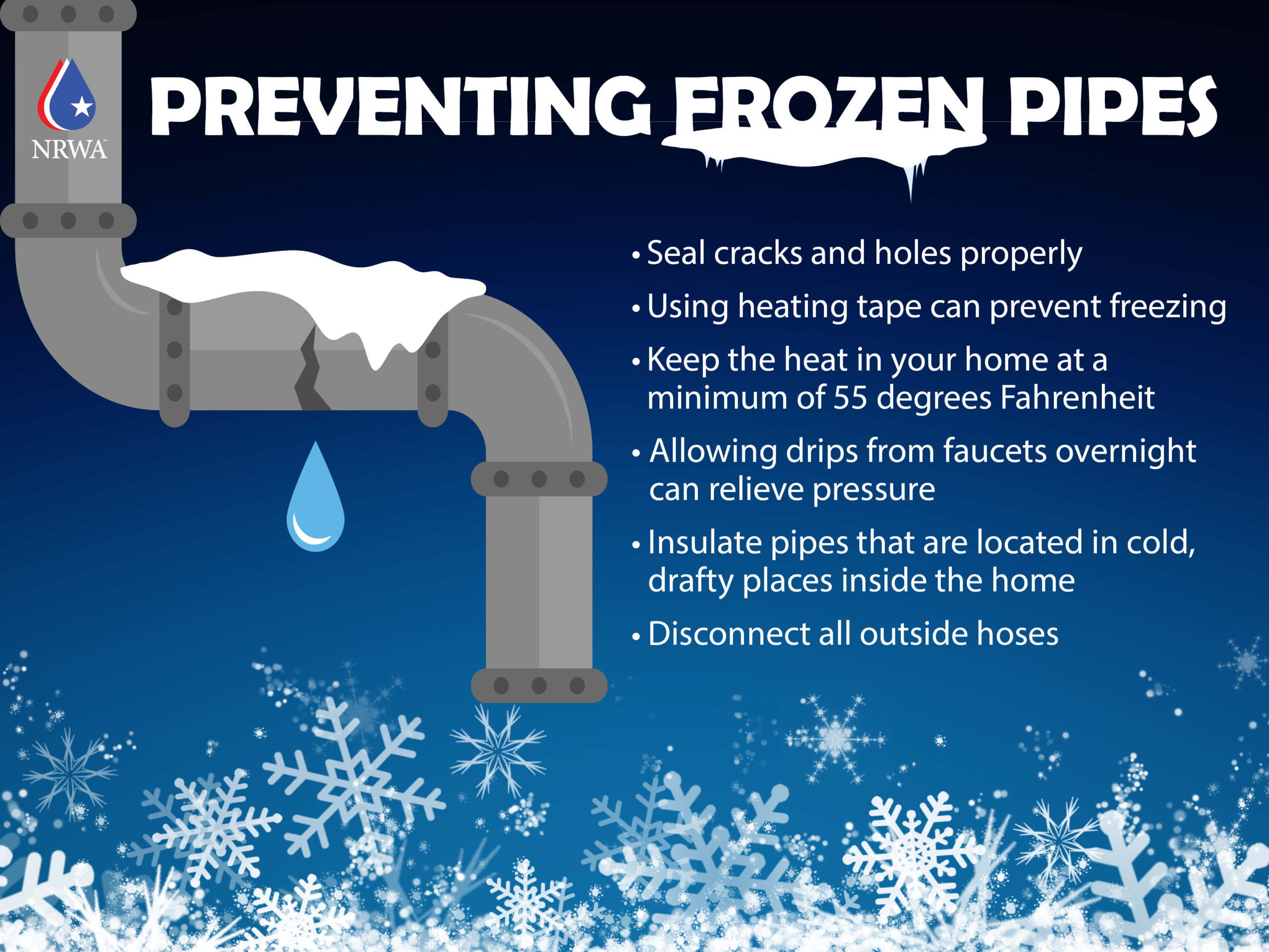
Ice is a lot different from snow. All it takes is a glazing of ice to cause issues on the roads.


You must be logged in to post a comment.