

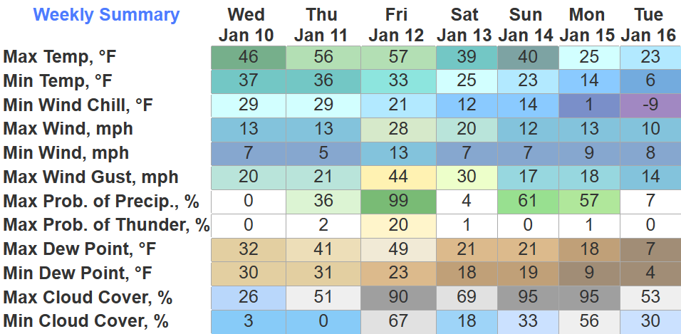
A busy forecast coming up for us.
The rest of today and Thursday will be calm. Thursday + Friday we’ll even be 5-10 degrees above average. Enjoy this, it will not last long.
Friday things change.
A strong low-pressure system will pass to our NW and will provide a whole bunch of wind + rain, maybe some storms.
- non-thunderstorm wind gusts up to 35 – 45 mph are likely, with isolated higher gusts possible throughout the day Friday
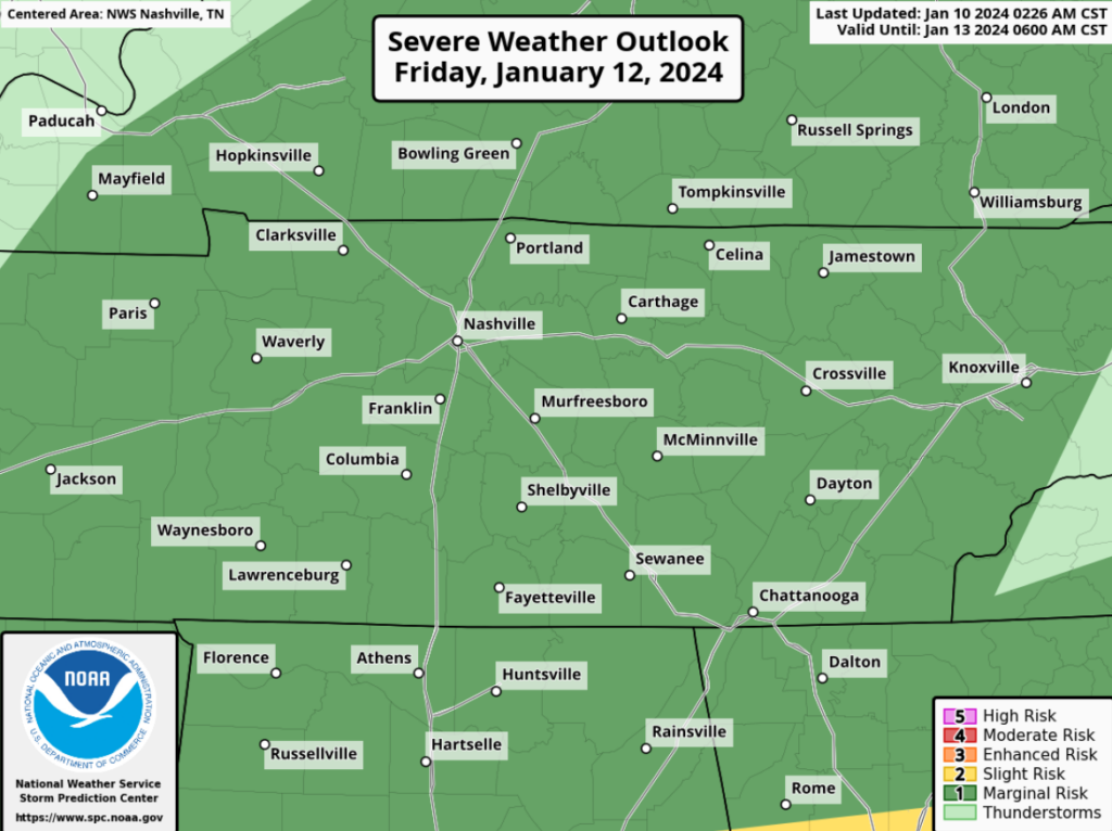
In addition to the non-thunderstorm winds, the Storm Prediction Center has also outlooked both our counties with a 5% chance of severe weather within 25 miles for Friday.
As of right now, signs point to this being a possible straight-line wind event. Models are in good agreement that our atmosphere will not be supportive of tornadoes.
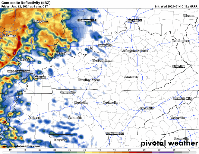
HRRR model shows rain arriving early Friday morning and lasting through midday. Models think we will have very little, if any CAPE (aka storm fuel) in place during this time, causing our severe chances to be very low, but not zero.
Regardless of if we see severe weather or not, our non-thunderstorm wind gusts will be ~ 40 – 50 mph, close enough.
Forecast subject to change, stay tuned.
Some flurries are possible Friday night, but no accumulation is expected with surface temperatures above freezing.
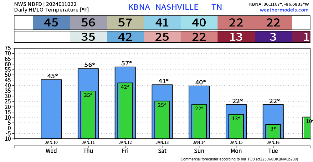
Saturday looks dry, but a lot cooler with highs struggling to reach 40°.
Prolonged Sub-Freezing Temps Expected
Before we get into the snow talk, I’d like to talk about what could be argued to be the headline of the upcoming forecast – the extreme cold coming early next week.
“…the coldest air we’ve had this winter — by far. In fact, it’ll be the coldest air we’ve had since December 2022. Remember that? Morning lows near zero? Yep. It’s coming again. Teens by Monday morning and by Tuesday morning models are consistently putting all of Middle TN at 5 degrees or colder. Pipe-bursting cold, y’all.”
– NWS Nashville Afternoon AFD
Sunday night we will go below freezing and will likely not get above freezing until maybe Wednesday afternoon – and we may stay below freezing Wednesday too. Wind chill values near or below 0° are possible Monday morning/night, Tuesday morning/night, and Wednesday morning.
Now is the time to start thinking about prepping exposed pipes, making room for pets inside, and checking in on neighbors who may not have adequate heating.
Ok Now Snow Talk
Well, snow lovers, I have good news.
“We’re still 5 days out and I can say, confidence is very high everyone will see snow, however the timing and location of the higher amounts is still bouncing around pretty significantly.”
– NWS Nashville Afternoon AFD
Models have been fairly consistent on showing at least some snow, likely either Monday or Tuesday. Specific amounts/timing are still unknown with this being ~5 days out.
Generally speaking, it seems right now like locations N of I-40 will receive more than locations S of I-40.
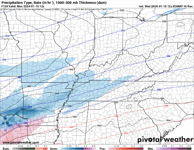
Above is 4 different models guesstimates at what the radar will look like Monday morning. For now, models are generally in agreement that there will be snow in the vicinity at this time. With temps well below freezing, any snow that does fall would have no problem accumulating.
This is still a longgg ways away, and this could all change. Really would like to get past the event Friday before we talk about any specifics on the snow. Models will likely bounce back and forth all week. Stay tuned for updates.
Quick References:
Weather changes constantly.
Follow @NashSevereWx on Twitter for any changes to this forecast.
Live coverage during tornado and severe thunderstorm warnings:

Look good.
Support the mission.

We are 100% community supported. No ads. No subscription fees. Keep it free for everyone.


Categories: Forecast Blogs (Legacy)
You must be logged in to post a comment.