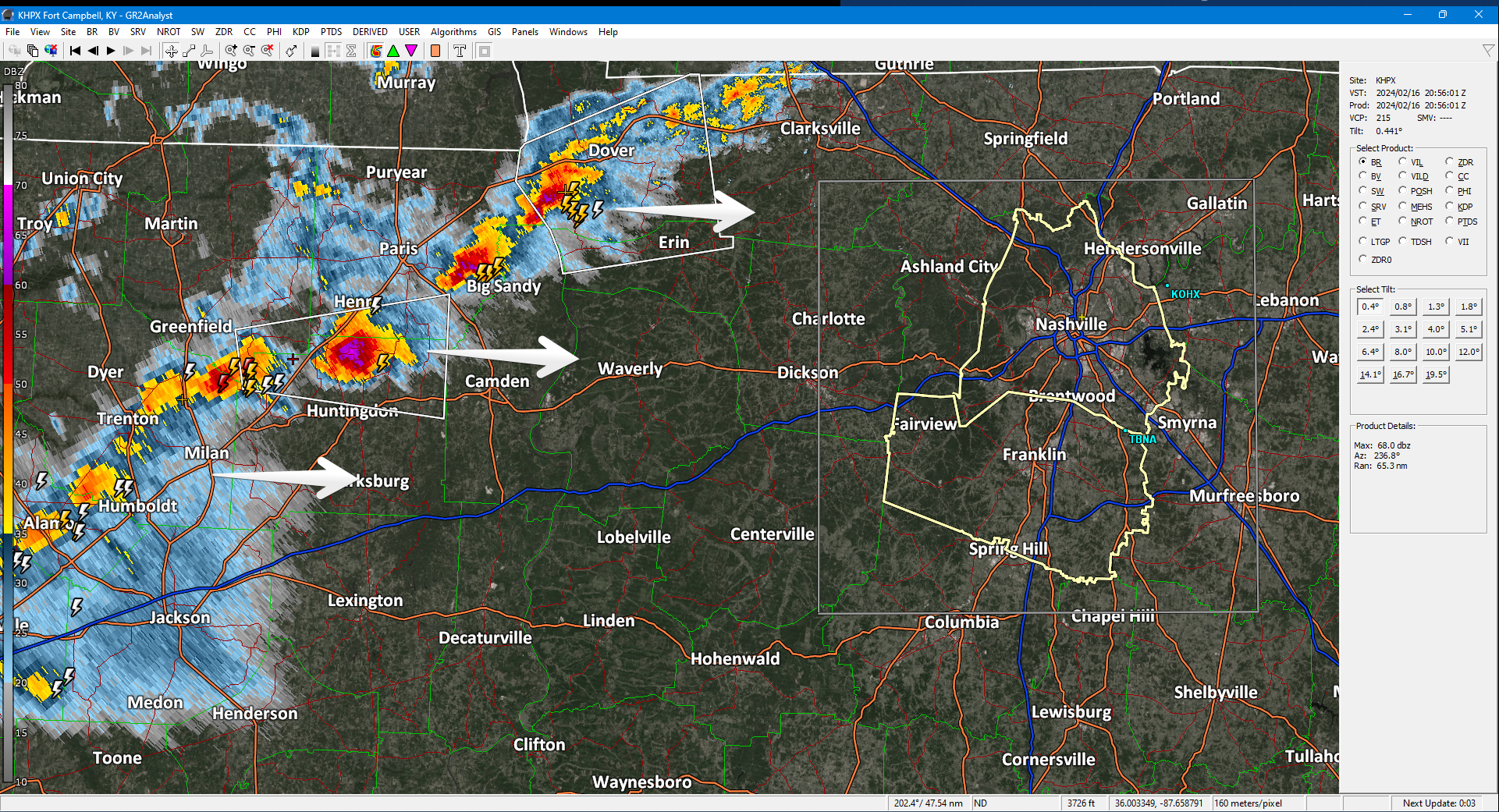
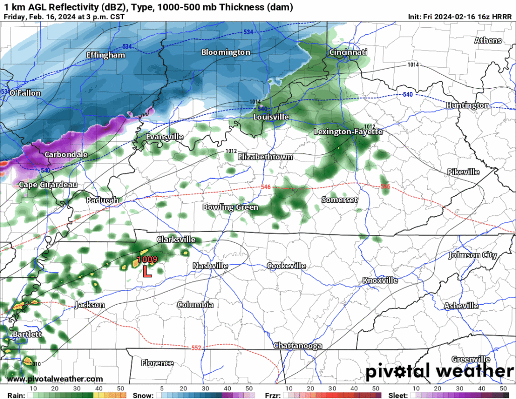
At 3 PM a strong thunderstorm line formed in West TN moving our way. Lightning, small hail, gusty winds, brief heavy downpours. 5-6 PM ETA per HRRR model. Very cold air behind it, bundle up if going out.

At 3 PM a strong thunderstorm line formed in West TN moving our way. Lightning, small hail, gusty winds, brief heavy downpours. 5-6 PM ETA per HRRR model. Very cold air behind it, bundle up if going out.
Nice day so far, but unfortunately change is coming.
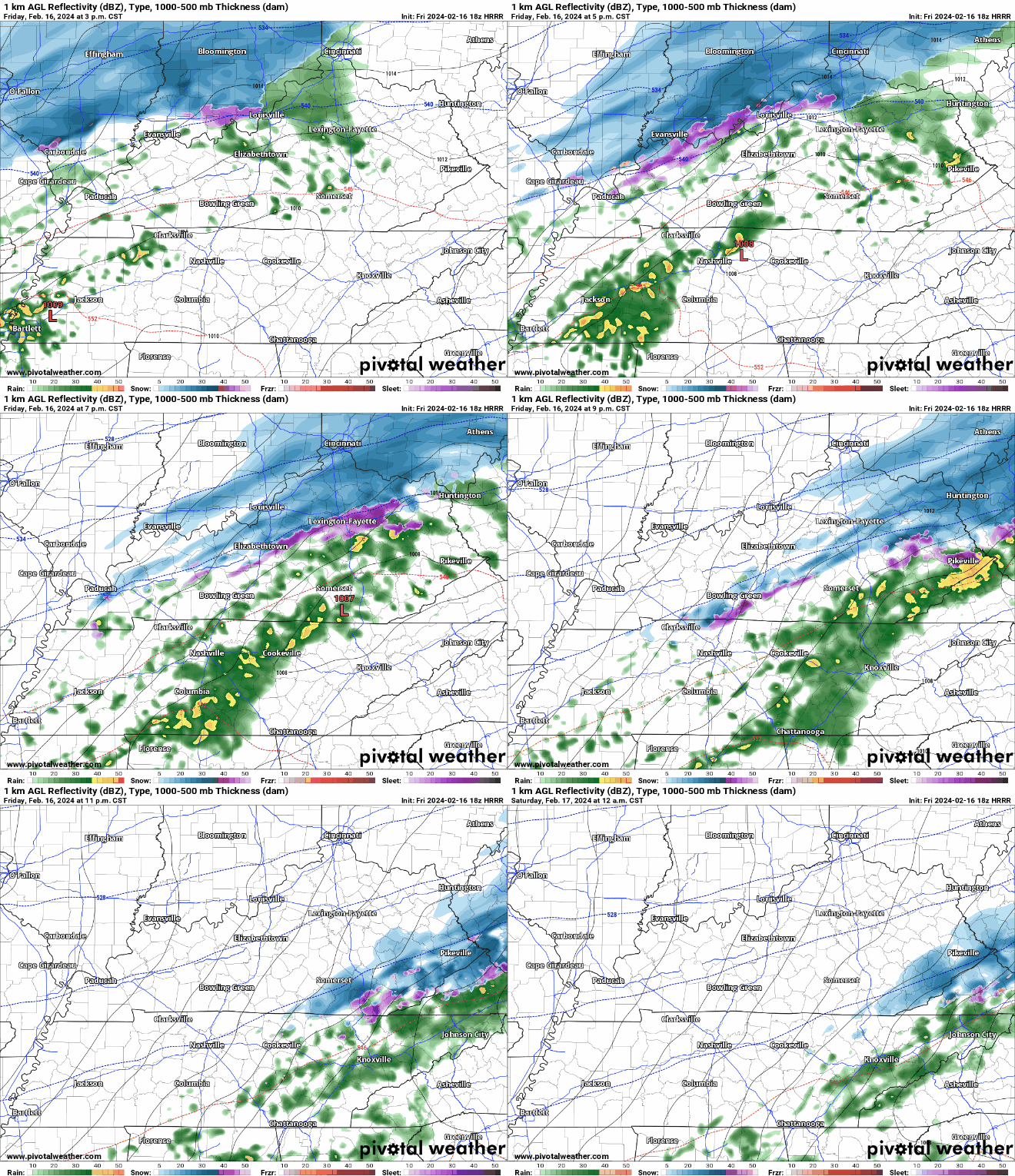
HRRR model (above) shows:
Saturday will be dry, but cold.
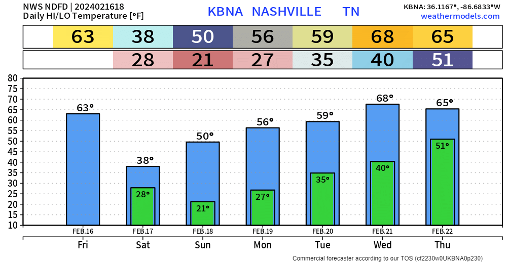
High temperatures Saturday are expected to only reach the upper 30s. Wind chills may not make it above the freezing mark tomorrow.
Thunderstorms and heavy downpours in model data, ETA 5-6 PM, plus or minus a few hours. You’ll want to be inside then.
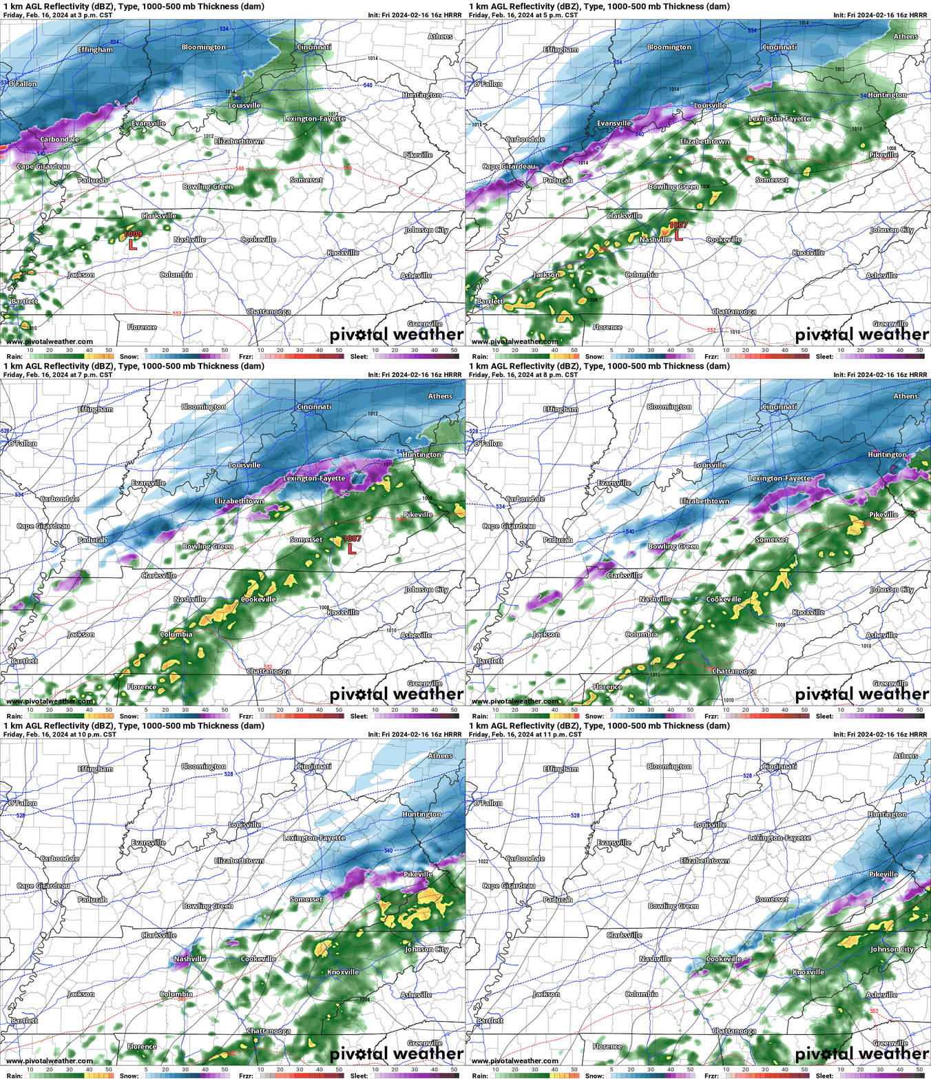
Rain passing thru bt 4:30 PM and 7 PM. Very little snow 9-10 PM tonight. Few/No travel impacts. Bridges, Overpasses, High Elevation Areas may be slick.
Wind chills below freezing from around 9 PM tonight through late morning Sunday.
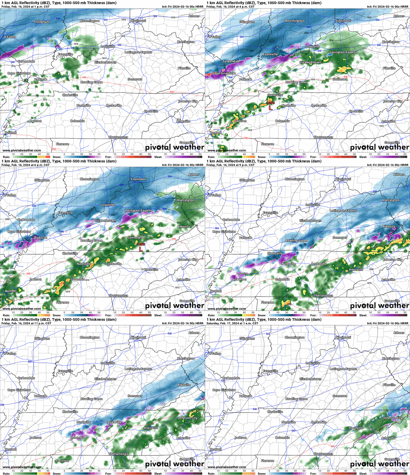
New HRRR model run, Friday timing. Estimates only. May change:
Most snow to melt on impact. Little to no accumulation.
Bridges, Overpasses, and Areas at Higher Elevation may be slick late Friday night thru Sat AM. Expecting below freezing temps late Friday night until about 9 AM Sat. Bridges and overpasses are the exception because they cool down way faster than earth.
Beautiful day today with BNA nearly getting to 70° today.
Rain moves in tomorrow.
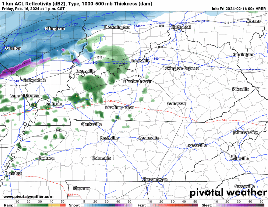
HRRR model (above) shows:
Saturday will be dry but will also be the coldest day we’ve had in a while. High temperatures may not make it to 40°…
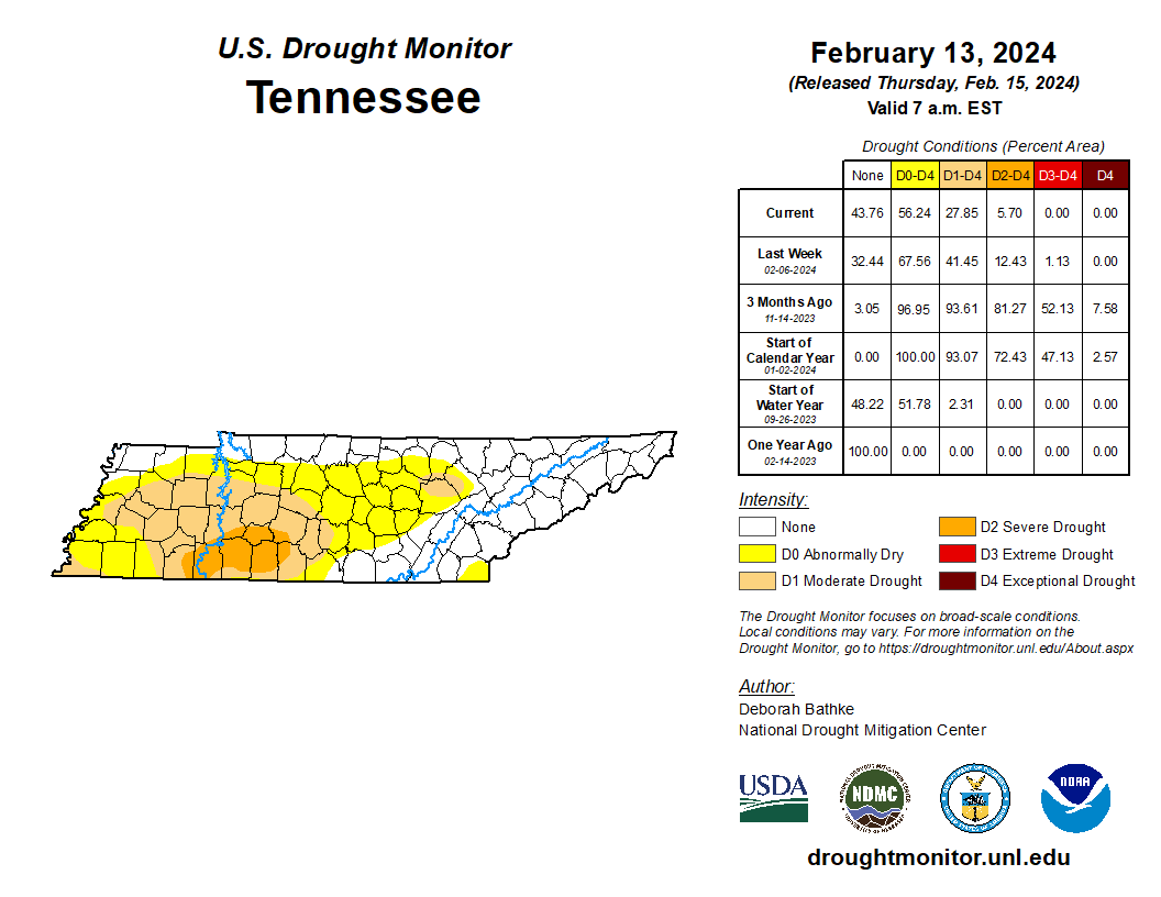
We’re still droughty, just less droughty. Takes time to catch up from our big rain deficit.
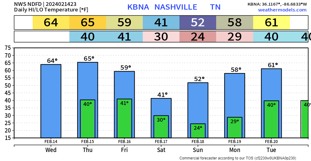
Plenty of sun propelled our temps all the way up to the mid 60s. Nice evening if going out to dinner.
Tomorrow will be a near copy and paste of today. Sun and high temps back in the mid 60s.
Friday…not quite as nice.
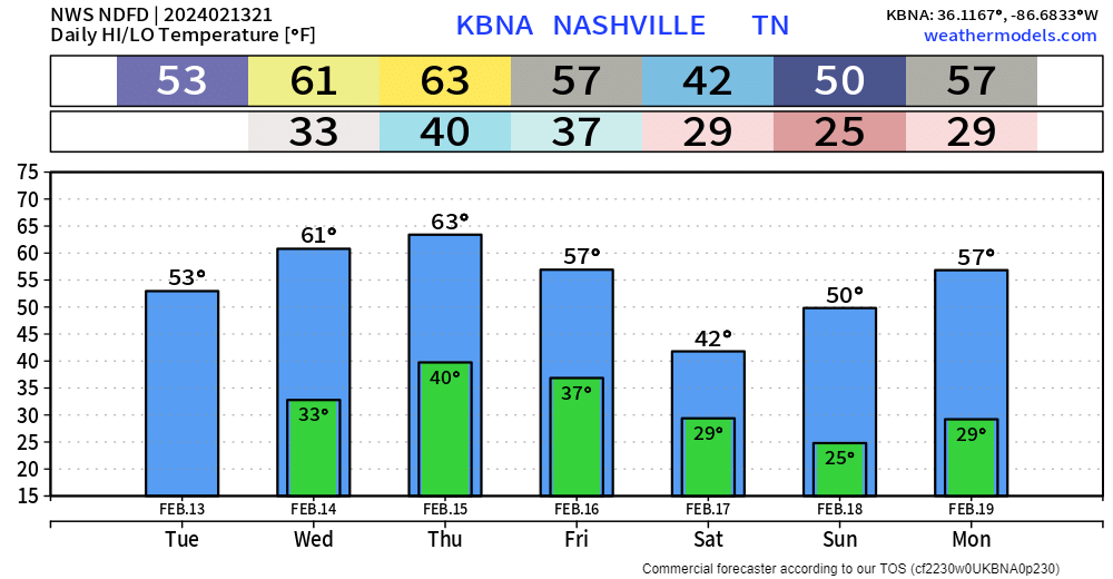
After quite the interesting night, today turned out nicely with high temps getting up into the low to mid 50s.
Wednesday and Thursday will be lovely with high temps reaching into the low 60s. Cold mornings to deal with tho.
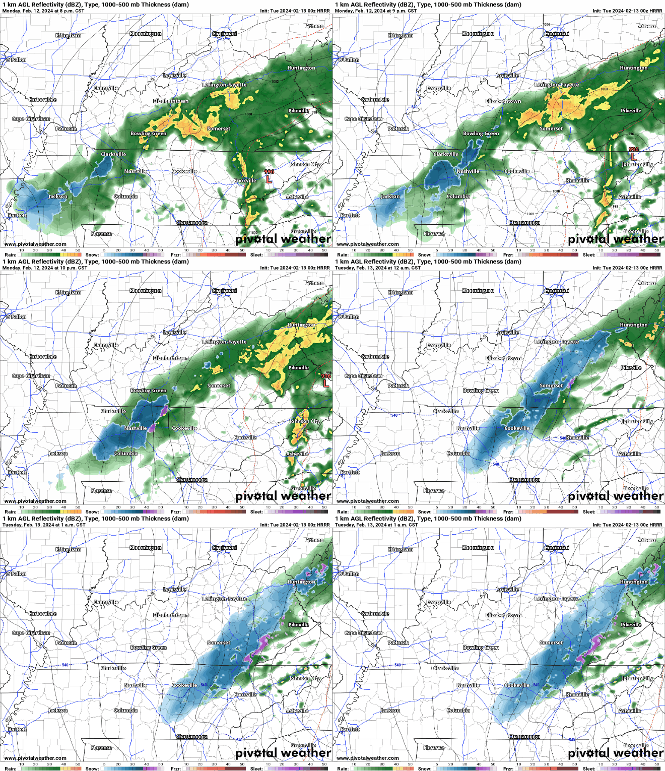
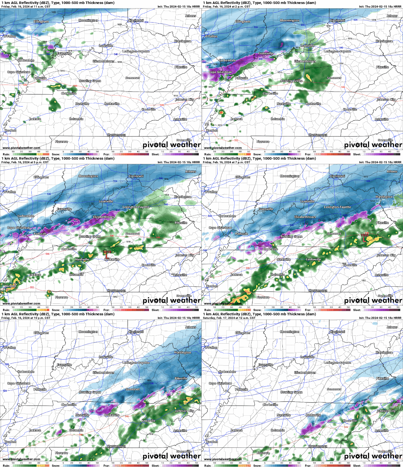
Changeover from rain to a mix of rain/sleet/snow currently happening in some areas.
HRRR model (above) suggests that a mixture of frozen precipitation may fall for a few hours tonight, but we have reason to believe that very little, if any of it will stick.
You must be logged in to post a comment.