
We woke up this morning to several inches of snow on the ground and air temperatures around 10°, with wind chill values around 0°. That doesn’t sound much like Middle TN. Quite the snow event we have here.
Snow will continue to fall thru this evening.
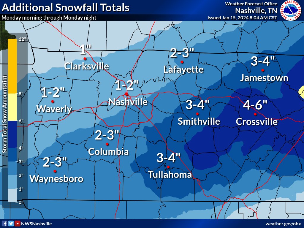
Above is additional snow possible throughout the day, on top of what has already fallen. Generally, north of I-40 around an additional 1 – 2″, with an additional 2 – 3″ south of I-40.
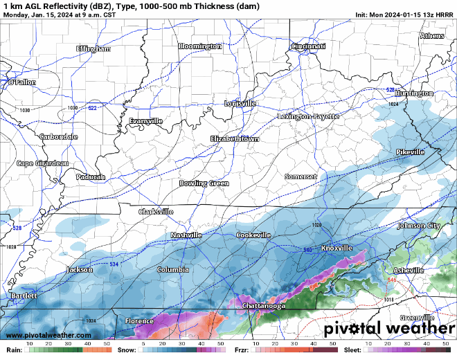
HRRR model (above) shows snow ending for the most part around 5 or 6 pm.
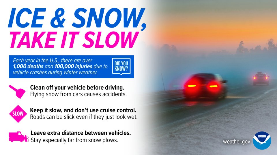
Road conditions are hazardous, and they will continue to worsen with additional snow.
Your safest bet is staying off the roads.
If you must travel, take it slow and leave plenty of room between you and the car in front of you. You know your vehicle best, don’t push it past its’ limits. And most importantly, *clear the snow off the top of your car! * Snow left on top of vehicles can become ice missiles. Please, don’t put others at risk.
You can check out the Road Conditions/TDOT SmartWay Cams here: TDOT SmartWay: Home (tn.gov)
Along with the snow, dangerous cold temperatures will stick with us. Temperatures will not make it above freezing until Thursday, so expect little melting until then.
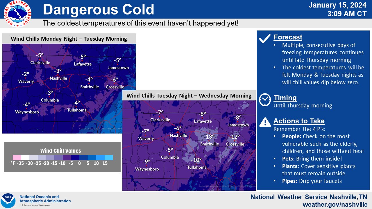
Low temperatures will slide down into the low teens and single digits tonight and Tuesday night, with wind chill values going below 0°. Even during the day today and Tuesday, wind chill values will stay in the single digits.
If going outside to enjoy the snow, make sure to dress warm, with multiple layers.
Check in on neighbors/friends who may not have adequate heating, and don’t forget to make room for pets indoors.
Enjoy the snow, but stay safe and warm!

A wintry mix with some more snow is possible Thursday night into Friday AM. Details are still fuzzy, more on this later. Temperatures will likely not get above freezing Friday or Saturday.
Quick References:
Weather changes constantly.
Follow @NashSevereWx on Twitter for any changes to this forecast.
Live coverage during tornado and severe thunderstorm warnings:

Look good.
Support the mission.

We are 100% community supported. No ads. No subscription fees. Keep it free for everyone.


Categories: Forecast Blogs (Legacy)
You must be logged in to post a comment.