
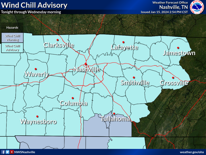
Wind Chill Advisory continues thru 10 AM Wednesday.
- “Wind chills as low as 15° below zero…plan on slippery road conditions. The cold wind chills could result in hypothermia if precautions are not taken.” – NWS Nashville
High temps only expected to make it to 18° today. Wind chills will be stuck in the single digits during the day.
Air temps tonight will be very close to 0°, your backyard may make it below zero.
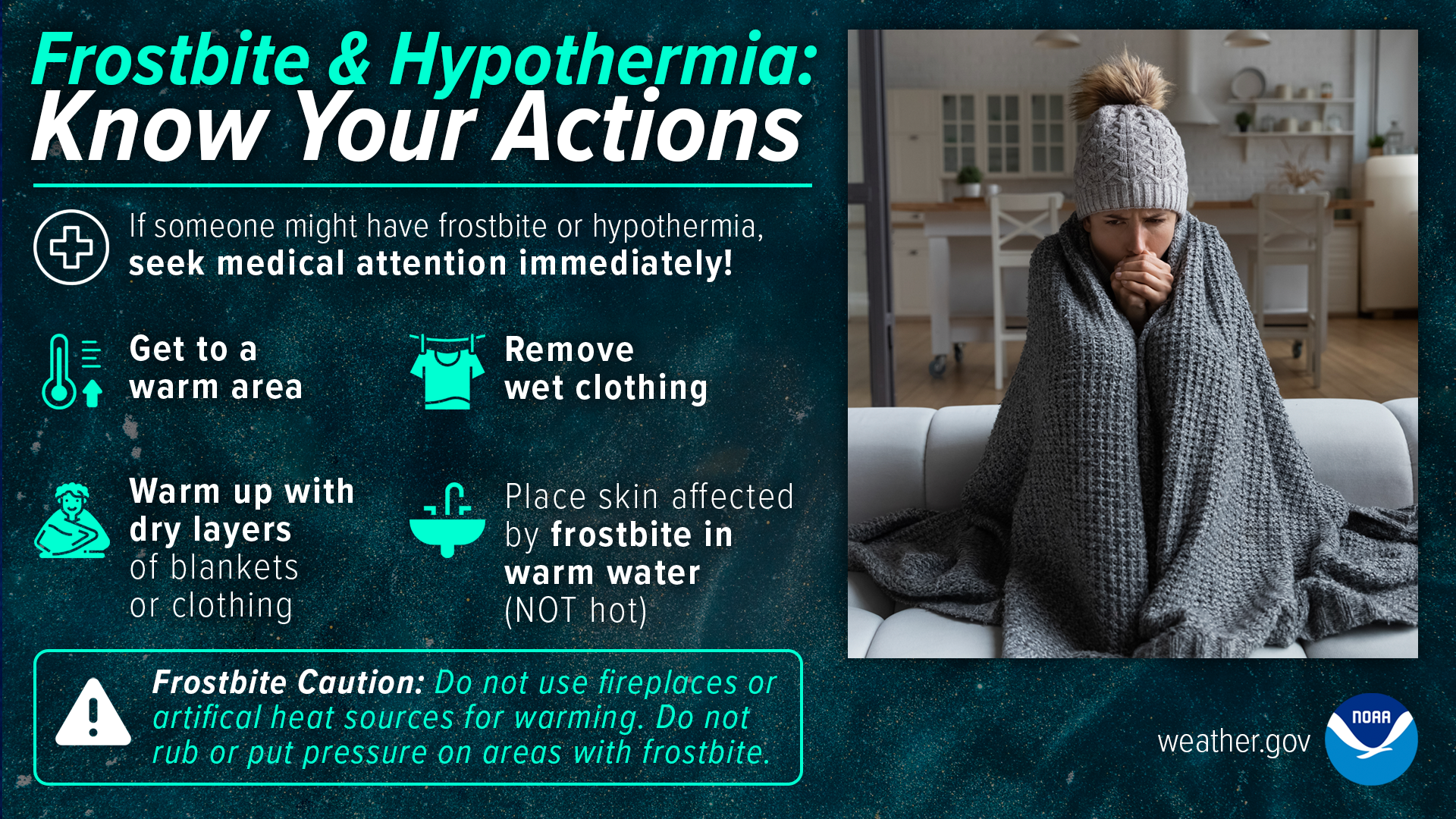
If sledding or going out today, make sure to bundle up. Frostbite and hypothermia can set in very quickly.
Road conditions are still sketch, especially backroads that haven’t been treated. Continue to take it slow if going out. Clear off the roof of your car before heading out. Do not let ice missiles fly into other cars. You can check the TDOT Smartway cams here.
If you were snow deprived, you were certainly left happy.
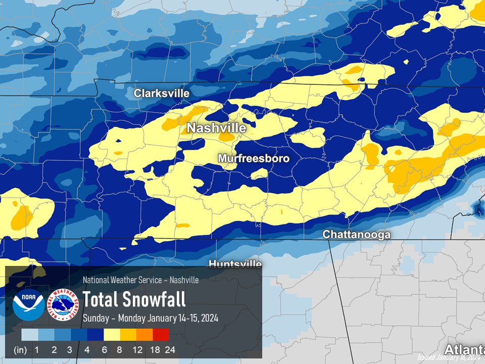
Most of us ended with 6-8″, some as high as 9″. Crazy.
With temperatures expected to stay below freezing until Thursday, not much melting will occur.
Another system may bring us some more wintry precip Thursday PM, but this set up is significantly different than what we just had. Temperatures will be hovering around the freezing mark, so it looks like we may get a mix of rain and snow.
For now, models think rain will start sometime Thursday afternoon, then snow gradually will mix in.

Snow totals look minimal, less than an inch currently expected for places north of I-40, very little, if any expected south of I-40.
Forecast subject to change, check for back updates.
Brutally cold temperatures return Friday and Saturday.
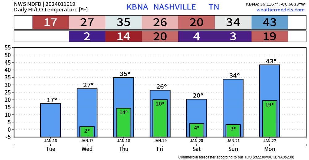
Sub-freezing temps all day Friday and Saturday, with low temps back in the single digits. Wind chills will likely be below zero at night.
If you dislike the cold, good news, change is coming.

Quick References:
Weather changes constantly.
Follow @NashSevereWx on Twitter for any changes to this forecast.
Live coverage during tornado and severe thunderstorm warnings:

Look good.
Support the mission.

We are 100% community supported. No ads. No subscription fees. Keep it free for everyone.


Categories: Forecast Blogs (Legacy)
You must be logged in to post a comment.