

Well…it’s snowing.
As expected, snow has quickly accumulated across the area and road conditions are quickly deteriorating. If you don’t have to get out, please don’t. If you must get out, please, take it slow, leave plenty of room, and *clean the snow off the top of your car*. Snow on top of vehicles can become aerodynamic ice missiles, and you do not want that flying thru a windshield.
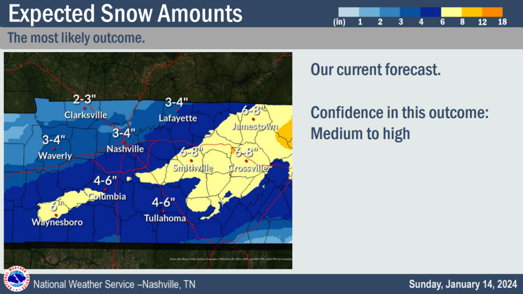
The most recent expected snow totals from NWS Nashville are 3-4″ N of I-40, and 4-6″ S of I-40.
Recent model trends suggest we may end up with the higher end of the range.
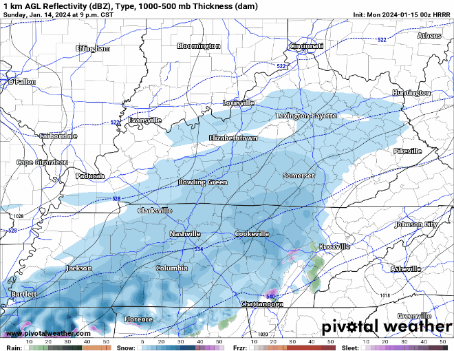
Latest HRRR model above shows fairly consistent snow thru around sunset Monday. Earlier models predicted a break Monday morning, but recent model runs suggest not much of a break. This is something to watch…
If latest model trends are correct, snowfall totals closer to the 5-6″ part of the range, with locally higher amounts would be possible.
Over the past day or so, a heavier axis of snowfall was predicted, but it was expected to be to our south. Recent data trends suggest that the heavier axis of snow will end up on top of us, thus the higher snow potential. This still isn’t a guarantee, but it appears more likely now.
Road conditions will continue to worsen overnight. You can check local traffic cams/road conditions here: TDOT SmartWay: Home (tn.gov)
Along with the snow, we also have dangerously cold temperatures to deal with.
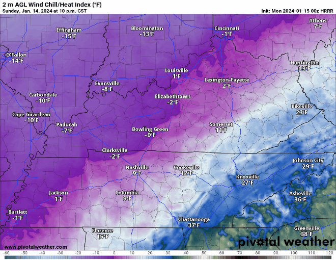
Wind chill values thru Wednesday morning are expected to stay around 0°. If going out, make sure to dress in multiple, warm layers.
Check in on friends/family who may not have adequate heating, and remember the four P’s – people, pets, pipes, plants.
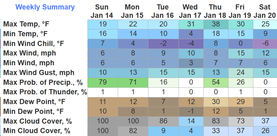
With air temperatures not expected to get above freezing until Thursday, very little melting is expected until then. Travel will likely remain hazardous for a couple of days.
Due to temperatures being so cold, the snow will be “lighter” and “fluffier” – unlike the heavy, wet snow we are usually get. Thankfully because of this, we aren’t worried about snow being a problem for trees/power lines.
We may have another winter weather event to deal with Thursday night into Friday AM, but let’s just enjoy this one right now…
Keep checking in for more forecast updates…
Quick References:
Weather changes constantly.
Follow @NashSevereWx on Twitter for any changes to this forecast.
Live coverage during tornado and severe thunderstorm warnings:

Look good.
Support the mission.

We are 100% community supported. No ads. No subscription fees. Keep it free for everyone.


Categories: Forecast Blogs (Legacy)
You must be logged in to post a comment.