
Overnight tonight a cold front will swing thru, bringing in our very cold air. Along the front, there could be some flurries. Areas north of I-40 could see a dusting, no major impacts expected.
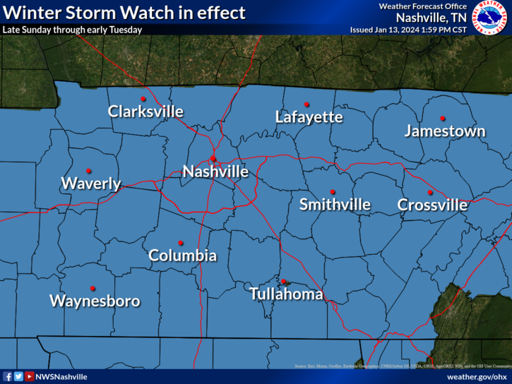
Both of our counties are under a Winter Storm Watch from Sunday evening thru Tuesday morning. This will likely be changed to a Winter Storm Warning later tonight or tomorrow.
Confidence has increased that we will see accumulating snowfall.

As of Saturday evening, our most likely snowfall totals look to range from 3 – 4″. *This could change, higher or lower.*
An enhanced band(s) of snow could produce higher snowfall totals, in the 5 – 6″ range, but where this band(s) form is unknown.
Looking thru the models trying to find the “bust” and “boom” scenarios, the GFS and Euro have both been all over the place, per usual with snow events. Recent GFS and EURO runs seem to represent our “bust” scenario with 1 – 2″. For our “boom” scenario, the SREF Ensemble shows a possibility of 6 – 7″. Neither of these solutions are the most likely scenario, but they are possible. The most likely outcome is currently forecasted to be 3 – 4″.
Timing:
Short-range models are in a decent amount of agreement that snow will start sometime Sunday evening.
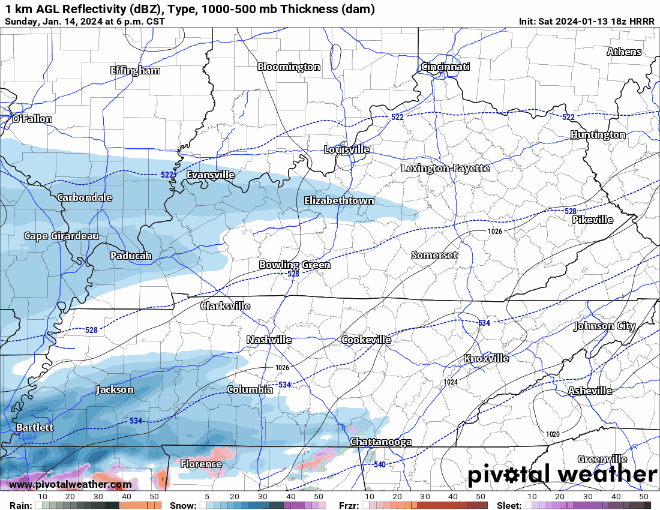
Here’s a look at the HRRR model above. This is just one run of one model. Most short-range models agree that it will be snowing most of the day Monday. Try not to pay too much attention to the specific timing, this is just meant to give a general idea of what the radar *could* look like. This could change!
Models generally agree that snow will be mostly gone from our area by Monday night/early Tuesday morning.
Impacts:
With temperatures being well below freezing throughout the entire event, it won’t take much for snow to accumulate, including on roads. Road conditions could begin to start deteriorating starting Sunday evening, worsening throughout the Monday.
With temperatures expected to stay below freezing until Thursday, very little melting will occur until then. Sun on Wednesday will help a bit, but temperatures will dip back below freezing Wednesday night.
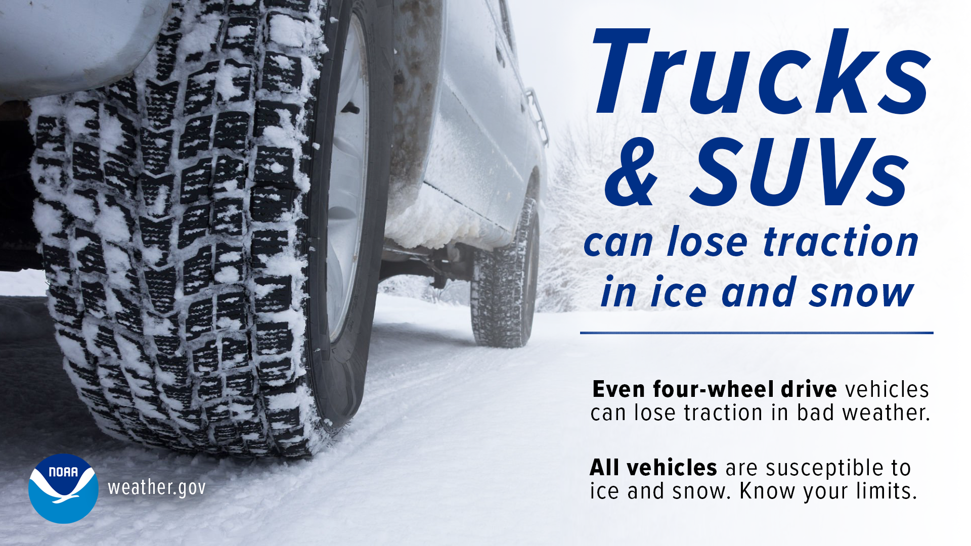
There is no way of knowing exactly how ‘x’ road will be at ‘y’ time. Generally speaking, if you don’t have to get out, probably just best to stay home. You know your vehicle best, it’s best not to push it past the limit.
We also do not know about flight impacts. The airport is equipped for dealing with snow, but there is no way of telling if your flight will be delayed/canceled. School questions are also not answered.
Dangerous Cold:
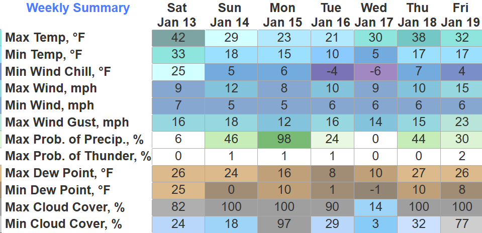
At some point tonight we will fall below freezing and we are not expected to get above freezing until Thursday afternoon, leaving us with ~100 hours below freezing.

Coldest temperatures will occur Monday + Tuesday nights when our wind chill values could get as low as -5 to -10 degrees.
Some things to consider doing tonight in preparation would be…
The more prep done, the better you’ll feel.
*The forecast could change*, so it’s important to stay connected for any updates. There are no guarantees, especially with winter weather here. We’ll keep you posted.
And yes, there is another chance of more frozen precip later in the week. Let’s just get past this event first.
Quick References:
Weather changes constantly.
Follow @NashSevereWx on Twitter for any changes to this forecast.
Live coverage during tornado and severe thunderstorm warnings:

Look good.
Support the mission.

We are 100% community supported. No ads. No subscription fees. Keep it free for everyone.


Categories: Forecast Blogs (Legacy)
You must be logged in to post a comment.