
First Saturday of the month, which means Davidson Co tornado sirens are tested at noon.
Tornado siren tests are scheduled for today. Davidson at noon. Williamson at 1:00. Be not startled.
Late Night Weekend Forecast.
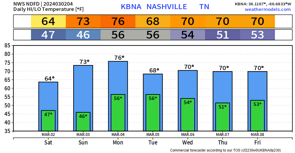
If you are up right now, props. If you see this in this morning – that’s okay too, it’s late.
We get rewarded with a warm + dry weekend.
Dry weather can’t last forever as rain chances return Monday, and last thru mid next week.
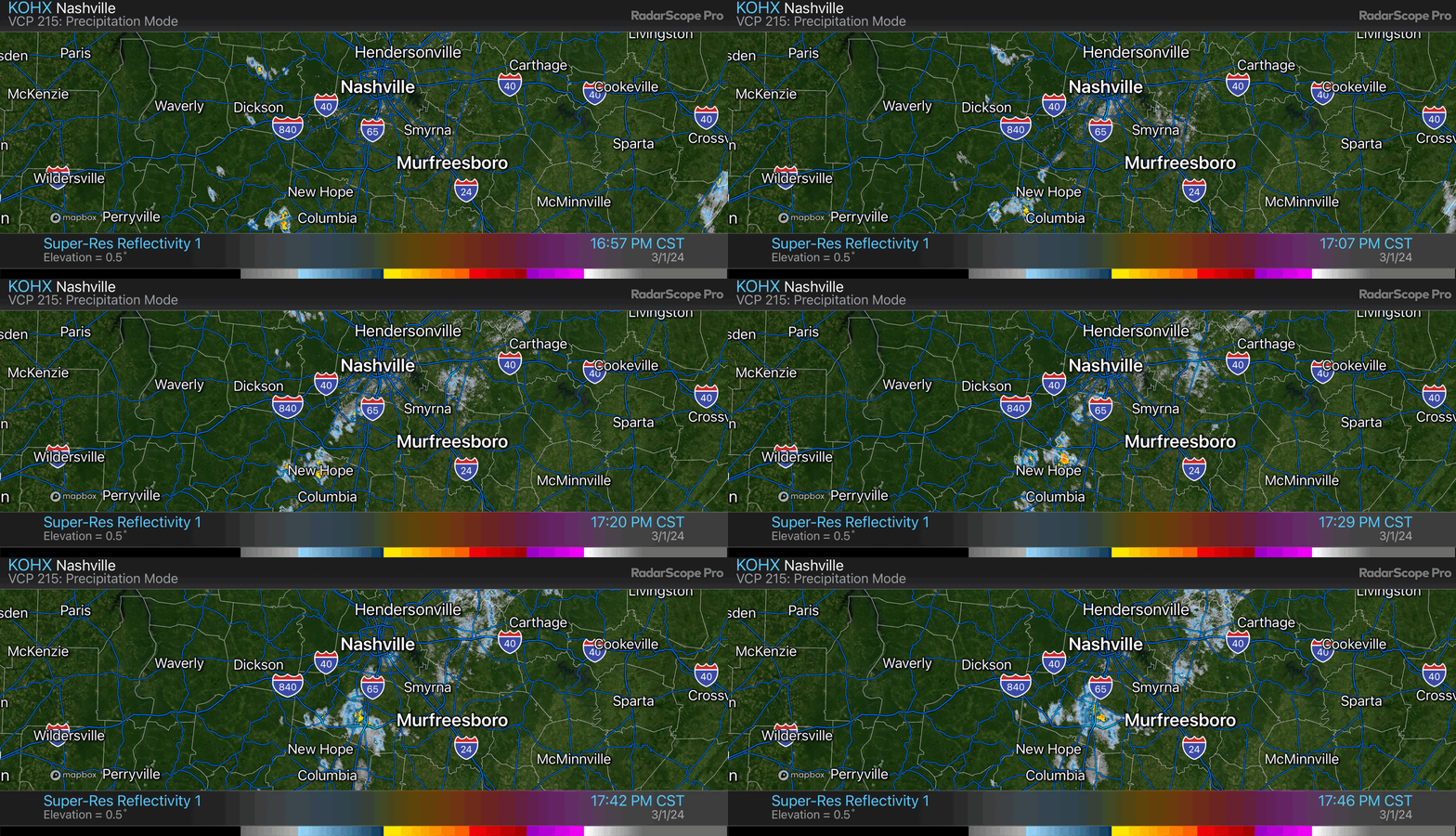
Drizzlemist tonight. Rain developed in Will Co.
On/Off Rain Friday, Drying Out + Warming Up This Weekend

Chilly day today, and tomorrow will fairly similar but with rain chances.
HRRR model (above) shows rain beginning early Friday, lasting on and off throughout the day. No severe weather concerns, just a cold rain. Bleh.
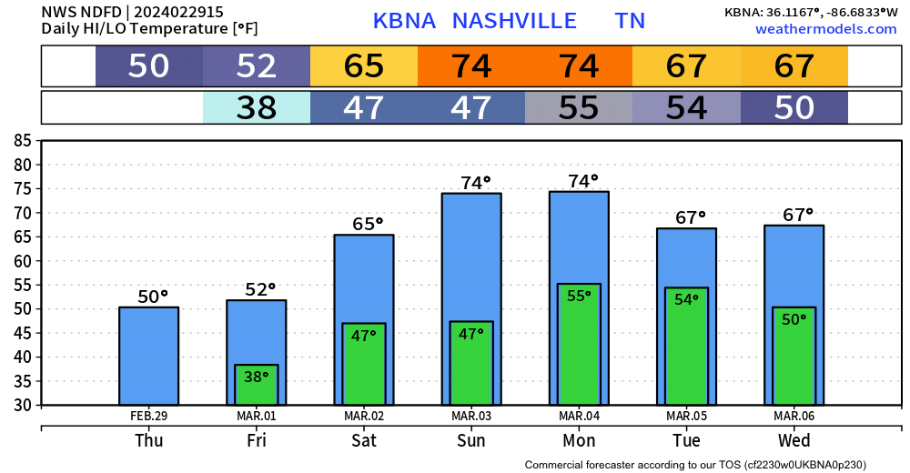
Warm weekend incoming.
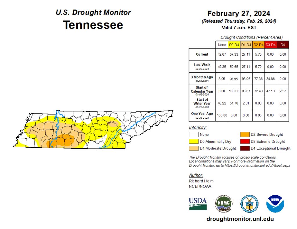
New drought monitor. Most of Nashville out of drought. Many abnormally dry. Low end drought remains for about half of Will Co.
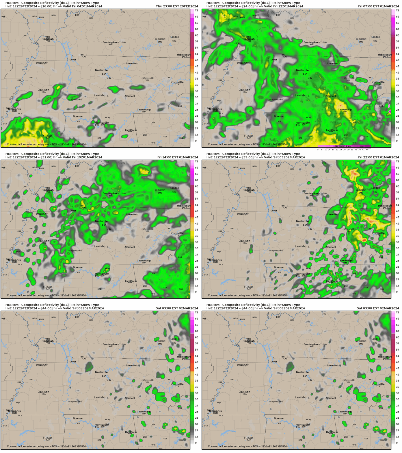
Light rain off and on Friday. HRRR model 👇🏽.
Total rainfall ~ 0.25”.
Rain next week.
“[M]ultiple rounds of rain is expected Monday through at least the middle of the week. Forecast rain amounts over this time period is currently around 1 to 1.5 inches.” -NWS-Nashville
Few Chilly Days, Rain Returns Friday.
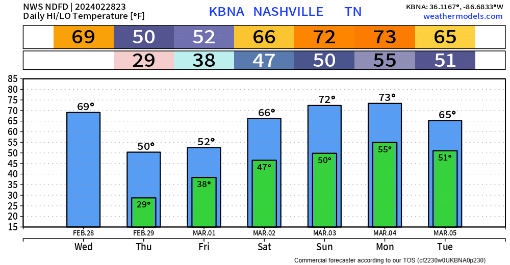
This morning, temperatures were in the low 70s. As of 6:45pm, we are in the low 40s, and on our way to about 28° tonight. Your backyard may be a few degrees warmer/colder.
We’re expected to barely make it to 50° on our extra day for 2024.
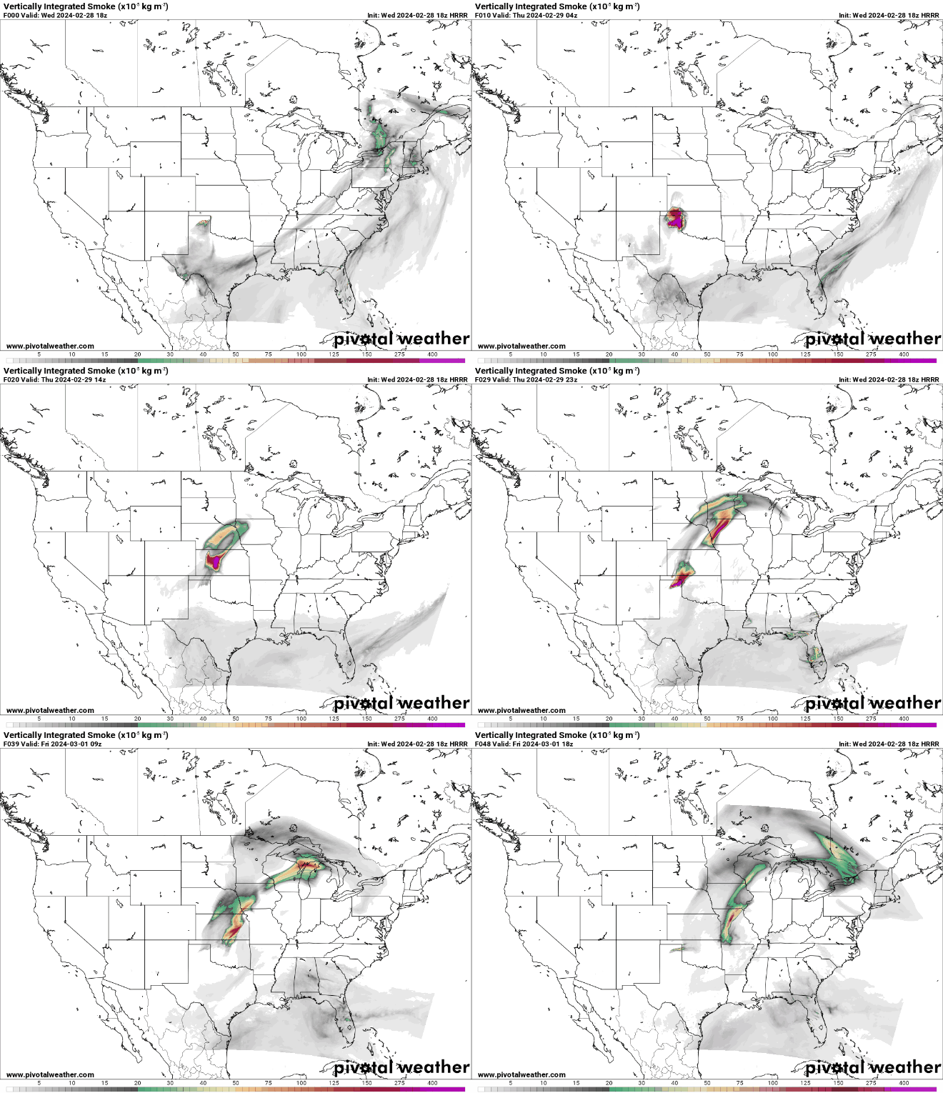
Texas panhandle wildfires continue. HRRR model shows where all those smoky particles should go over the next 45 hours. Gross.
It was 72° at 7:25 AM. BNA has 45° at 11:25 AM (37° wind chill). Steadily colder until we hit 28° around sunrise Thursday.
You must be logged in to post a comment.