
A majority of the rain has moved out. Can’t rule out a few scattered showers this afternoon/evening, but our severe threat is over.
We still have a Wind Advisory thru midnight tonight, wind gusts up to 45 – 55 mph will be possible.
Could see a few flurries flying later tonight, but no accumulation expected.
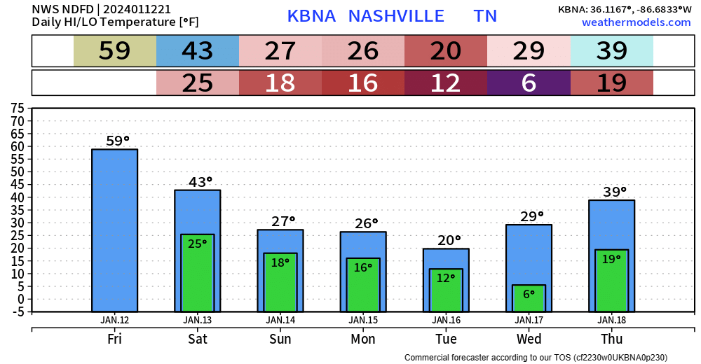
Saturday will be cold and mostly dry. High temps in the low 40s.
The HRRR model, shown below, hints at some wintry mix Saturday night.
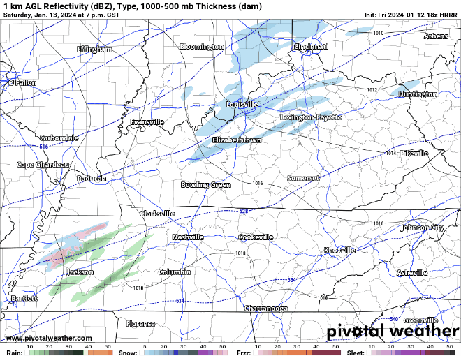
Other models don’t show this, so confidence is fairly low in this, but worth keeping an eye on. Temps are forecasted to be near freezing at this time.
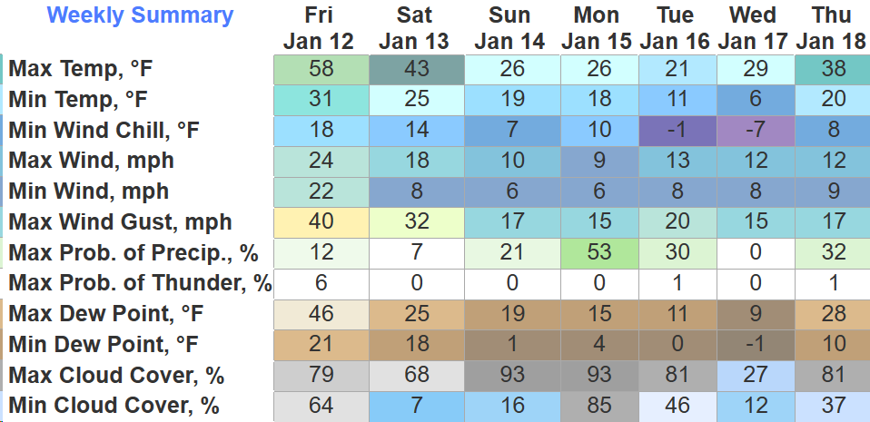
Below Freezing Temps Sat Night – Thurs. Afternoon
Temperatures are forecast to go below the freezing mark Saturday night and are not expected to get back above freezing until sometime Thursday afternoon. Gross.
Low temperatures in the teens and single digits will be common early to mid next week.
Wind chill values below zero are possible, especially Monday/Tuesday night and Tuesday/Wednesday morning.

A Wind Chill Advisory may be needed for these dangerous temperatures.
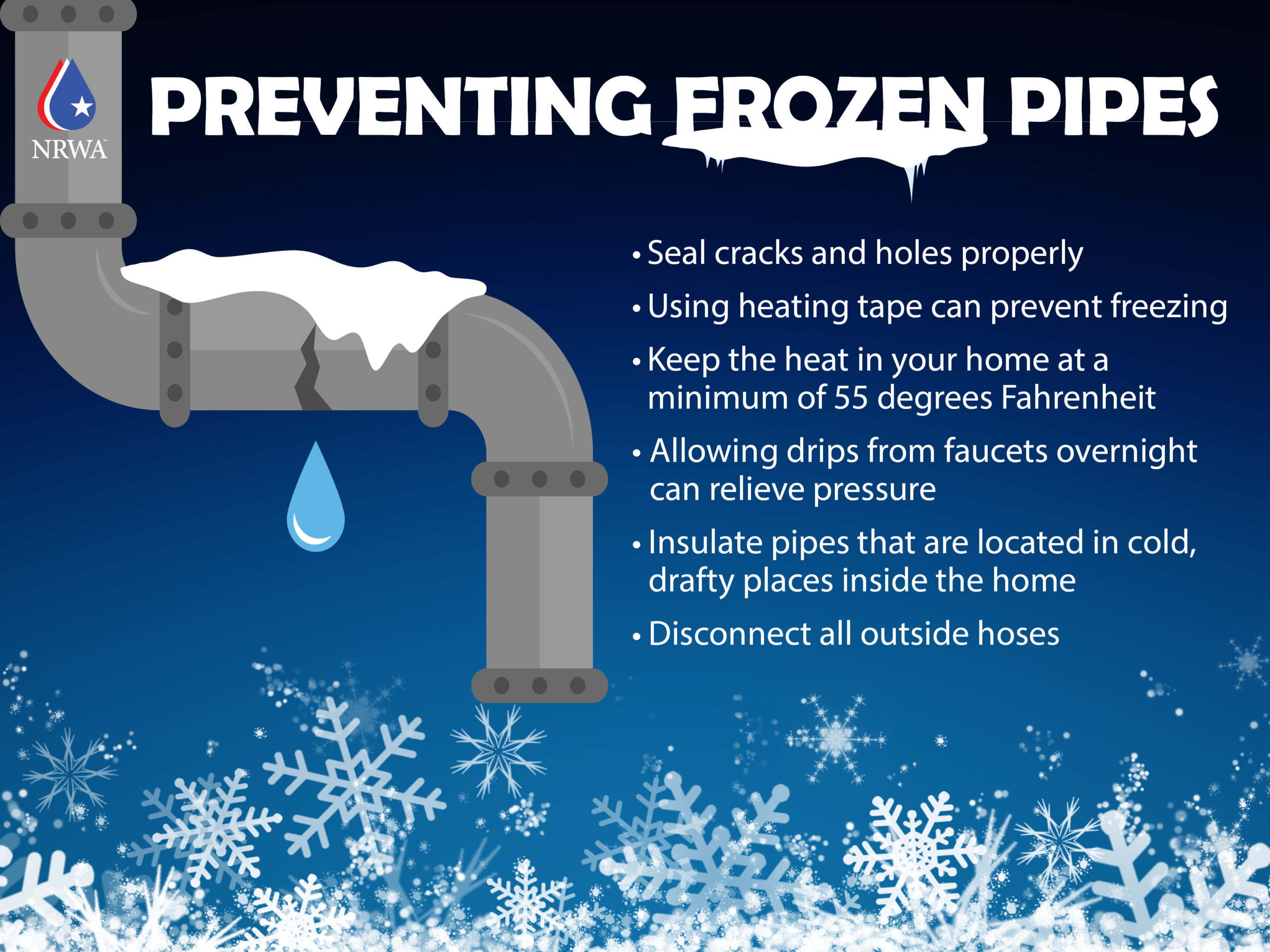
Now is the time to start prepping exposed pipes, making accommodations for outdoor pets, and checking in on friends/neighbors who may not have adequate heating.
Snow Potential…
The bright side of the cold temps will be that it’ll bring snow chances with it.
Models are generally in agreement with that we will at least see some snow. Specific amounts and timing are unknown.
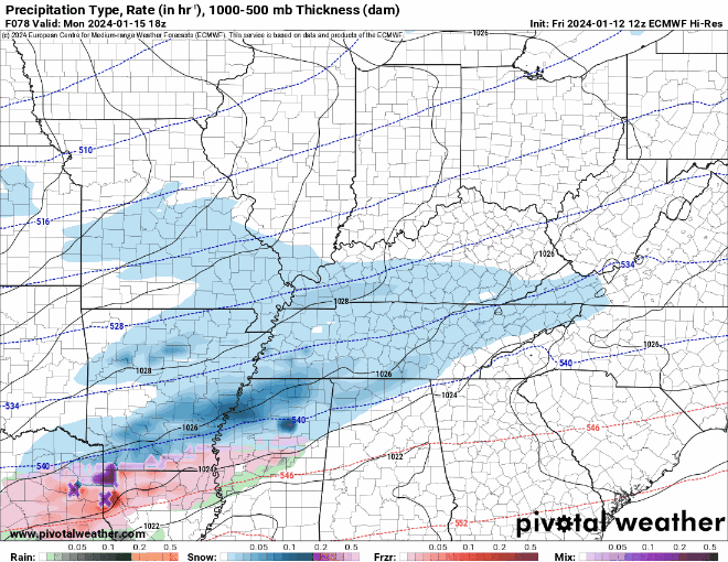
Above shows 6 different models agreeing that snow will be around midday Monday. This could change, models this far out are difficult to trust. However, six different models agreeing says something.
For now, NWS Nashville thinks our probability of getting at least 1″ of snow is around 60 – 70%. Our probability for 3″+ of snow drops to 20 – 30%.
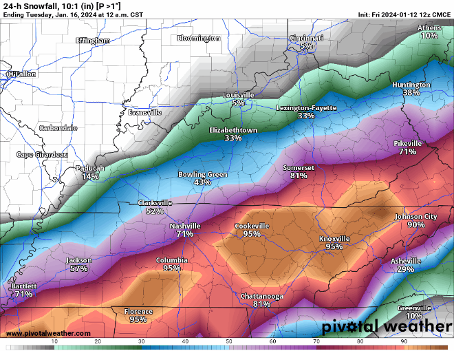
The gif above shows 4 different model ensembles, giving their probability of at least one inch of snow. All in general agreement with NWS Nashville, in the ballpark of 60 – 75%.
Any snow that does fall will have no problem sticking, and no problem sticking around either with temperatures expected to stay below freezing until Thursday afternoon. If it were to snow, it would not have much of an issue sticking to roads, so travel conditions may deteriorate starting sometime Sunday night or Monday morning.
Confidence will increase as we get closer to the event. Forecast is subject to change, stay tuned.
Hazardous cold temps are possible again next weekend. One event at a time.

Quick References:
Weather changes constantly.
Follow @NashSevereWx on Twitter for any changes to this forecast.
Live coverage during tornado and severe thunderstorm warnings:

Look good.
Support the mission.

We are 100% community supported. No ads. No subscription fees. Keep it free for everyone.


Categories: Forecast Blogs (Legacy)
You must be logged in to post a comment.