
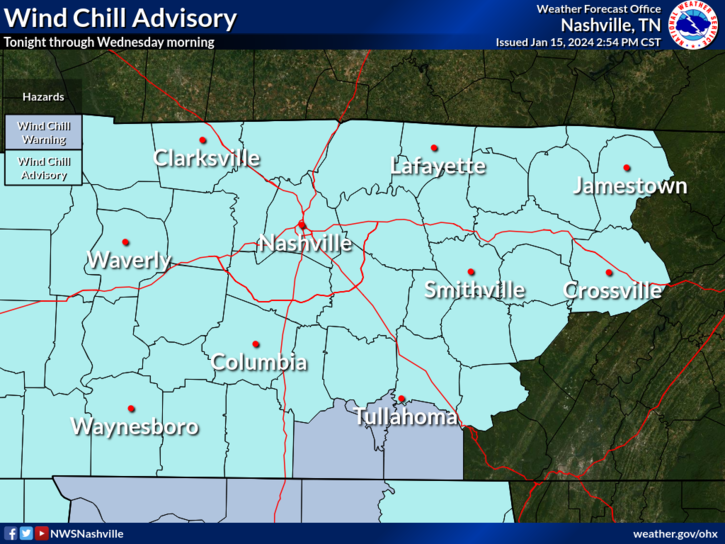
Wind Chill Advisory. Tonight 10 PM thru Weds 11 AM.
- Wind Chills “as low as minus fifteen” (-15°) expected.” -NWSNashville.
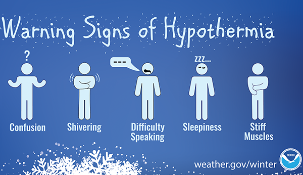
- Winds could “result in hypothermia if precautions are not taken.” -NWSNashville.
- Any traveling vehicles need full weather clothes, flashlight, food, water should you slide off icy roads. If you crash you’ll need supplies.
- Tues morning temperature low: 7°. Weds morning low 2°. TWO. Wind chills will be much colder of course.
Snow Totals Vary 5.5″ to 9.5″. Snow fell unevenly. Elevation and location skew results. I’ve seen 5.5″ to 9.5″ in our replies. An average winter in the last 30 years delivered 4.7″. Snowfall is ending now and should be gone after dark. Send measured snow taken from hard surface (not grass) by tagging it with #tSpotter on Twitter.
Check Road Conditions. Use TDOT Smartway to get a look at the interstate system. Secondary roads are a mess. Do not attempt necessary. We all know YOU know how to drive perfectly in this, but the problem is OTHER DRIVERS who cause wrecks. This further stresses police and fire first responder capacity. Do not be victimized by other driver negligence/ignorance.
Melt?
- “With the long duration of below freezing temperatures, snow will be very slow to melt. Sunshine on Wednesday will help melt snow.” -NWSNashville.
- Above freezing temps expected late Thursday morning — but that will only be for a few hours – then another system swings in.
- Reinforcing sub-freezing air will lock in a frozen Fri-Sat.
- This snow will be around a while. Especially shady areas.
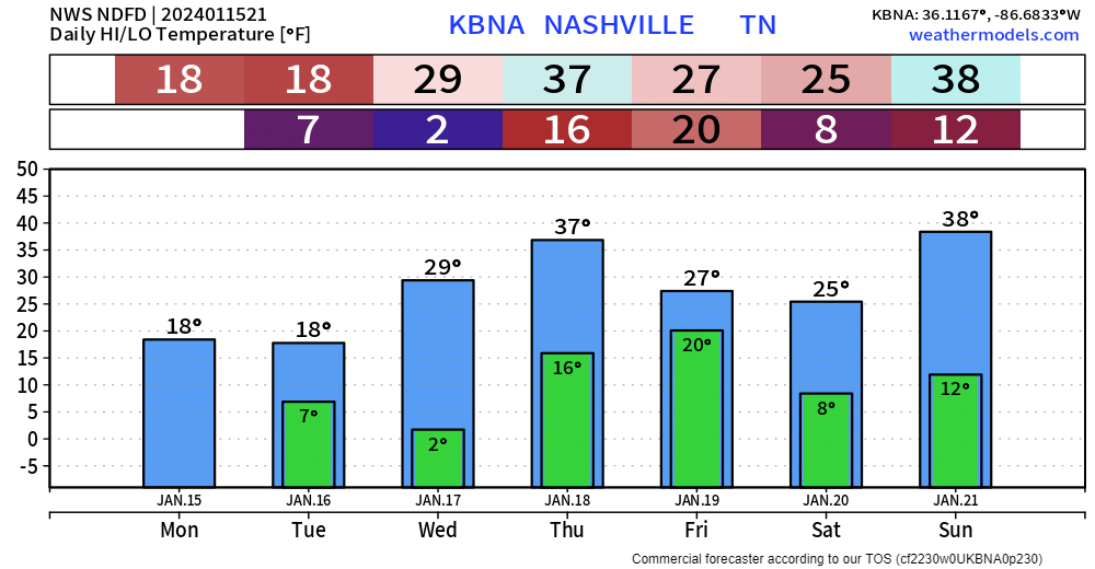
Snow Event Thursday Night? Maybe, under 1″ current forecast.
- Looks like a rain/snow mix transitioning to snow after dark Thu.
- Seven different models snapshotting 6 PM on Thursday are below. Notice the lack of rain vs snow consensus.
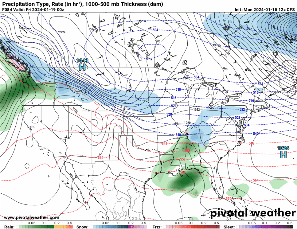
Precip type will not be as easy with this one as our current system. Profiles around 850 mb will start to warm to near or just above freezing, we will also see surface temperatures warm above freezing during the afternoon Thursday. This will bring some rain mixing with snow. This mix will continue into the evening as surface temperatures fall below freezing again. Right now is doesn’t look like we will see any ice accumulation but we could see some light snow accumulation. Totals look to remain very light, under an inch.
NWS-Nashville, Afternoon Discussion, 1/15/24
Reduce Sled Injury Risks. Avoid sledding near fences, too close to other sledders, trees. Head injuries are devastating. Have heard some scary/sad stories already with this event. Helmets are good ideas. Be safe out there.
Quick References:
Weather changes constantly.
Follow @NashSevereWx on Twitter for any changes to this forecast.
Live coverage during tornado and severe thunderstorm warnings:

Look good.
Support the mission.

We are 100% community supported. No ads. No subscription fees. Keep it free for everyone.


Categories: Forecast Blogs (Legacy)
You must be logged in to post a comment.