
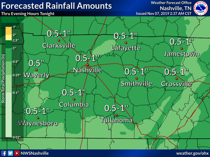
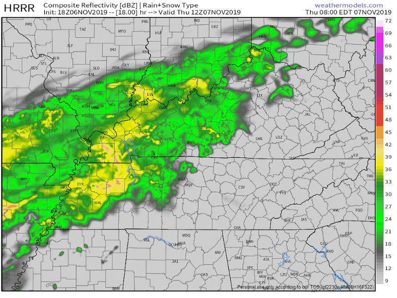
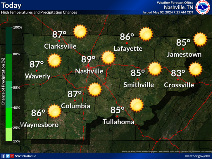
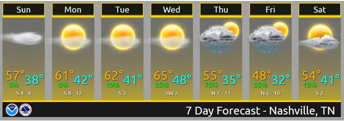
Cold this Morning, Warming Up Nicely
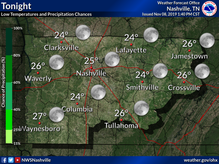
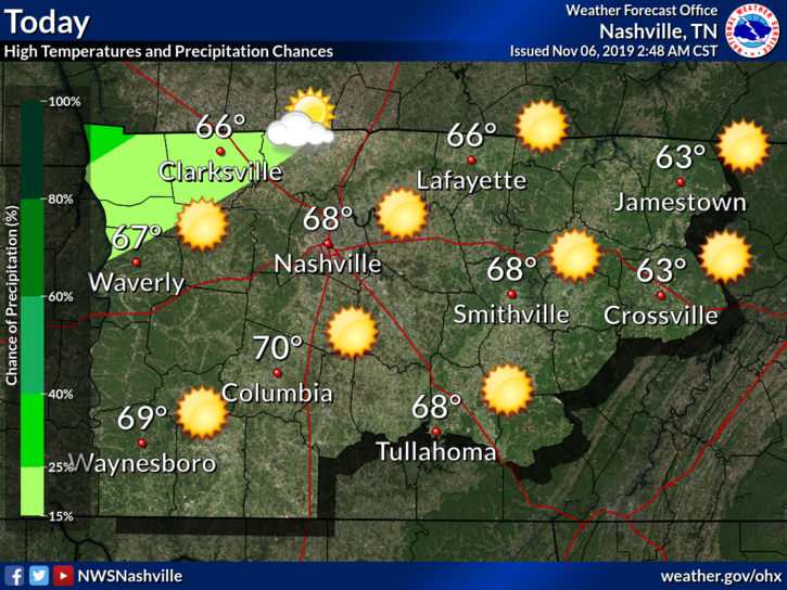
Despite the cold we are dealing with this morning (8:16 AM at the time of writing this), we will start a warming trend for the weekend.
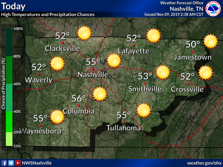
We will be up into the mid 50°s with clear skies for today. Get outside this weekend. It’s your best chance for a while.


You must be logged in to post a comment.