
Nice End to the Week
Thursday: Sunny, high of 81°, southerly winds of 5-15 MPH with gusts as high as 20 MPH.
Friday: Some clouds move in, dry, high of 83°.
Overall, a great end to the week.

The Weekend: Rain Chances Return
Saturday starts off dry, but the chance of rain increases later into the afternoon and evening.
A snippet from the NWS-Nashville Discussion:
WPC`s model discussion and this forecast lean toward a blend of solutions, with rain and thunderstorms approaching the TN River around [6 PM Saturday]. Enough instability will be in place for a couple strong or severe storms Saturday night. Damaging winds will be the main concern as low-level wind fields run parallel to storm motion. The SPC has highlighted locations along and west of I-65 in a Marginal Risk for severe storms on Saturday night.
NWS-Nashville AM Discussion, 03/26/20
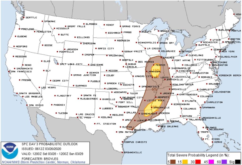
Nashville and areas west of I-65 have a 5% chance of seeing severe weather within 25 miles of a location. For now, this does not look like a tornado event for us, but that may change. News is encouraging. The trend has been away from the worst of this system. Compared to two days ago, when the highest risk was atop us, today that greatest risk for severe weather (the 15% chance) shifted even further away:
Temps stay warm Saturday with a high of 79°.
Sunny skies return Sunday and high temps drop down to the upper-60s.

Categories: Forecast Blogs (Legacy)
You must be logged in to post a comment.