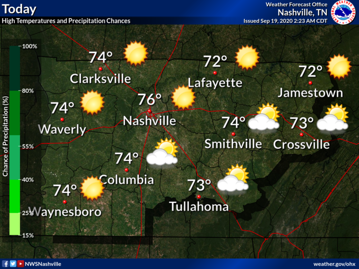
It’s going to feel great today!

Highs will be near 76° with a nice breeze and clear skies!
Temps will drop into the lower 50s tonight. If you have any outdoor plans, you might want to grab a light jacket!

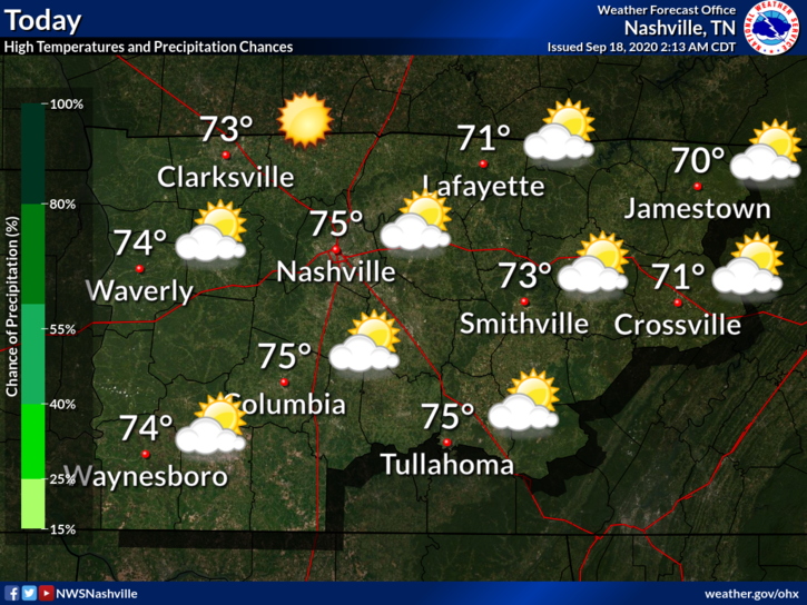
It’s going to feel great today!
Highs will be near 76° with a nice breeze and clear skies!
Temps will drop into the lower 50s tonight. If you have any outdoor plans, you might want to grab a light jacket!
Three of the best words in weather.
A few clouds this morning will give way to a mostly sunny afternoon. High temperatures will reach 75º.

The wind may pick up a bit, but nothing a little kite flying can’t take care of.
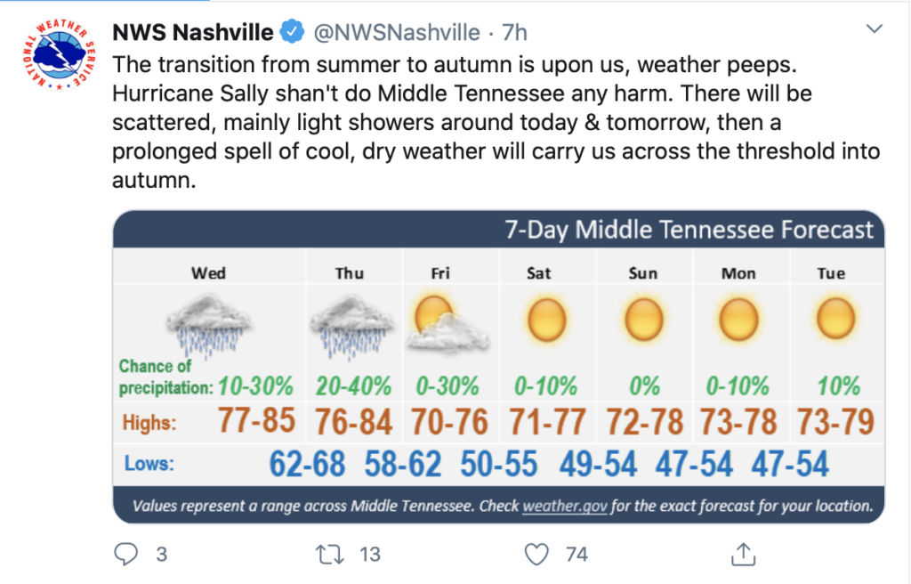
Tropical Depression Sally will pass east of us today. Winds rotate counterclockwise around Sally. As Sally passes east, our east wind will shift into a cooler, drier north wind.
Today’s north wind will continue into the weekend. Friday temperatures will drop humidity and temps, with afternoon highs in the mid 70’s.
Hurricane Sally made landfall as a Category 2 hurricane after churning the Gulf Coast this past week. Maximum sustained winds of 100 MPH brought heavy winds and catastrophic flooding to the coast area like Gulf Shores, AL, and Pensacola, FL

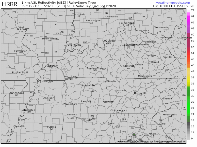
A few scattered showers may sneak into Middle Tennessee this afternoon. The HRRR model thinks this is unlikely, though.
Pretty scattered if you ask me… If anything materializes, it will be in the afternoon.
A pretty mild and dry afternoon approaching with our high temperature in the mid-80s.
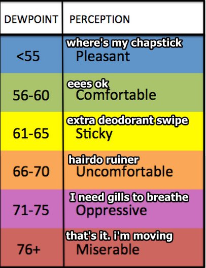
It’ll feel warmer, though, with those dewpoint temperatures projected to hang out in the upper 60s today.
A chance for isolated showers is forecast for the southern region of the state. Most of the activity will stay mainly south of us, along the Tennessee and Alabama border this afternoon.
That’s what we’re going to be looking at for much of the day today.
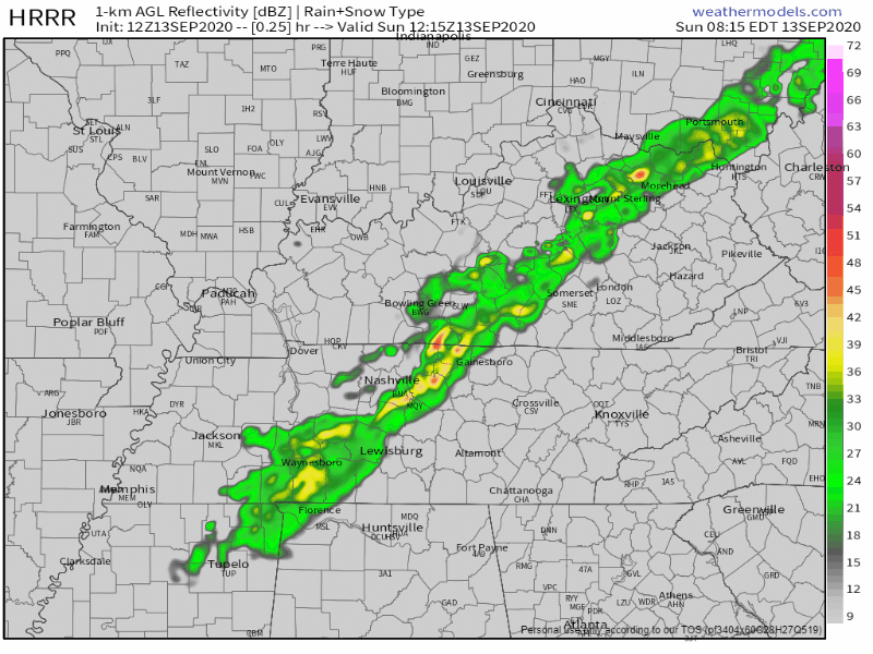
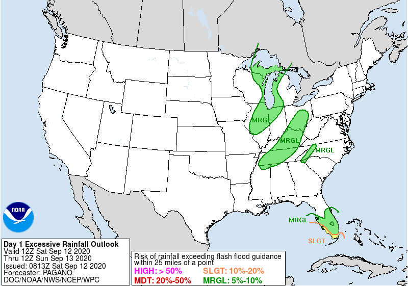
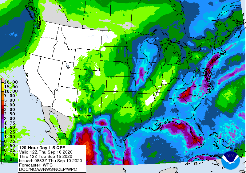
The National Weather Service issued a flash flood watch for the area through 7 pm. Anywhere from 1 to 3 inches of rain is expected to fall, but some areas could see locally higher amounts.
A front that’s currently located over the Tennessee Valley region will move north this afternoon, increasing our rain chances.
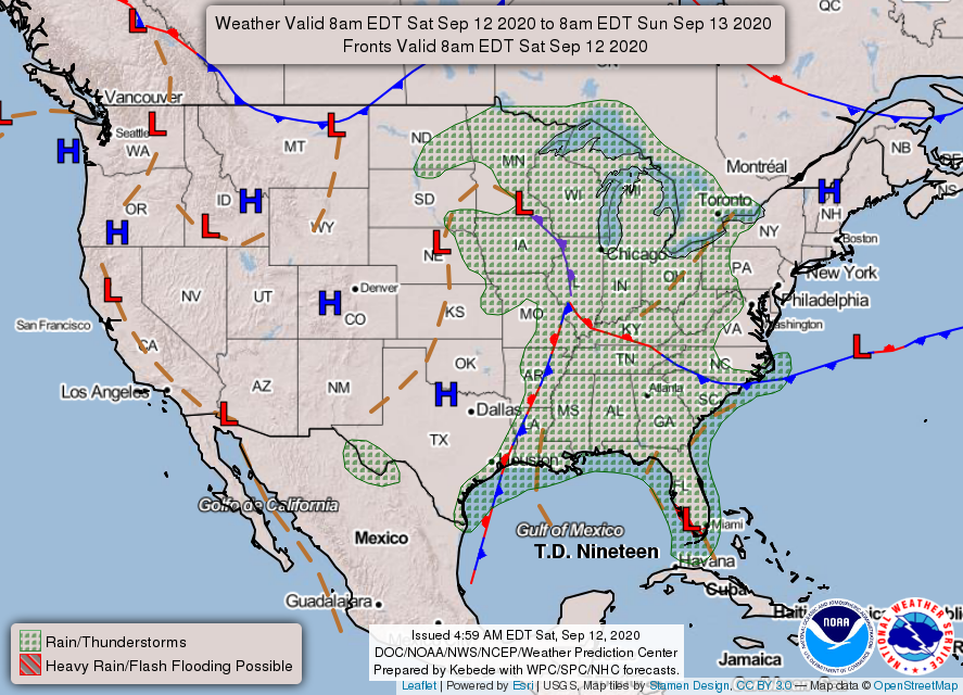
See how we are sandwiched between the stationary front (red and blue patterned front) and the warm front (red patterned front)? That means we are in the warm and rainy sector of this frontal system.
TGIF! This morning we are starting out with sunny skies and temperatures in the low 70’s.
By the mid afternoon hours those temperatures will get into the low 90’s.
There is a slight chance for showers later this evening between 5pm and 8pm. Anything that may pop up will be very isolated and short lived.
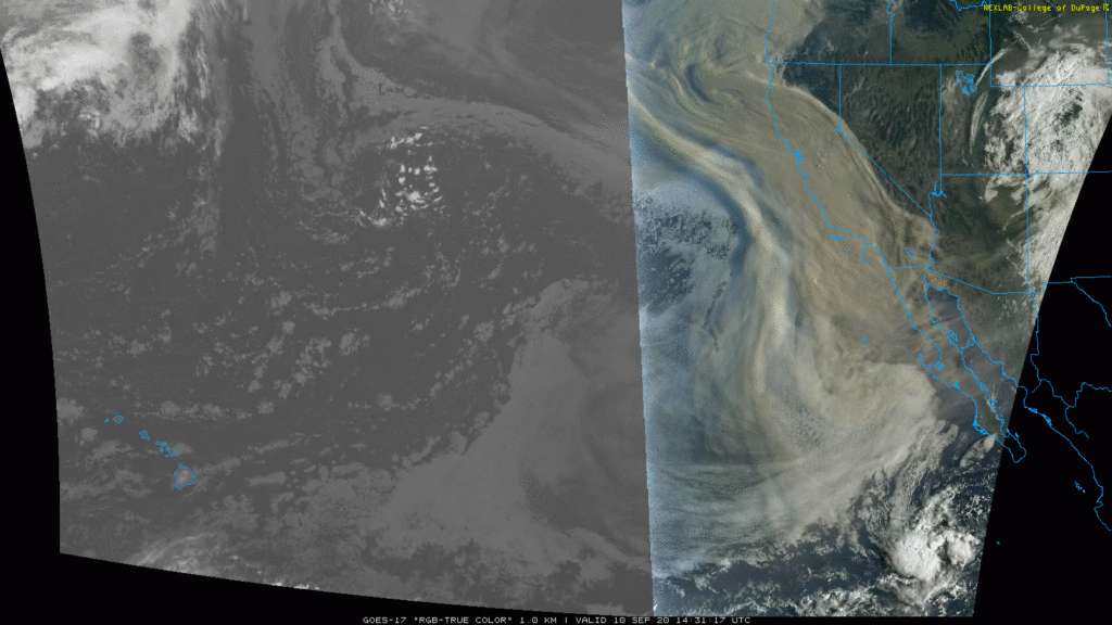
A non-Zoo tiger is loose in Knoxville, parts of hurricane hit Louisiana remain without power, and check out the smoke covering large parts of Oregon and California.
Things aren’t so bad here.
Plenty of sunshine Thursday with a high around 91. The rain will be way east of us.
You must be logged in to post a comment.