
Act 1
Nashville. Williamson County. Saturday morning. A weary community awakes.
A warm front arrives. Behind it, a waterlogged atmosphere.
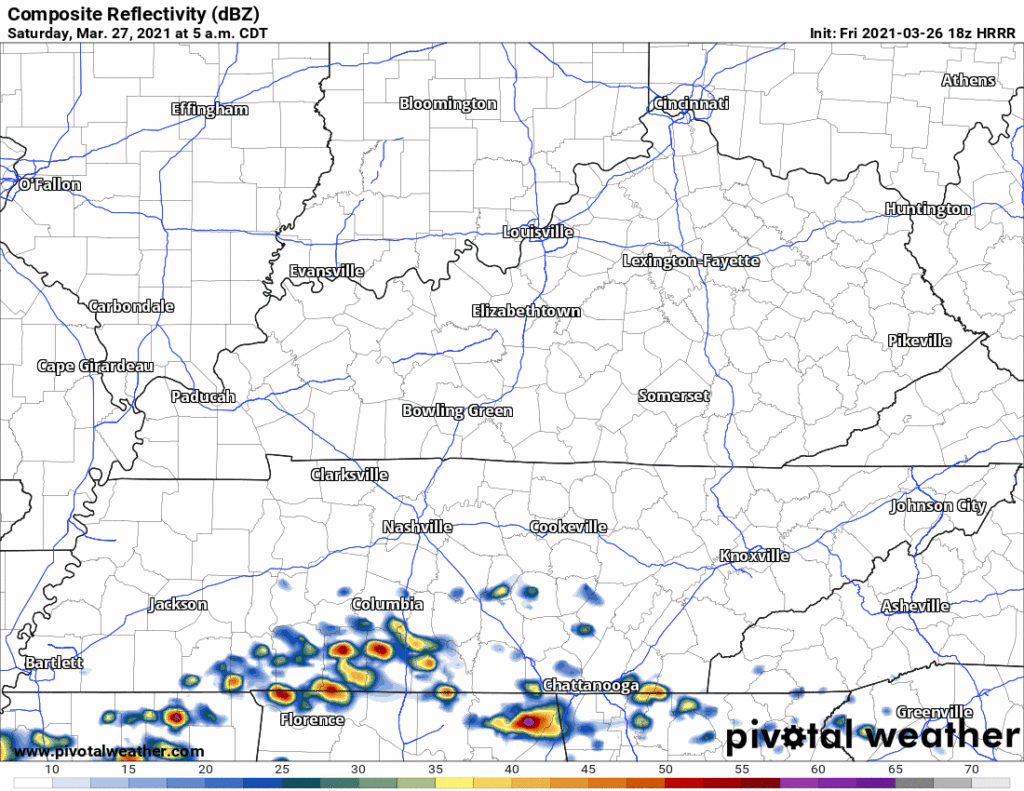
HRRR Model
7 AM, rain begins. Will Co first. First rain drops south of I-40. Soon the tattered rain curtain covers both counties.
Stage Manager
Heavy rain, lightning. Off and on in the morning, continuing off and on into the early afternoon.
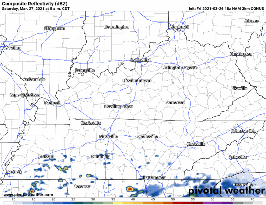
NAM3 Model
I know I’m usually drunk and yeah it’s going to rain I think the HRRR may be overstating the amount of coverage of rain in the morning was that O’Doul’s that better not have been an O’Doul’s.
Stage Manager
Who here claims to know the future?
Theologian
Magnificent question. St. Augustine wrote tha…
Weather Nerd
Morning tornadoes unlikely. Storms should lack surface based moisture needed to make them. Forecast soundings show a low level inversion unfriendly to tornadogenesis.
Conditions may turn tornadofavorable early in the afternoon as surface moisture fills in and the low level inversion irons itself out.
Grammar Nerd
Tornadofavorable is not a word.
Stage Manager

NWS-Nashville
There is reason to think rain will be heavy in the morning. Of course we cannot say exactly where but it looks likely in Williamson and Davidson Counties.
Weather Nerd
Hail looks entirely possible in the morning and afternoon as supercold air aloft arrives, teaming with wind shear to lift and rotate hailsupportive updrafts.
Grammar Nerd
Hailsupportive is not a word you
Censors
This is a family show.
People Who Love Their Cars
/looking for a garage or covered space/
Don’t park next to that giant tree!
Stage Manager
Round 1 should end by mid to late afternoon. No specific times.
Weather Nerd
Flash Flooding is possible. Saturated grounds with a waterlogged atmosphere aloft releasing its moisture to earth. A Flash Flood Watch is in effect from 7 AM Saturday through 7 AM Sunday.
Truck Guy
Grunts.
If Calvin can pee on Hobbes, my truck can handle a puddle.
Insurance Adjuster
[laughing]
Nah.
[picks up the phone, dials Underwriting]
Intermission
Mid to late afternoon. Rain/Storms have stopped.
Cool People
Let’s all review our weather safety plan.
Everyone Else
Obviously yes we will do that.
Coach Campbell
Let’s make sure we have our helmets.
Emergency Responders
I hope we get zero calls from motorists stranded in flooded cars.
Hunter
Musical Salad Dressing Debaters
Act 2
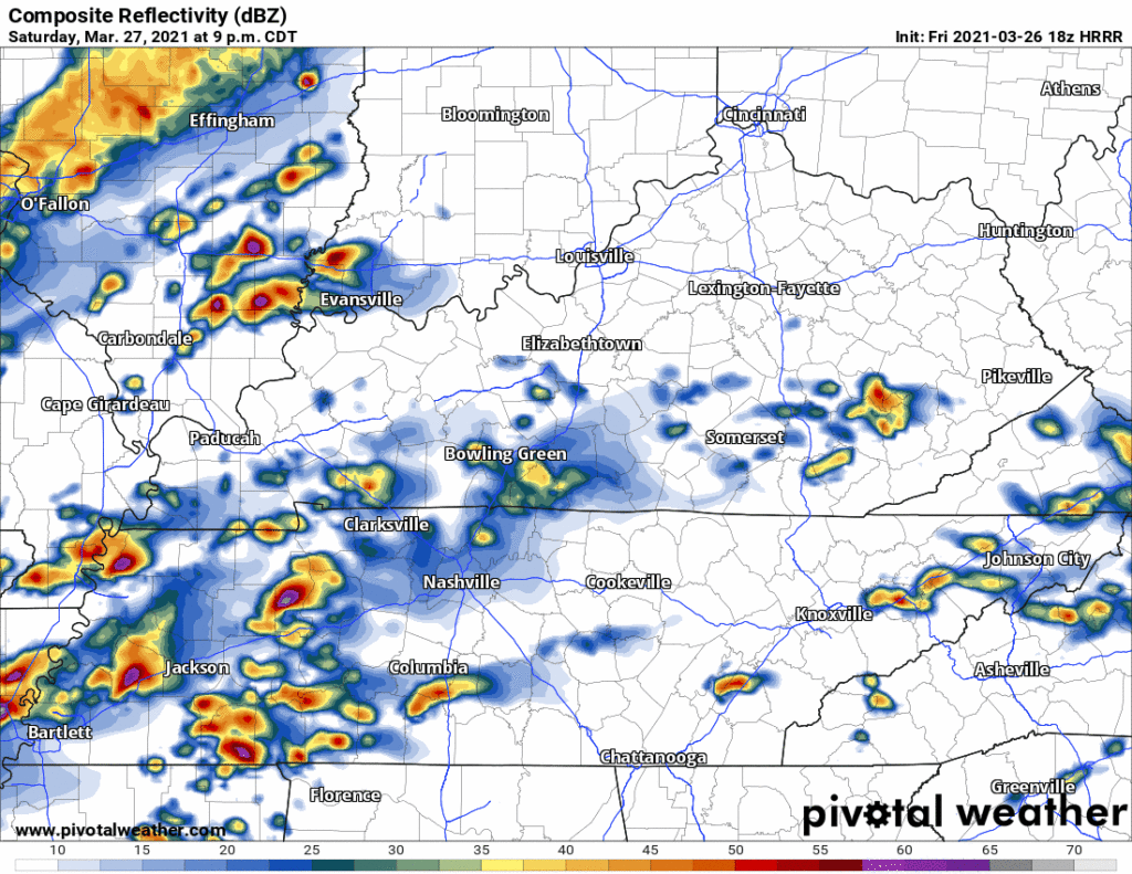
A cold front. A weary city wishing sleep. A fast moving line of storm clusters rolls closer from West Tennessee. Main threats damaging straight line winds and quick, spinup tornadoes.
HRRR Model
Not quite sure about this but ETA 10 PM to 11 PM. Ask me for updates tomorrow.
Weather Nerd
Every event is different, but the risks are lower Saturday night than they were Thursday night. Little consolation if the low-risk threat lands on you.
{Flashback to the past}
The Guy It Happens To
I thought it would happen to someone else.
[end of flashback]
Weather Nerd
Tornadoes will be possible during this time.
Hail also possible.
If it starts around 10-11 PM Saturday, the worst of it should be over by 1-2 AM Sunday.
Severe thunderstorms aren’t headliners but they can really do damage.
Pete
Stage Manager
Additional rain will be unwelcome in drenched grounds and swole waterbodies. Watercovered roads hazardous at night. Darkness disorients drivers. Rescue response hampered by darkness. That was me emphasizing the flooding. Flood threats like to hide, but they are statistical leaders in loss of life.
Floody McFloody
I’ve been outed.
Storm Prediction Center
The probability of a tornado happening within 25 miles you tomorrow with either storm system is 5%. Drew ya a picture.
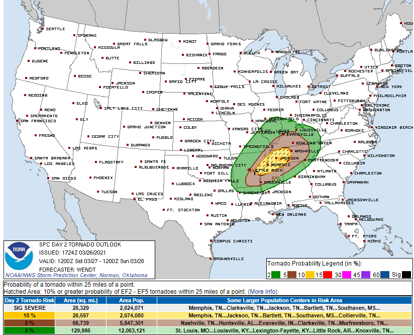
Probability is 15% for damaging straight line winds. Remember, that’s within 25 miles of you. Hail, also 15%. We’ll update this a few times in the morning.
Mathlete
Within 25 miles? That’s what, a total area of 1,963.5 square miles, right? So a 15% percent chance of something happening in a 1,963.5 square mile area?
Storm Prediction Center
Nice job mathlete. If the risks changes, we will update you with a Severe Thunderstorm Watch or a Tornado Watch.
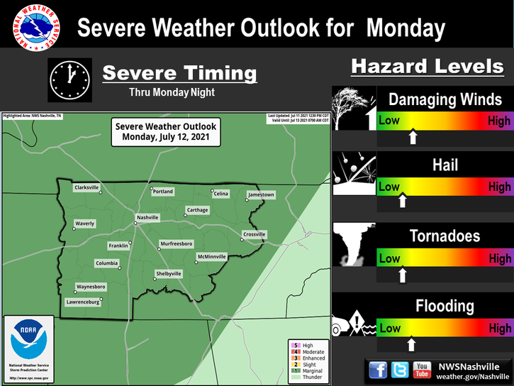
NWS-Nashville
And if an event may get personal, we’ll draw you a polygon in our warning.
We also got forecast grafs, y’all. Look at us go. Note this is for all of Middle Tennessee.
Screenplay Critic
That was terrible.
Me
I know. I titled it.
Screenplay Critic
What is the matter with you?
Me
I don’t understand what’s happening. There’s no blood going to it. I’ve never had to locate it before.
I still hope Fred Savage reads it.
Categories: Forecast Blogs (Legacy)
You must be logged in to post a comment.