
Join Us On YouTube Live!
Back To Your Regularly Scheduled Content
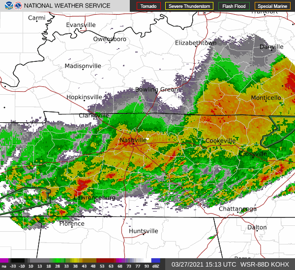
Storms this morning packed a punch with gusty winds, heavy rainfall, and hail.
Current radar shows sub-severe rain over the area. Unfortunately, this will only exacerbate the flooding concerns.
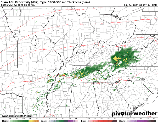
HRRR Model below shows off and on showers this afternoon before perhaps a more substantial line of storms rolls through overnight.
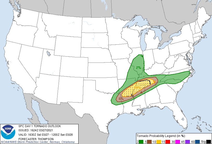
New SPC severe probabilities of “x” within 25 miles of you are:
Tornado: 5-10%
Wind: 30% with some higher end gusts possible (70mph)
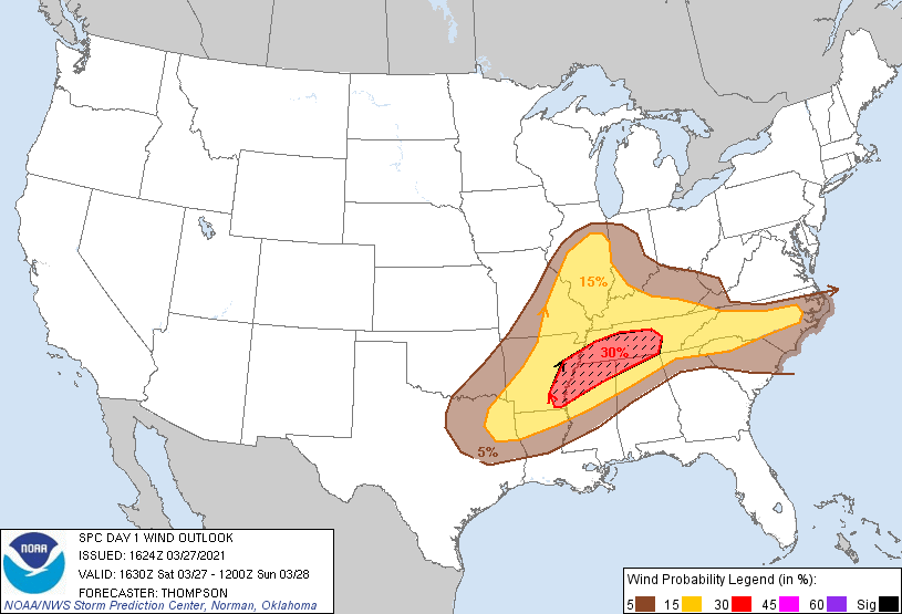
Hail: 15%
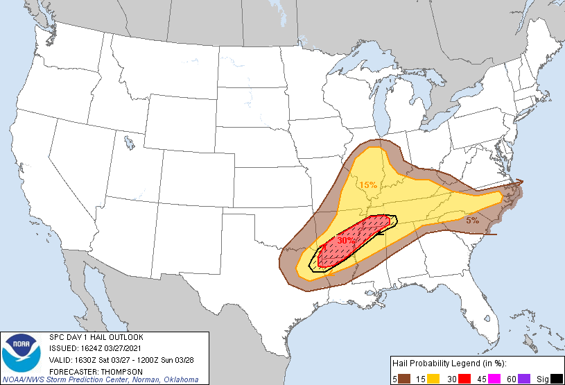
Keep in mind, these outlooks are valid until 7AM Sunday.
Timing for the most intense storms is roughly 9PM-2AM. This could change with newer data.
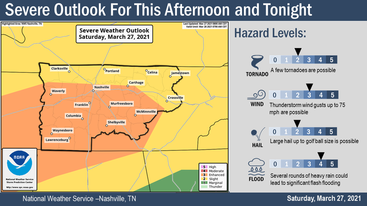
Here’s a more detailed graphic from NWS Nashville detailing the threats.
The biggest threat tonight could be the flash flooding potential.
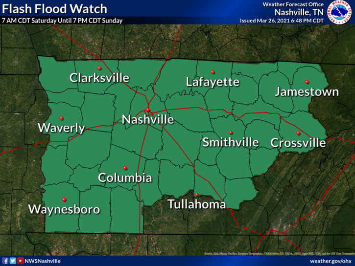
We are under a flash flood watch until 7PM Sunday Evening.
WPC has placed Davidson/Williamson counties under a 20%-50% risk for excessive rain with 25 miles of you.
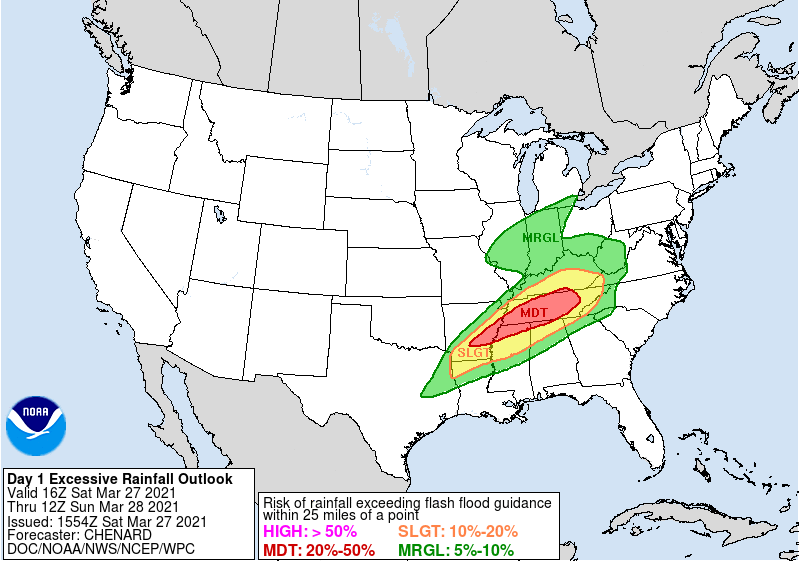
This is a heightened risk that needs to be taken seriously, especially if you live near a river/creak or in a flood-prone area.
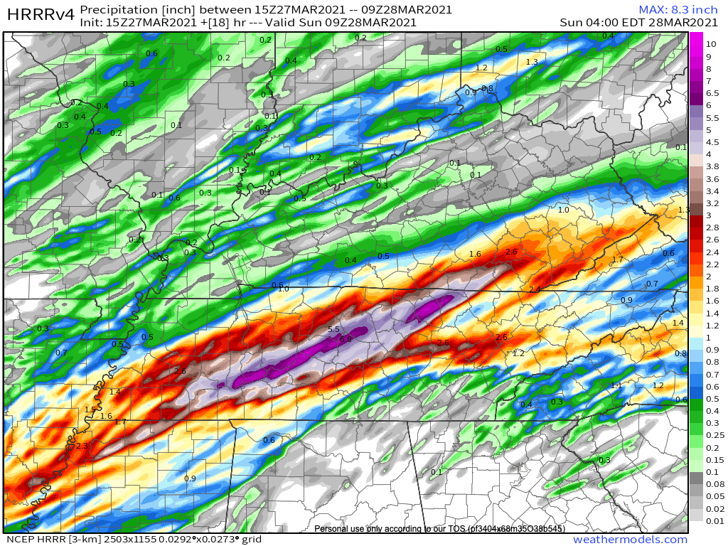
HRRR Model puts widespread amounts of 3-5 inches with a heavier stripe of 6-7 inches through the middle of Williamson County.
Stay connected all day and have a way to receive warnings as this will be a nighttime event. A NOAA weather radio is excellent at waking you up should warnings be required. And never drive through a flooded roadway. Turn Around Don’t Drown
Categories: Forecast Blogs (Legacy)
You must be logged in to post a comment.