
Quiet Friday
Check out today’s sunrise over the hills surrounding Grassland in Williamson county.

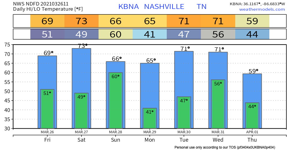
After last night’s severe weather, we dry out for most of today followed by decreasing clouds throughout the morning. We’ll be topping out near the upper 60s for our high temperature and the lower 50s for our low overnight tonight.
Enjoy today’s weather while it lasts! Our next round of showers and thunderstorms lingers tomorrow morning and night.
Stormy Saturday
SPC Categorical Outlook:

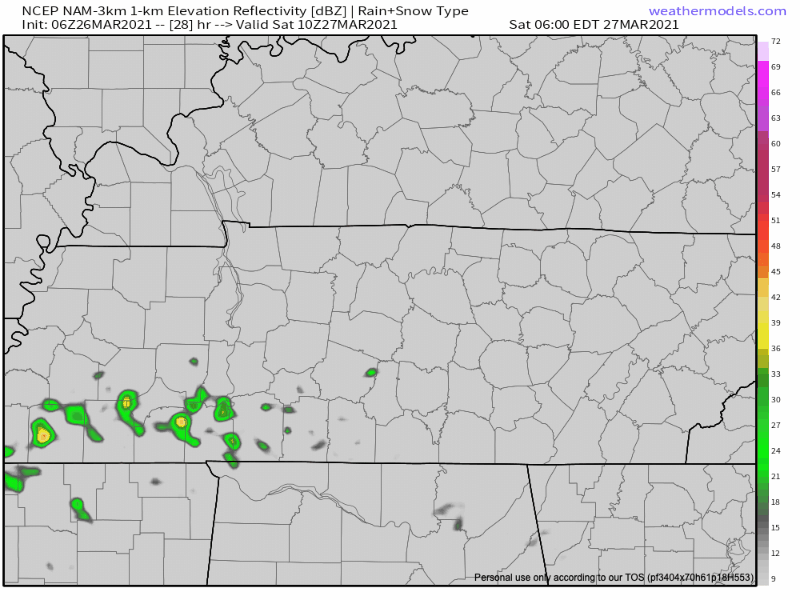
A warm front is expected to move north over the area late tonight into early tomorrow morning bringing a round of scattered showers and stronger thunderstorms. We’ll see most of the activity kick up closer to 6 AM tomorrow and carrying through to early afternoon. The main threats Saturday morning are looking to be heavy downpours, frequent lightning, and damaging hail.
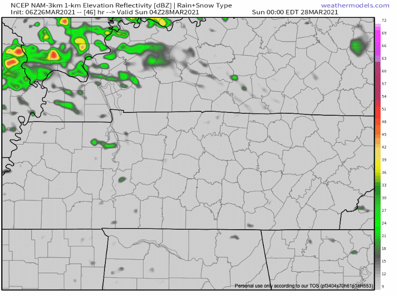
We then get a break in activity in the afternoon until a cold front pushes southeast late Saturday night/early Sunday morning, bringing a more organized line of showers and thunderstorms.
Main threats associated with this line are damaging winds, large hail, local flooding, and if any of these get the ability to rotate, the possibility of an isolated tornado cannot be ruled out.
Probabilities for Saturday’s event do not look as high as what we saw yesterday.
Make sure to stay weather aware during this event tomorrow. Have a way to receive weather warnings and always make sure to indicate your safe spot if storms do become severe.
Looking Towards Next Week
Another break from thunderstorm activity is indicated for Monday and Tuesday!

Around mid-week we’ll see our next chance for showers and storms arrive as another frontal boundary pushes through the region. Temperatures cool slightly next Thursday with projected highs only in the 50s.
Categories: Forecast Blogs (Legacy)
You must be logged in to post a comment.