
Rain will continue off and on today through Monday. The greatest possibility for flooding will arrive Sunday night through Monday. Severe weather threats remain minimal. If you have outdoor stuff you NEED to do, Saturday afternoon is your best shot.
Timing
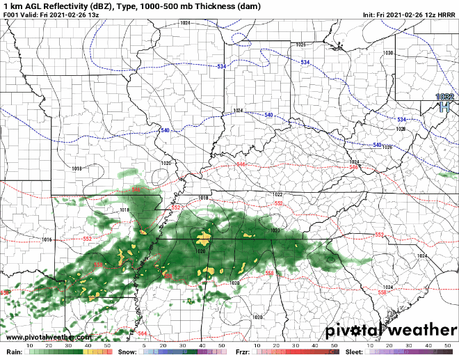
Expect off and on rain showers through tonight. The current wave of showers will drift off to the northeast this afternoon. The HRRR model (below) shows a dry slot developing this afternoon. Not so dry that you should plan an outdoor picnic, though. Scattered showers are still probable.
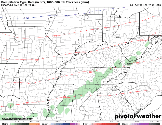
The GFS indicates showers continuing off and on Saturday. The heaviest rain should arrive Sunday afternoon into Monday.
Flooding Possible
Sunday afternoon into Monday, the system will bring a trailing cold front.
Read: training rain showers.
Read: possibility for flooding.
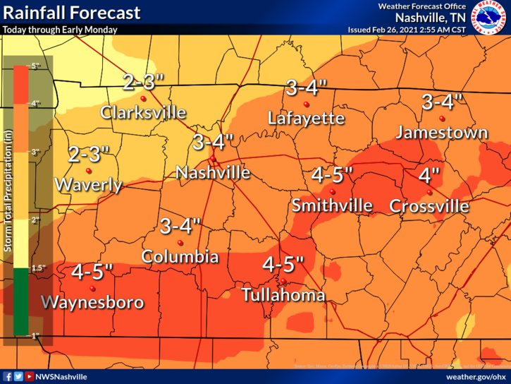
With rain like this, it won’t be long before the ground staurates. Rivers, streams, ponds, creeks, and any other water features won’t be able to hold all this rain. Flooding becomes an issue late Sunday through Monday with the trailing rain event.
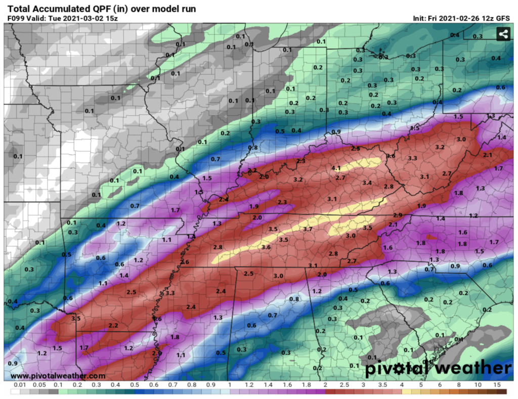
Rainfall totals are trending downward. Don’t get too comfortable with this, though.
Clear out your drainage ditch. Make sure your driveways are cleared for water to drain. For that matter, check your gutters. If your roof still has snow on it, that may create trouble for the water trying to drain.
The Good News: Low Severe Threat
While moisture transport and precipitable water look pretty good, instability is not so good. We may hear a few rumbles of thunder but that is probably it storm-wise.
-NWS Nashville Area Forecast Discussion
With the anniversary of last year’s tornadoes on our doorstep, we are keeping a close eye on any potential for severe weather. It’s unlikely, but we can’t say anything for certain. What we can say for certain is that @NashSevereWx on Twitter will have the most up to date information.
Tuesday and Beyond
Models have a few different opinions on precipitation chances following this system. I am sticking with the GFS, which shows a surface low pressure system moving over us but lacking precipitation. All in all, temperatures will remain warm, and we will keep our fingers crossed for a few days to dry out!
Until then, stay dry this weekend!
Categories: Forecast Blogs (Legacy)
You must be logged in to post a comment.