I am supposed to be at the gym.
I’m not because the forecast changed.

Earlier, there was question about whether a warm front would get far enough north “providing ample moisture for storms to feed on.”

I am supposed to be at the gym.
I’m not because the forecast changed.
Earlier, there was question about whether a warm front would get far enough north “providing ample moisture for storms to feed on.”
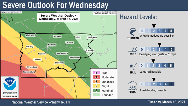
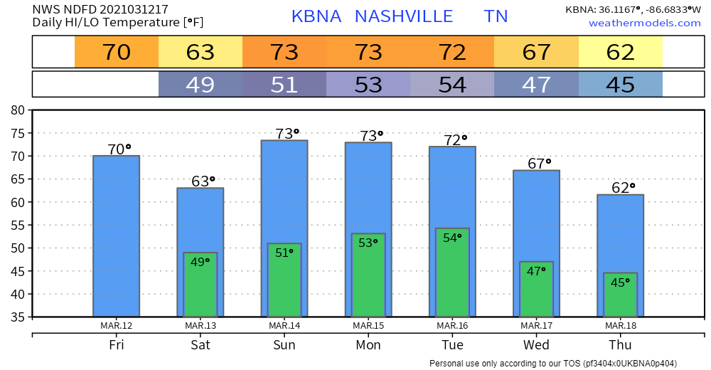
We will likely see two round of rain/storms Wednesday.
The first round will move through during the late morning and early afternoon hours.
This first round will race ahead of the warm front trailing behind it, so while gusty winds are possible, tornadoes are not expected to accompany this activity.
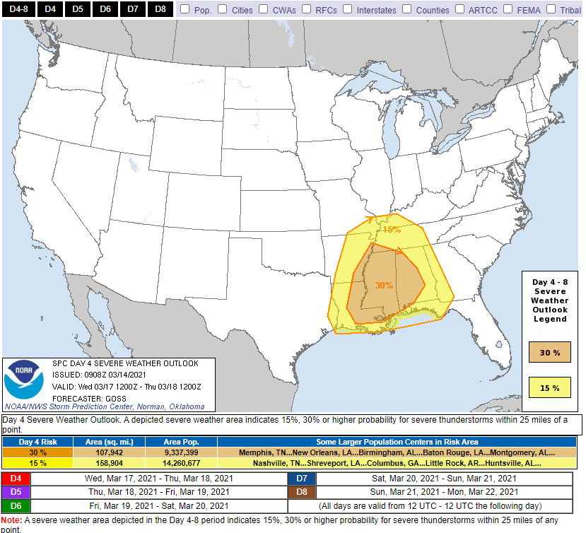
18z model runs (six of them, below) depict Wednesday’s severe event southwest of – but not including – Davidson and Williamson Counties:
This aligns with the 15% severe threat for Wednesday from the Storm Prediction Center.
Lunchtime rain is moving out. Should be clearing this afternoon.
This will all depend on two things: morning rain and where a high pressure is:
The Storm Prediction Center has put Nashville and Will Co under a 5% chance of seeing a severe storm within 25 miles of a point. The southwestern half of Williamson County is under a 15% probability, but I would not pay too much attention to that — the risk isn’t 10% higher in Franklin vs Brentwood, or the rest of our area.
Substantial wind shear will be in place as a line of storms approaches Monday morning. ETA late morning/lunch. But instability should be near zero, reducing if not eliminating most/all severe storm concerns. Winds may still be strong (40 MPH or so) — and we cannot totally rule out a severe wind event — but there is no reason for a hail or tornado concern Monday.

Weather requires lots of math. Lots of math, and lots of pi. In honor of one of the best math-themed holidays, I present to you a pi-themed forecast.
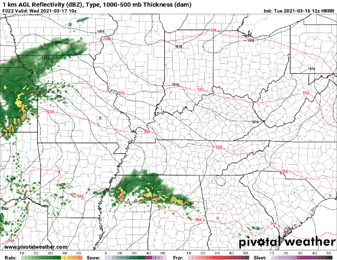
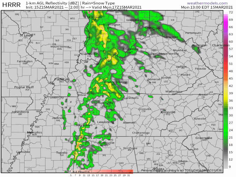
A thin slice of rain showers is moving through Middle Tennessee as seen on radar this morning:
An east-west line of storms will continue to impact the area.
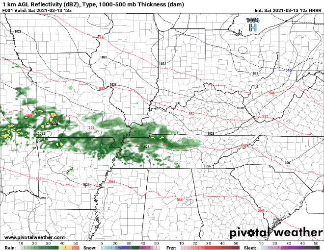
As expected, more rain north, less to the south. This activity will begin to taper off later this evening, with only spotty showers tonight. Washout potential is low but a good soaking is expected.
Rain will run off and on today and tonight, then turn steadier Saturday morning. HRRR below:
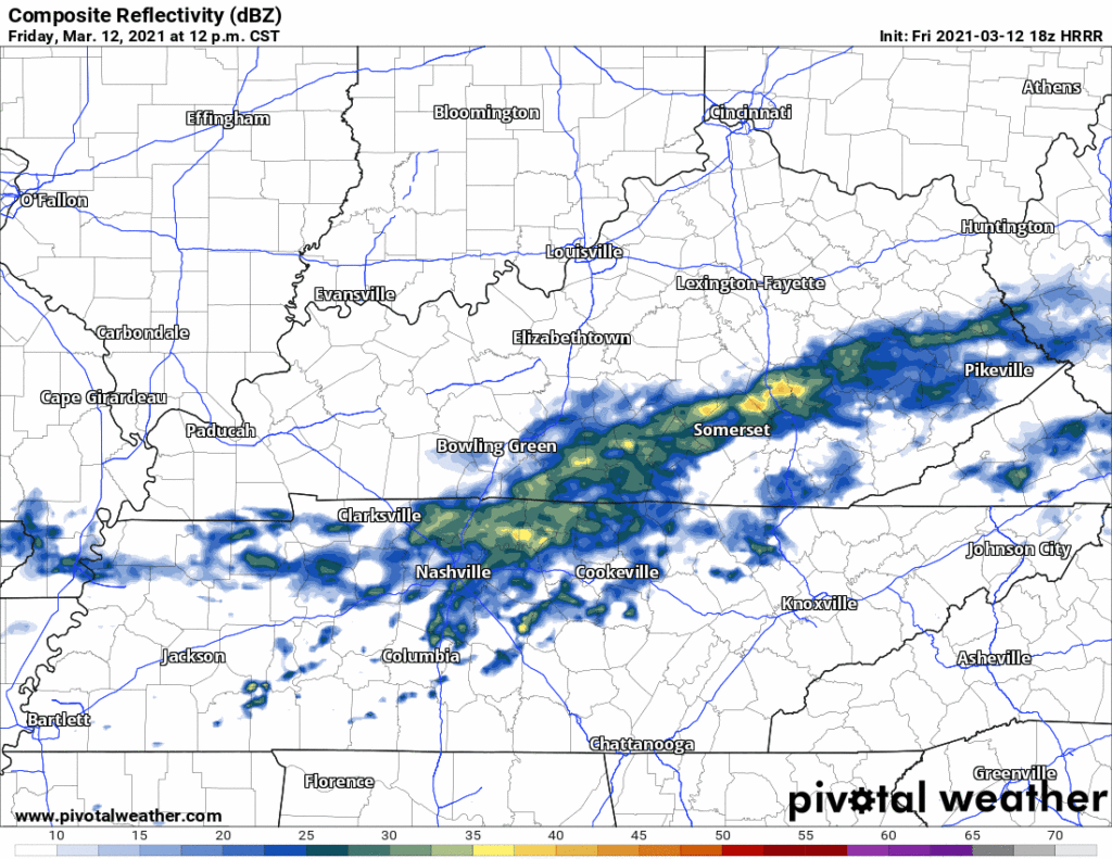
Rain should end around mid-afternoon Saturday.
This doesn’t look to be a complete washout, but we will get a decent soaking. About 1/3″ to 1/2″ possible, with more rain the further north you go.
#TBT
Those “warm and happy thoughts” will lead to high near 80 today.
Warmer temps will provide more energy for showers to develop Thursday afternoon. HRRR Model predicts most of the showers will stay to our north.
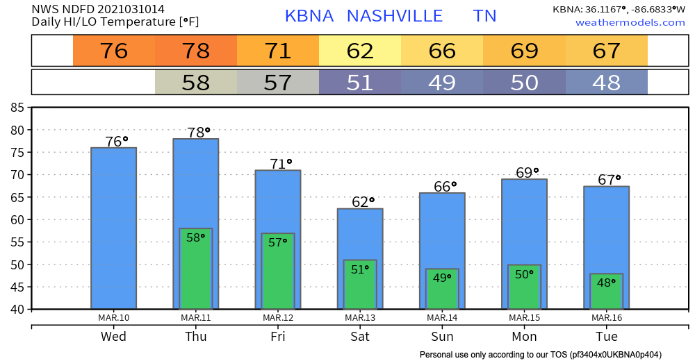
Our temperatures will continue to trend well above average by over 15º.
We can thank a surface high weather regime for these May-like temperatures. The surface high pressure will begin to move off to our northeast by tonight.
You must be logged in to post a comment.