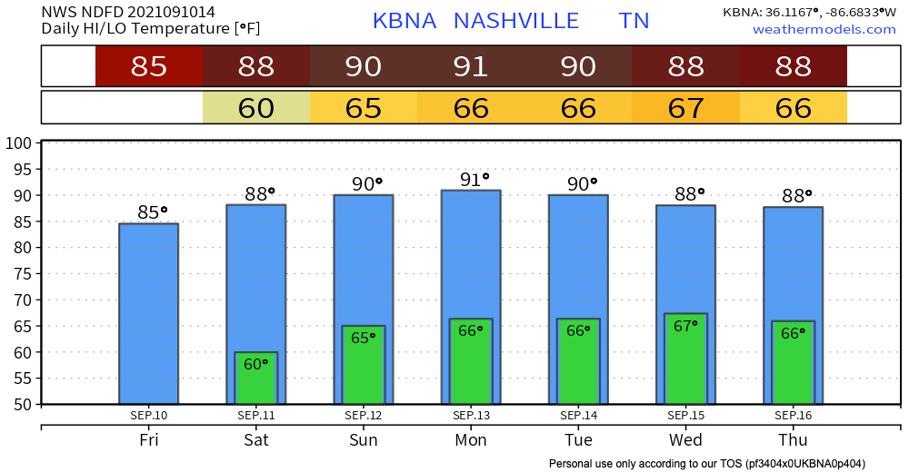
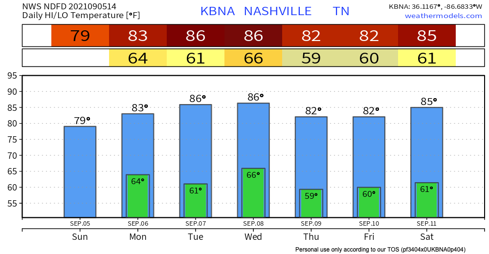
Sun today and temps in the low 80s. Dewpoint should hang out in the upper 50’s, so no need to worry about feeling sticky. Thank you surface high pressure.
HRRR shows nothing in terms of rain, all outdoor weekend plans are safe.

Sun today and temps in the low 80s. Dewpoint should hang out in the upper 50’s, so no need to worry about feeling sticky. Thank you surface high pressure.
HRRR shows nothing in terms of rain, all outdoor weekend plans are safe.
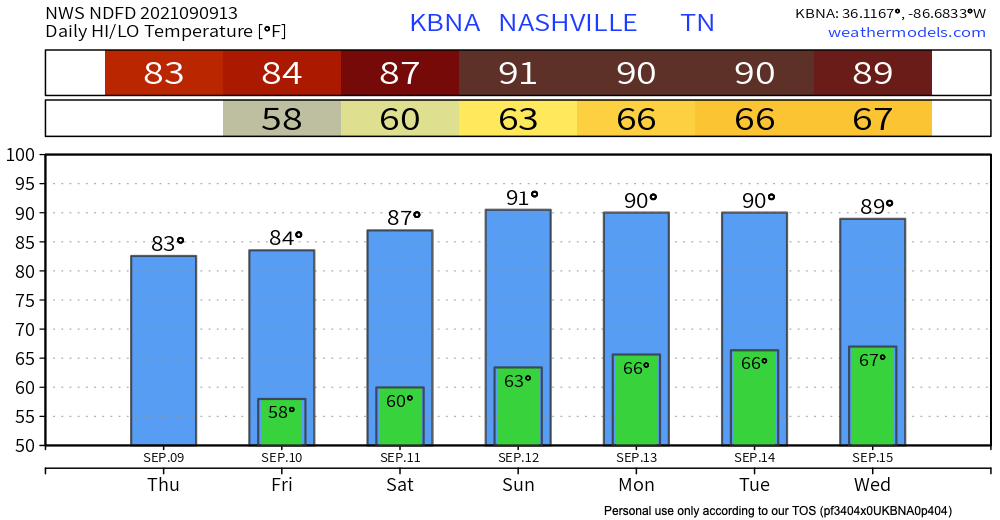
It’s a quiet one today. But hey it could be worse right?! The fog has mixed out from this morning leaving us with a beautiful day. High temps reaching the low 80’s and dew points in the mid 50’s. Thanks to the cold front yesterday, highs and lows are staying below average until the weekend. Models have us staying dry today and for the rest of the week plus the weekend. This will stick until early next week.
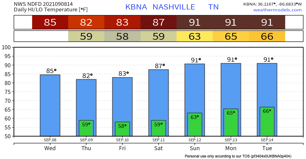
A few of us may get rained on today, but certainly not all of us. A moisture starved cool front will move through setting off a few showers/storms right along the front. But, we’re not expecting any problems out of these. If you have outdoor plans this afternoon and evening, have a plan for a brief shower or weak lightning storm. Otherwise, carry on!
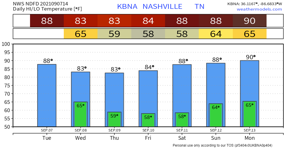
Not much to it today… expected to be warm and sunny. Any belated Labor Day plans are a full go. Slightly warmer than average highs in the upper 80s. Still enough to get us excited for fall. Dewps jump around a bit. Mostly at or below 60 degrees (comfortable) until later this afternoon. Low to mid 60s (sticky) this evening through tomorrow night.
A big blob of bleh moved into our area this morning. Lingering rain moves through our area the rest of the day. Nothing severe. See HRRR below:
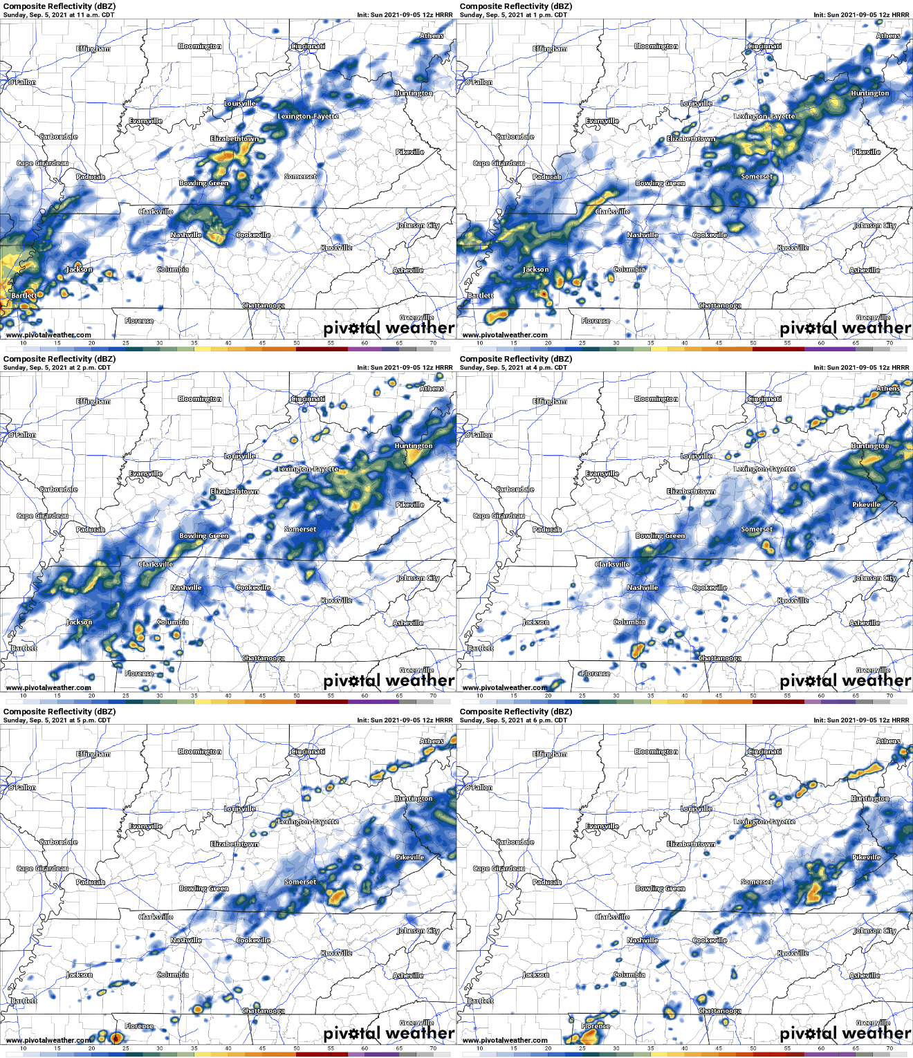
Rain becomes way more patchy after the initial round this morning. Some areas will get more rain than others. Looks like things should clear up around 6, so anything outdoors in the evening shouldn’t be at risk of rain.
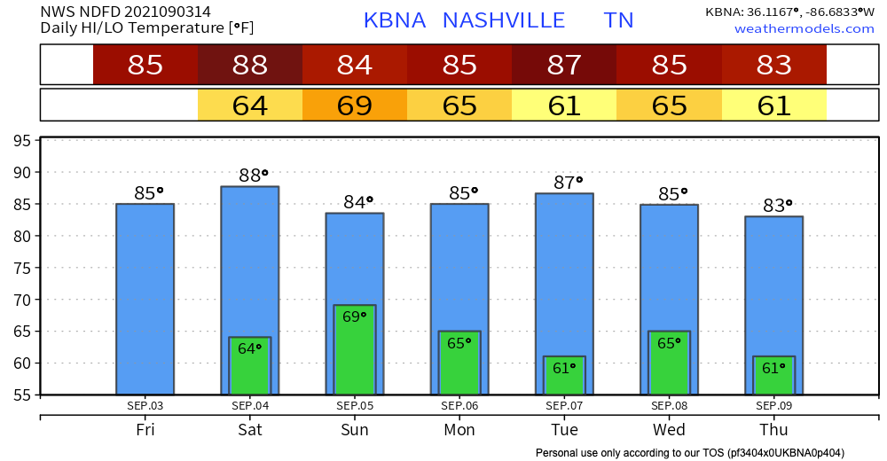
Happy Saturday! Low 80s this morning and much warmer temps this afternoon. Up to 88º. Blue skies and lots of sun!
What a way to start the day! The blue skies you’re seeing now will eventually change to clouds as we get closer to sunset.
Today, there is no rain in sight. Temperatures will be in the low 80’s, and dewpoints in the 60’s. It’ll be a great day for outdoor activities.

Eyes are on Sunday as the next day for rain. A low pressure trough will start pushing south, and with it comes some rain chances. The HRRR, as of now, thinks this will enter our area early in the morning Sunday, but this timing is uncertain. Other models think it’ll be later.
“Low humidity and mild temperatures will make today and Friday fantastic”.
Words straight from the NWS.

Alright, now let’s talk about why Thursday is looking so fantastic. High temps will be in the low 80’s & dewpoints will be in the high 50’s. Talk about a comfortable day. Ida took all the moisture with it I guess, and we are not complaining.
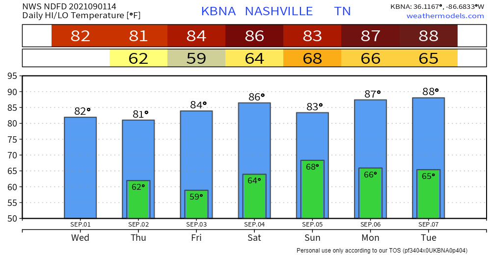
We finished up with Ida last night. What better way to follow it up than with clear skies and comfortable temps/dewps?
So what’s up? A little tease of fall, that’s what. Highs the next couple days hang out in the lower 80s, a couple degrees below average. What you really want to hear is that dewps are on a downward trend. Sticky today, but we might just creep into that “comfortable” range tomorrow and Friday–a far cry from the 66+ degree dewps we’ve come to know and hate.
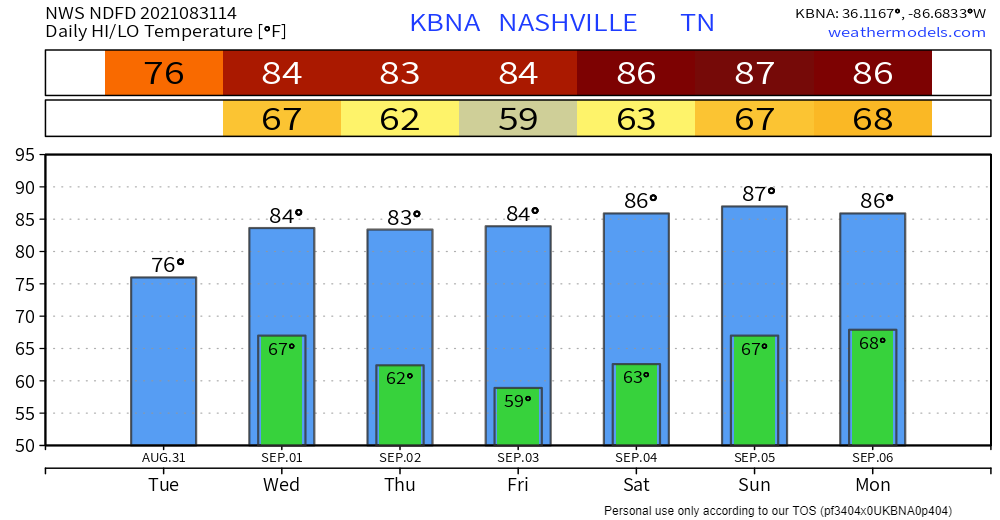
Rain continues today, but it appears the majority of the rain for this system has already fallen. The latest HRRR run shows most of us receiving less than an inch of additional rainfall, but a few spots may pick up a quick downpour.
You must be logged in to post a comment.