

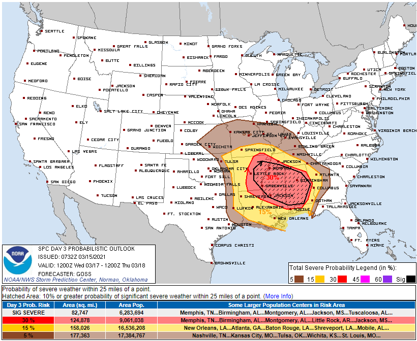
18z model runs (six of them, below) depict Wednesday’s severe event southwest of – but not including – Davidson and Williamson Counties:
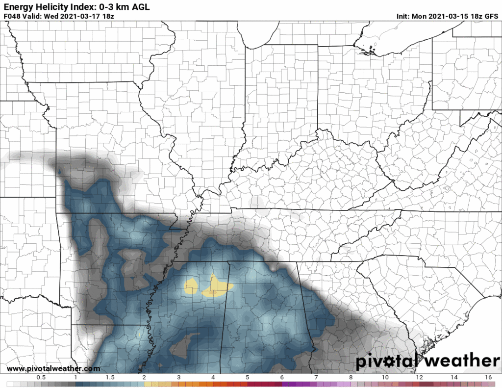
This aligns with the 15% severe threat for Wednesday from the Storm Prediction Center.
You should not stop reading here. We are not “safe.” That’s only the current thinking, based on 18z model data. 0z data will arrive late tonight and better define the risk area.
We think it’ll rain Wednesday morning while shear is very high, but instability should be low. That should keep storms relatively weak. The morning stuff is not the “main event.”
Then there should be a break in the afternoon.
Next we’ll wait to see if the big storms show up late Wednesday afternoon or evening.
Two things are trending in the right direction to lower the alarm for Wednesday.
First, the location of the warm front. If the warm front lifting north from MS and AL during the day Wednesday doesn’t pass through here, we will be fine. We could get severe thunderstorms north of the front, but we will not get tornadoes north of the front. You need to be south of the front for tornadoes. We think we will be north of the front — but we are not sure about that. Right now we think the higher risk will be in SW Middle TN, and in MS and AL.
Second,rain Wednesday morning will consume available energy, leaving very little energy remaining for the afternoon to power the incoming system. By the time precip clears, our atmosphere may not have time to destabilize. If that happens it will keep our severe threat low/close to zero.
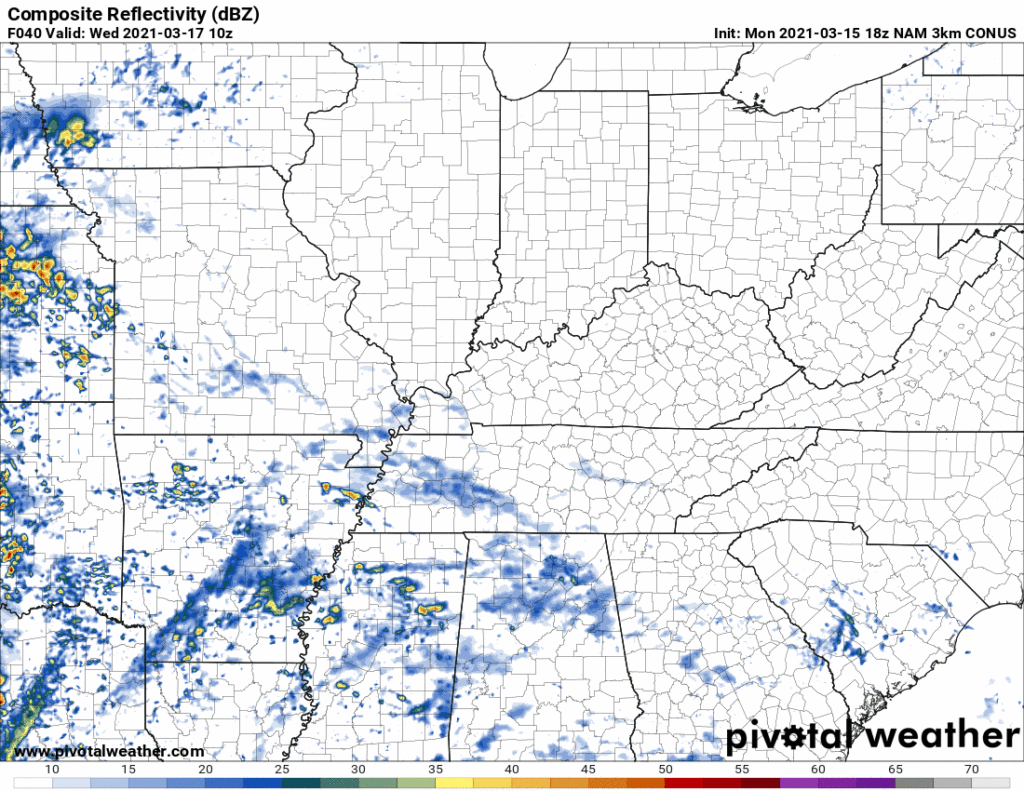
The NAM3 model is the a high res model currently in range of this event. It shows the morning rain, then a break Wednesday afternoon and early evening, then a line approaching closer to midnight. The morning round looks weak, and by the time the evening event gets in here, the atmosphere appears rather stable with maybe some weaker/low end storms closer to midnight.
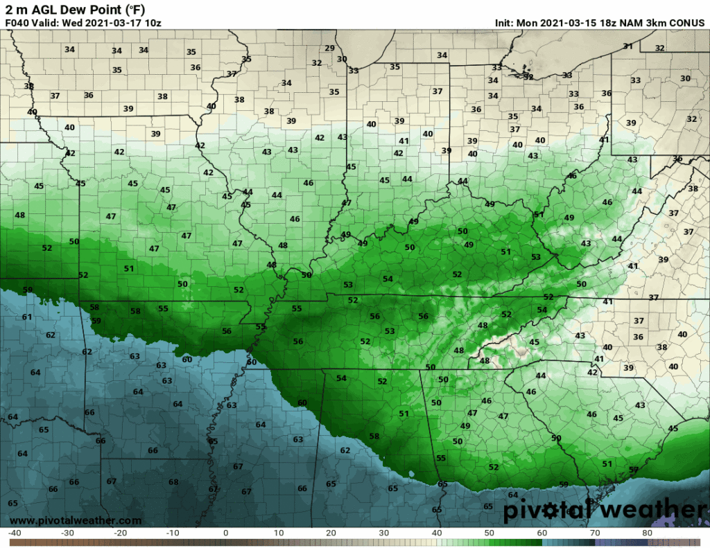
Notice below the same model run, where it shows the expected dewpoints. Notice how the deeper blues just don’t quite cover us up. That indicates we are on the safer/northern side of this warm front.
So the main concern, then, will be powerful supercells developing to our SW, then moving NE in our direction. If this forecast is “correct” then those supercells will cross the warm front to our SW, run into more stable air, where they will weaken.
All this could be wrong. Shift things 50 miles in either direction and things could change, perhaps substantially. And if the warm front actually sets up over us, it can enhance storm helicity and increase a tornado threat. That’s why tracking that warm front will be our first priority Wednesday. Check back on Twitter and on this site Tuesday as we update the forecast with better information.
This will not be our last event. Clear out your safe space, locate your helmets, hard soled storm shoes, and other things you need. You never know when you may need them.
Categories: Forecast Blogs (Legacy)
You must be logged in to post a comment.