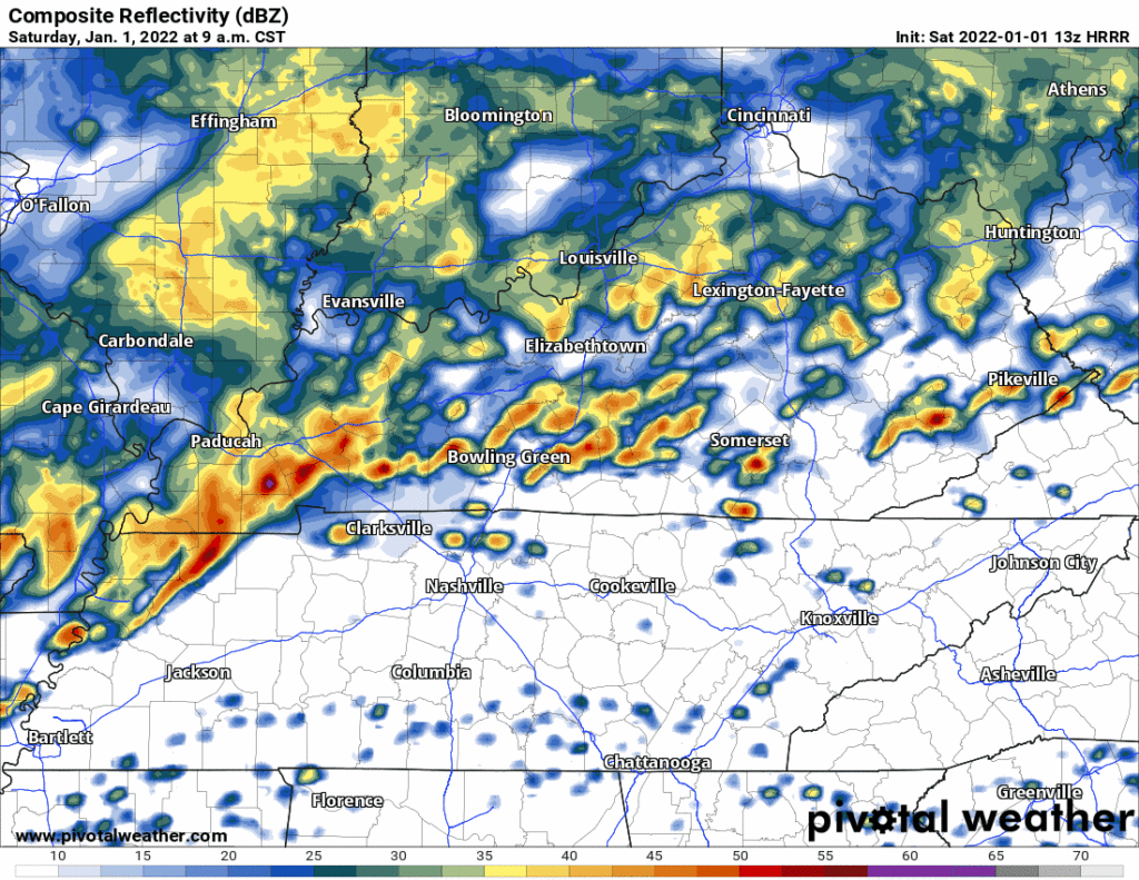
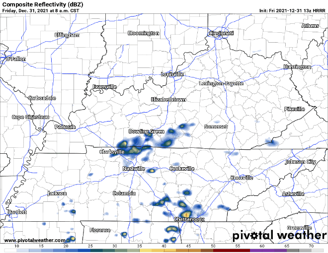
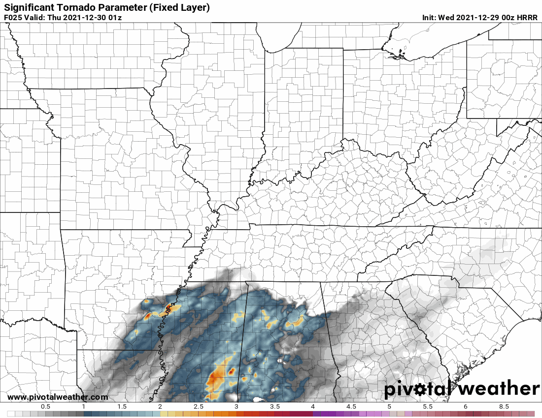
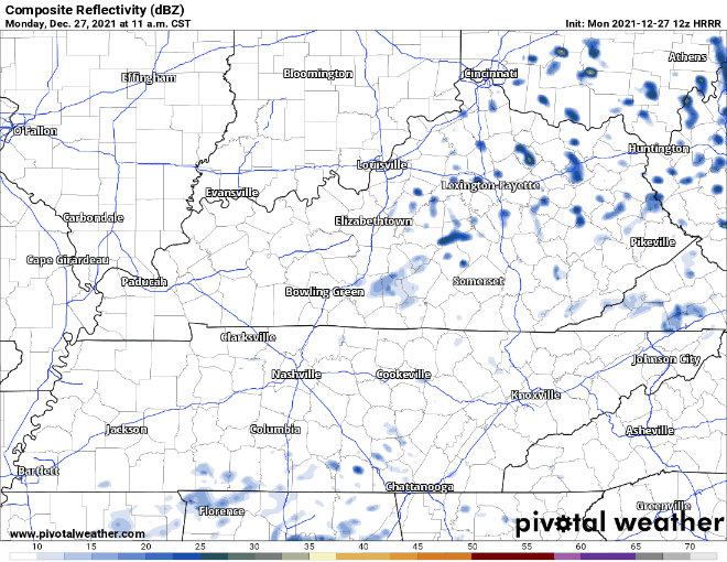
The 13z HRRR model run shows supercells and multicell storm clusters forming ahead of a cold front this afternoon.
These storms will rotate. Some rotating storms will be capable of producing damaging straight line winds, tornadoes, and hail.

The 13z HRRR model run shows supercells and multicell storm clusters forming ahead of a cold front this afternoon.
These storms will rotate. Some rotating storms will be capable of producing damaging straight line winds, tornadoes, and hail.
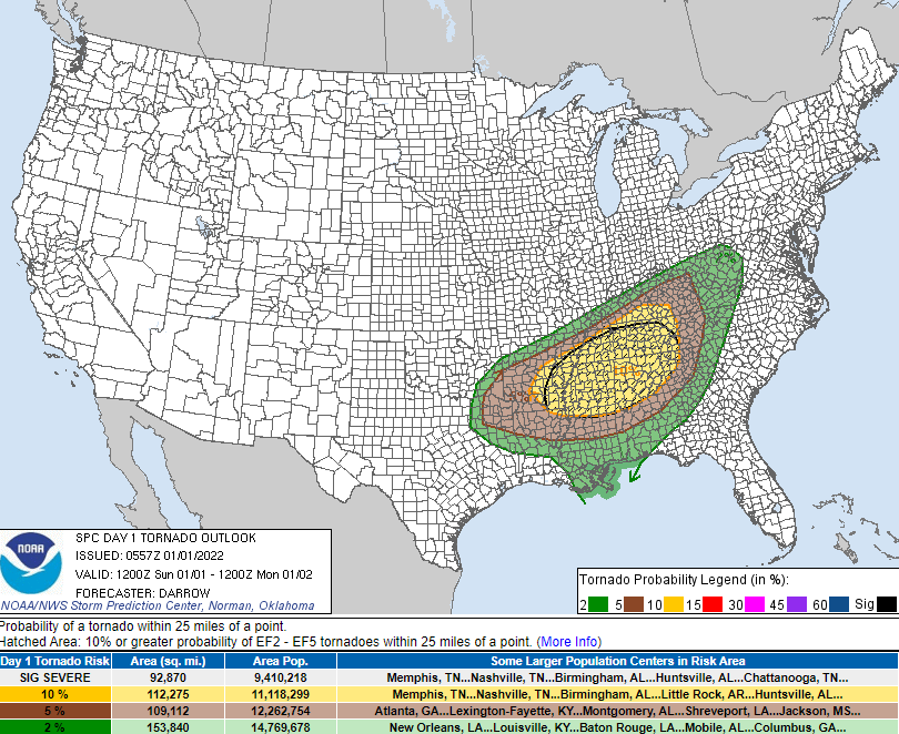
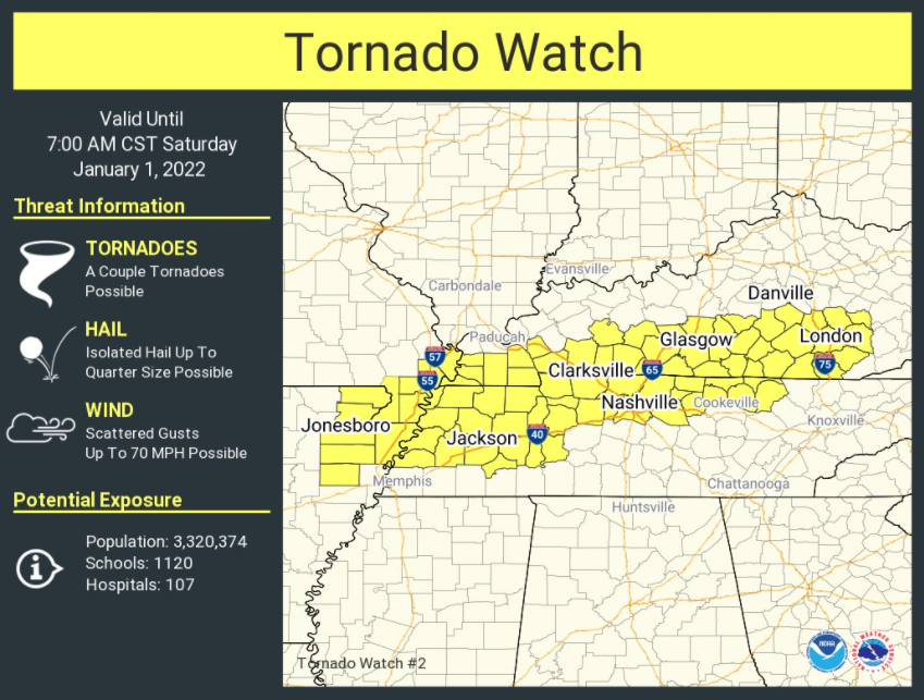
SPC issued a tornado watch that expires at 7:00 am for a large area that includes Davidson County. Williamson County is excluded.
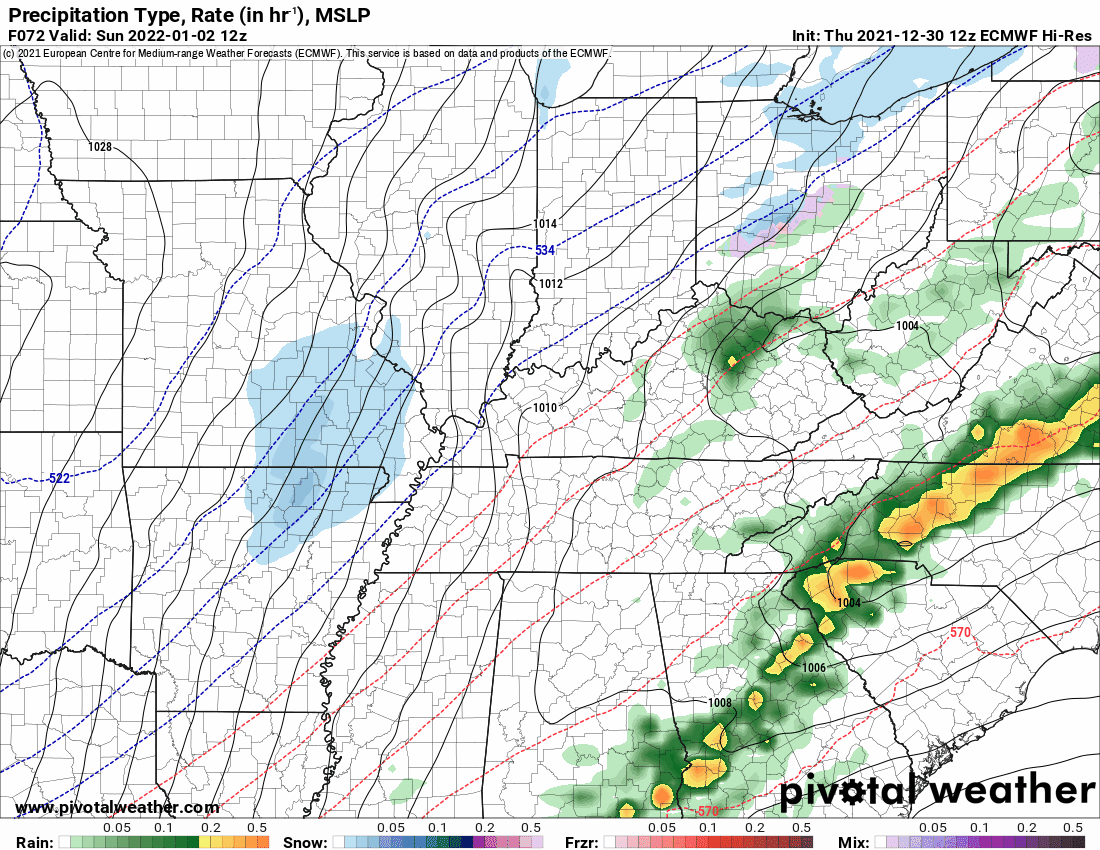
The model trend throughout the day Friday has been for storms to develop increasingly north and west of Nashville. This has become the case as the new year has begun.
This morning we’ll be seeing some scattered showers around the area, which should clear out before lunch time.
Later into this evening, some heavier storms will make their way through. The HRRR currently has the rain moving in around 8pm and sticking around through that New Years toast. This unfortunately means outdoor parties are a no-go. Probably going to be hard to shoot fireworks in the pouring rain.
This is a complicated forecast that we make easy lol. Let me start off saying we’re relying on the HRRR model. I point this out because there are so many Somewhat Different Ideas from other weather models about Friday and Saturday. Were we to talk about all those that would make this weather briefing more annoying than it already is. I say that to ask you to please check back in the morning because timing and hazards may change, and I think the data might give you a clearer picture of what’ll be incoming. Saturday looks worse than Friday, generally speaking. I’m hoping this will at least help you plan your weekend.
No rain for us today. We got that out of our system yesterday. There is plenty more on the way though. Let’s talk about that.
New Year’s Eve looks dry for the most part, until we get to the evening. This is probably preferred on any day of the year except NYE. The weather wants to party, too.

The warm front never got here today. This eliminated the severe weather threat. Thursday will be quiet. Most of the day Friday should be quiet. Next event incoming Friday night. Let’s talk about it. It’s kinda meh, maybe.
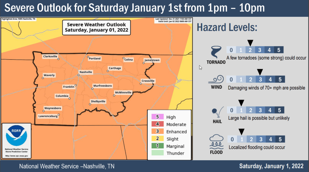
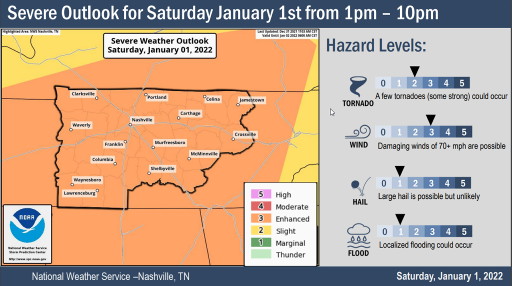
SPC places a greater severe weather chance south of I-40. The majority of our counties are still included in the slight risk category for today’s severe thunderstorms.
The main threat is damaging straight line winds (60+ mph) with a 5% chance of damaging winds/gusts within 25 miles of you. A tornado can’t be ruled out in this situation with a 5% probability of a tornado within 25 miles of you. Small hail is possible with a 5% chance of hail with a diameter of 1 inch or greater within 25 miles of you.
If you’re just going to look at one thing then look at this:
It’s true I like to write and much of this blog is indulgent but I think it has good information in it so maybe keep reading until the next commercial, your video ends, someone texts you, it won’t take long.
It’s windy, and there may be showers around today, tonight, and in the morning:

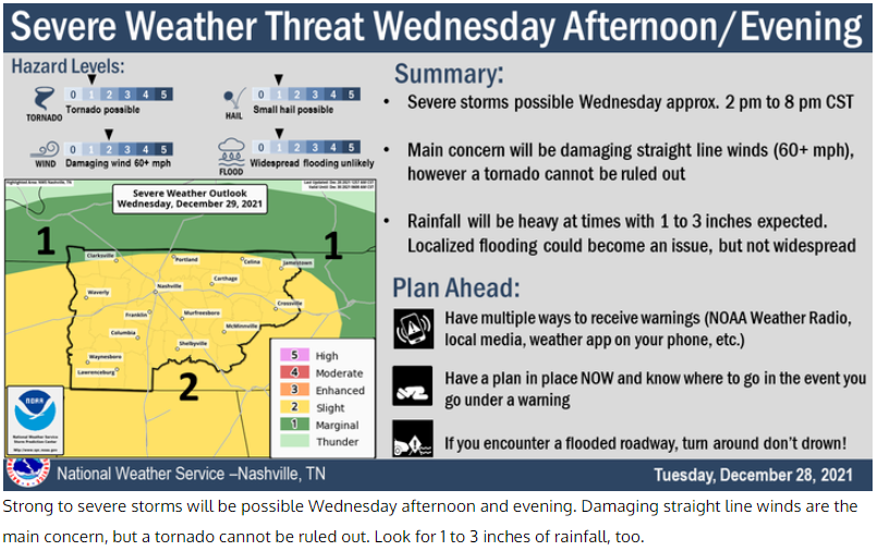
Strong to severe storms are possible Wednesday afternoon and/or evening. Since yesterday, our area’s been upgraded to a slight risk of severe weather by the Storm Prediction Center.
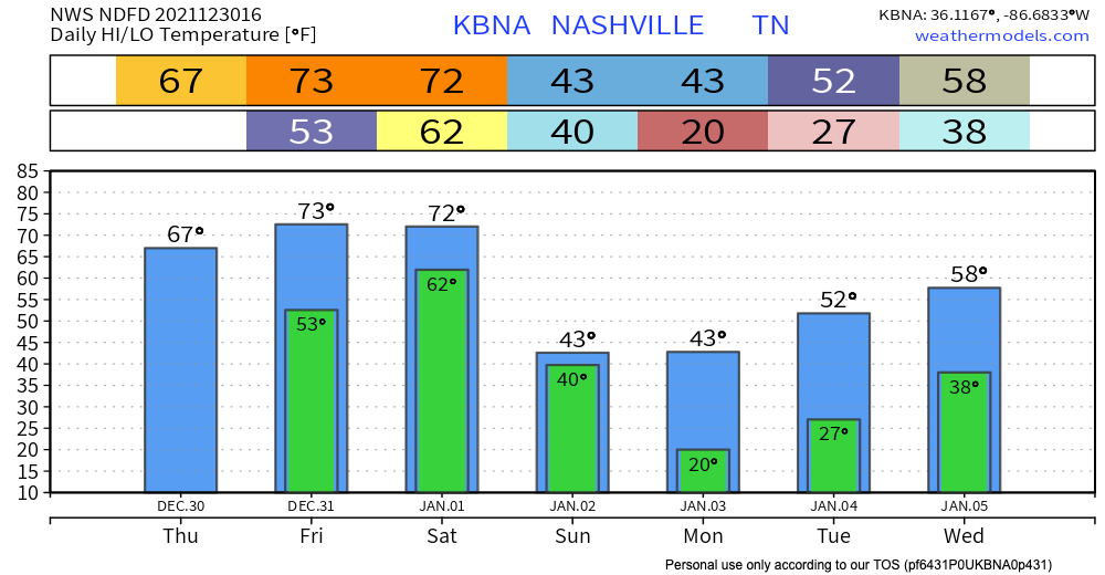
Highs are running 20-25 degrees above normal this week. Rain is possible every day, most likely Wednesday and Saturday. Those are the days we are concerned about.
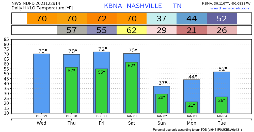
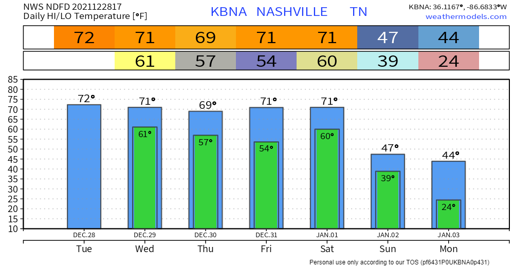
Below shows Monday and Tuesday, no worries about it.
You must be logged in to post a comment.