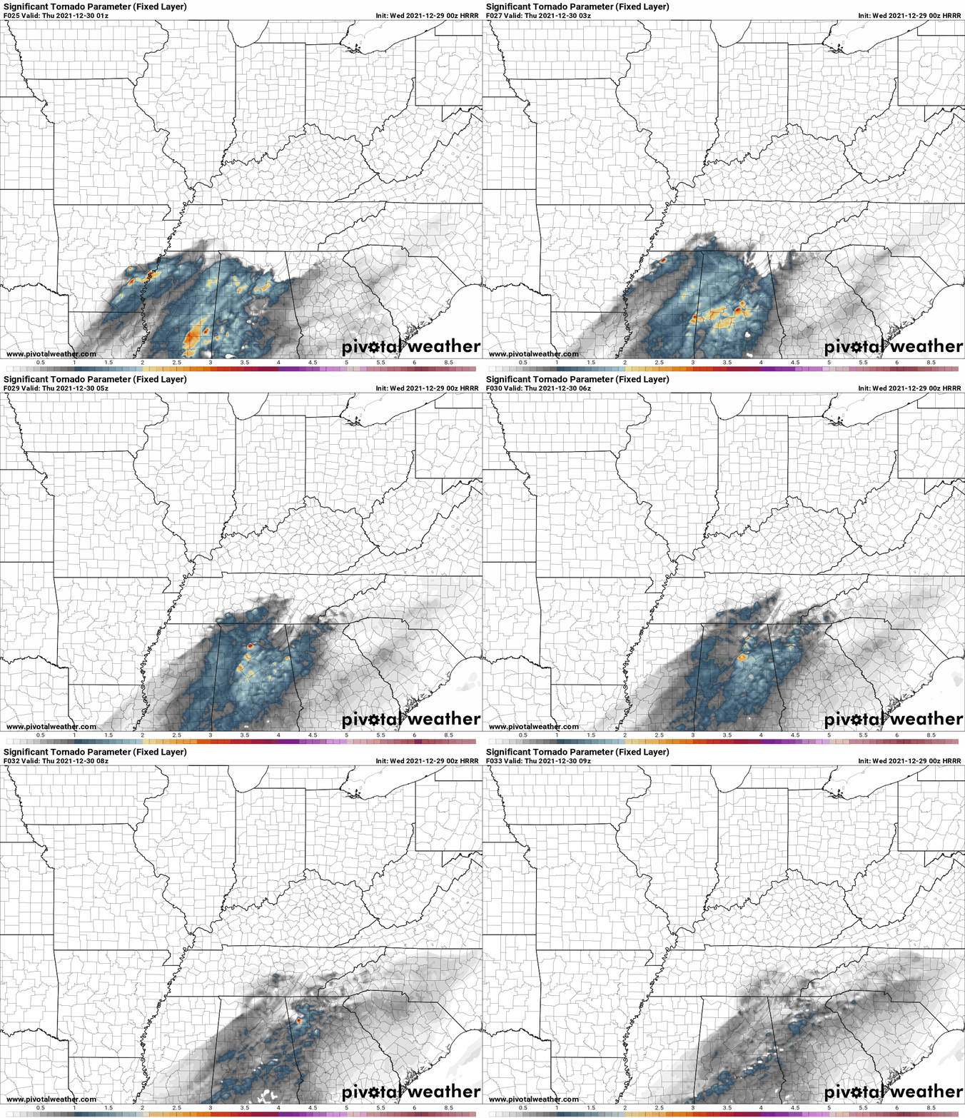
If you’re just going to look at one thing then look at this:
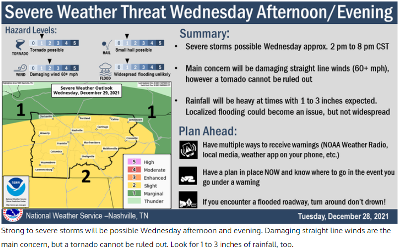
It’s true I like to write and much of this blog is indulgent but I think it has good information in it so maybe keep reading until the next commercial, your video ends, someone texts you, it won’t take long.
It’s going to rain pretty hard and even thunderstorm tomorrow, ETA from the HRRR (Subject to Change) is 6 PM to midnight.
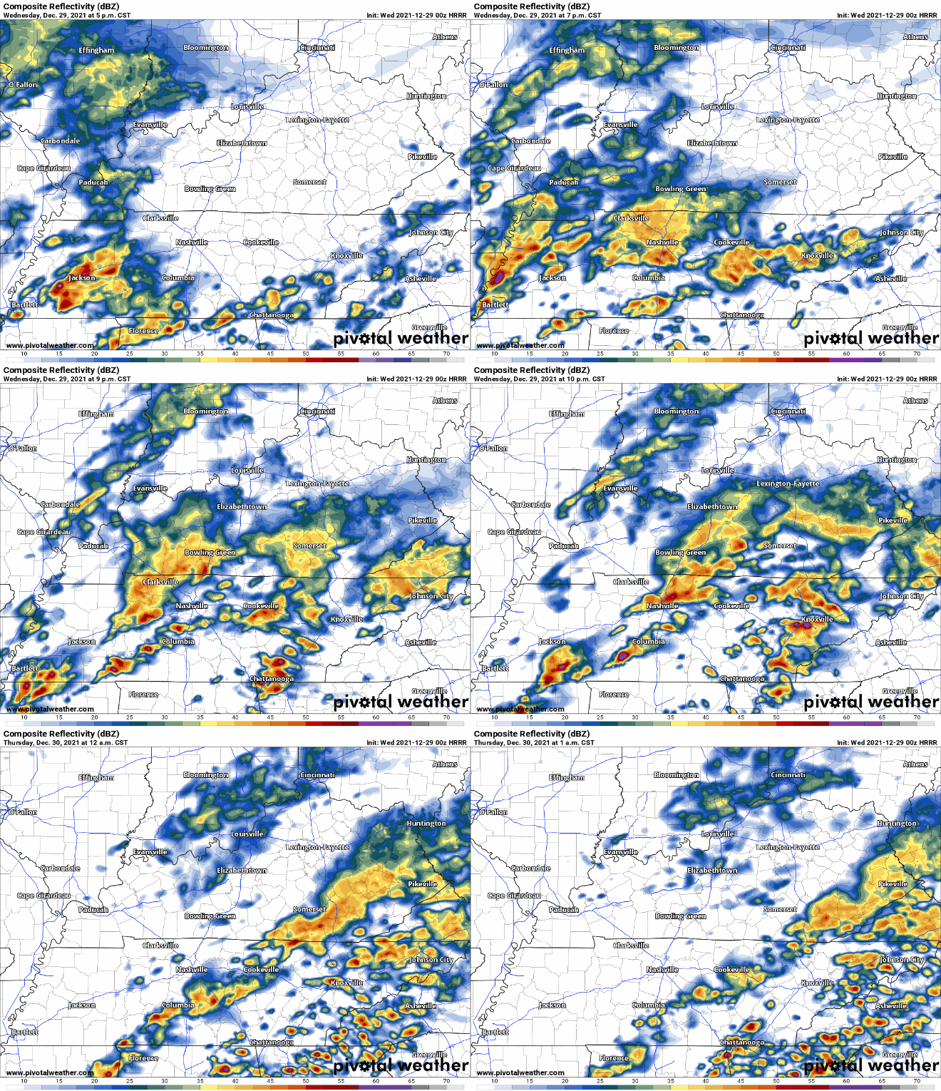
It all may start sooner than that so stay updated for timing changes.
The real question will be whether the warm front goes north of your house in Williamson County or Davidson County.
That’ll determine storm severity.
If the warm front crosses from south to north over your house like a warm washcloth across your face, then you’ll be left on the moist, warm, unstable side of this system, #NotGreatBob, where tornadoes and damaging straight line winds could occur. Not that they will occur, they could/might occur. If you’re playing the odds, those south of the warm front still are unlikely to experience an impactful event. SPC maintains probabilities of 5% tornado, 15% damaging straight line winds, and 5% to 15% hail, any/all within 25 miles of you.
So we prepare (as we have to, as responsible people) and stay informed and have a plan.
So as I just said it’s north side for the win (well, you’re still getting rain and thunderstorms probably). South side for the potential problem.
I’ve been watching models all day and there’s no real clear signal how far the warm front will go. It could make it to the TN/KY Line which would be bad for us. But the HRRR has the warm front’s tornadomaking ingredients south of Nashville and south of Will Co, which, as Aurelia says in Love Actually, that would be nice.

(I had friends once try and convince me that Usual Suspects is better than Love Actually which is a matter of opinion but can I please say I Strongly Disagree, and this coming from a man who signed off on watching Die Hard on Christmas Eve #NotAChristmasMovie. Also the Die Hard and Love Actually villains: same actor, but I digress).
Below we have the NAM4 model trying to answer “where you gonna be, warm front?” It puts the front right around the Will Co / Maury Co line which is Not Great, Bob, because sometimes these storms like to attach to the front itself, a wiggle north and that puts southern Will Co south of the front which as I wrote above is not what we want:

Finally, behold the HREF ensemble model below (consists of several members). The average of those members keeps the front south of Will Co but uncomfortably close to Will Co. A few lift the front further north which is not what we want, but most of them limit the tornadomaking ingredients well south of us.
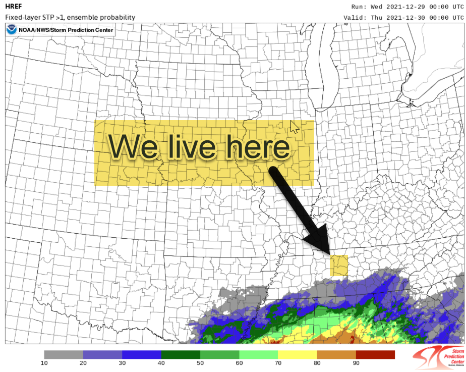
What you should do is be sure you’re ready in case Wednesday lands in the weather crapper. If you’re not sure what To Do then read this link and then Actually Do The Things It Says and do them so hard that you flex your knowledge to friends. You could be the first person to make tornado and storm safety cool. You could try this winning argument:
You know what’s not cool, getting surprised by a tornado, even worse, not knowing what to do when a warning is issued for my crib.
You may want to reword that, IDK your friends, be sure to capture the essence.
Now you might be thinking to yourself dude must not be worried look at all the bad jokes which is true but this tone is intentional because if tomorrow it all Gets Real hopefully you’ll notice a tone shift and get the message a little better than if the night before I’m all OHHH NOOOEEESSSS READ ME RETWEET ME THE END IS NIGH which, frankly, is a message I’ll tweet in exchange for a Stanley Cup and maybe a Super Bowl but that’s it.
I should also mention the rainfall will be pretty heavy. WPC says 10% to 20% probability of flash flooding. Doubt it’ll be widespread but still, if flooding happens, don’t drive across a water covered road. 2021 has been the worst Flash Flooding Year in Tennessee since those records have been tracked: 28 killed, almost all of them in Middle Tennessee. Tornadoes kill, yes, but y’all, flash flooding does too. Respect floodwaters, they do not respect you.
More on the storms tomorrow. We’ll be on the Tweeter and, hopefully not, YouTube Live (because that means there is a warning), with more information. Timing may change and new data may make what I’ve just written terrible enough to be lobbed into a landfill, so check back for updates.
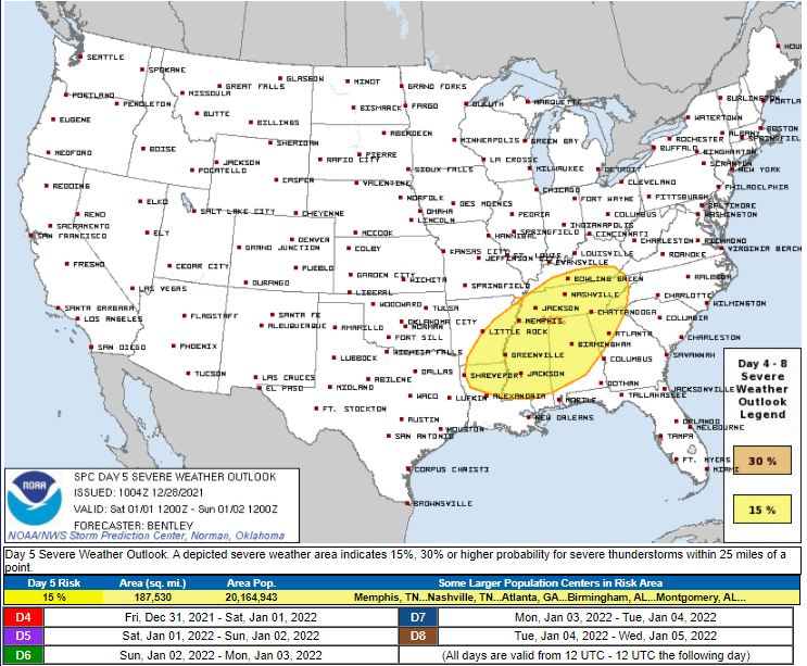
We still have to watch out for Saturday. SPC has already outlooked us for severe weather, but let’s do one event at a time, ok? Although real talk, can 2022 just, IDK, not begin with severe weather?
The global models aren’t in yet about the snow probability for Sunday. It’ll be a while. I’m not holding up this severe weather blog to scoff at our snow “chances.” Looks freaking cold Sunday if you consider a high of 45° cold which today I do having watched my neighbor cut his grass while I walked my dogs while wearing shorts.
Categories: Forecast Blogs (Legacy)

You must be logged in to post a comment.