Most, if not all of the rain has moved out for today. One flood advisory remains at press time, Whites Creek near Bordeaux. Many creeks are high right now, take extra caution if you live or work by one. Turn around don’t drown.

Most, if not all of the rain has moved out for today. One flood advisory remains at press time, Whites Creek near Bordeaux. Many creeks are high right now, take extra caution if you live or work by one. Turn around don’t drown.
A wet, weather-filled week is ahead of us. Two rounds of potential severe weather are coming our way this week. Starting off with today:
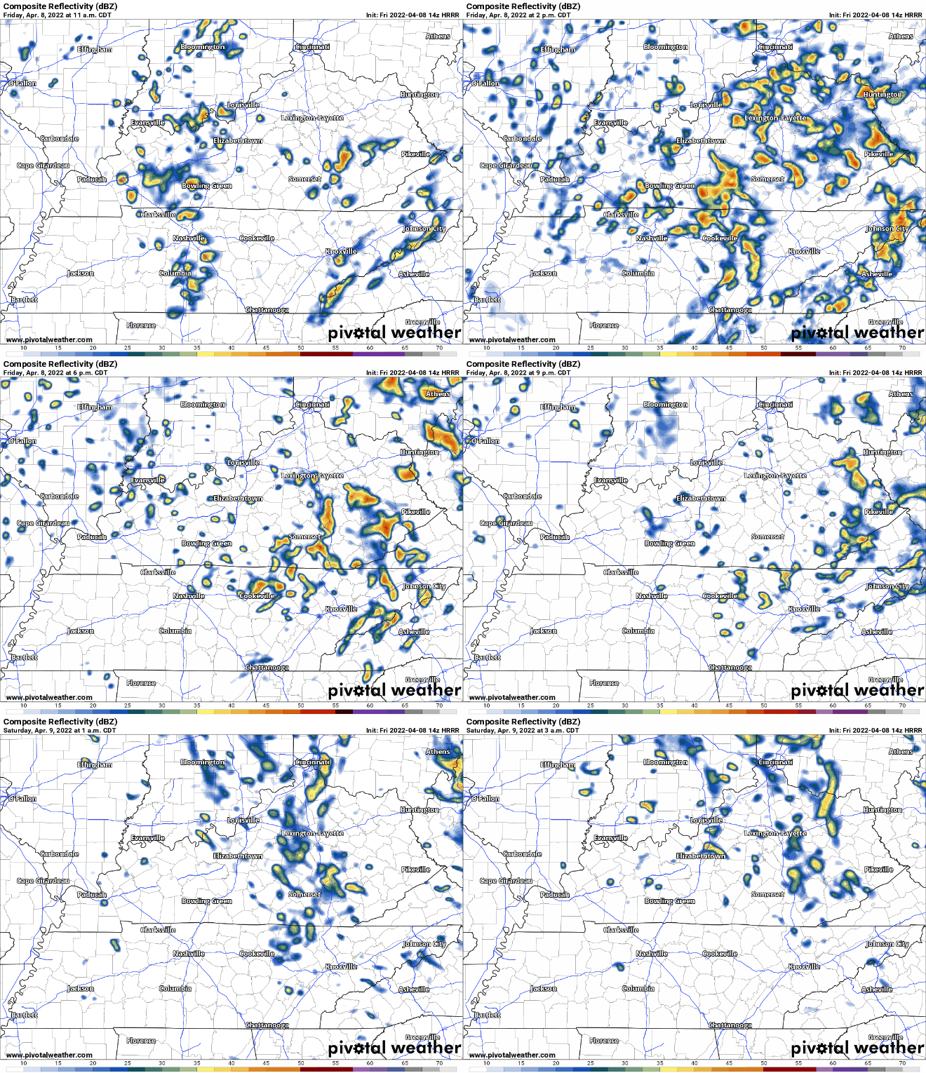
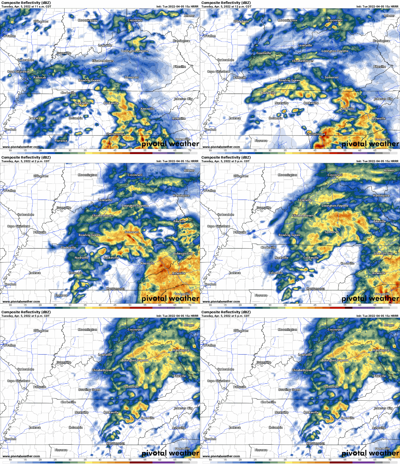
Showers persist today with a small break in rain this afternoon for some of us. HRRR model below has strong storms coming into our area after sunset. These continue into the overnight hours and should be out of our area by Tuesday morning.
Sunday will be warm and sunny. A little breezy, too. Perfect day to get outside, enjoy it because rain is coming.
Monday will bring on and off rain showers and storms. Classic spring weather. Expect more “off” than “on” rain. Nothing severe is expected. There could be some lightning and thunder, but that’s it. ETA looks to be just before lunchtime. See HRRR below:
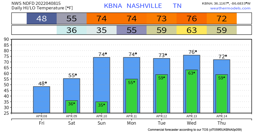
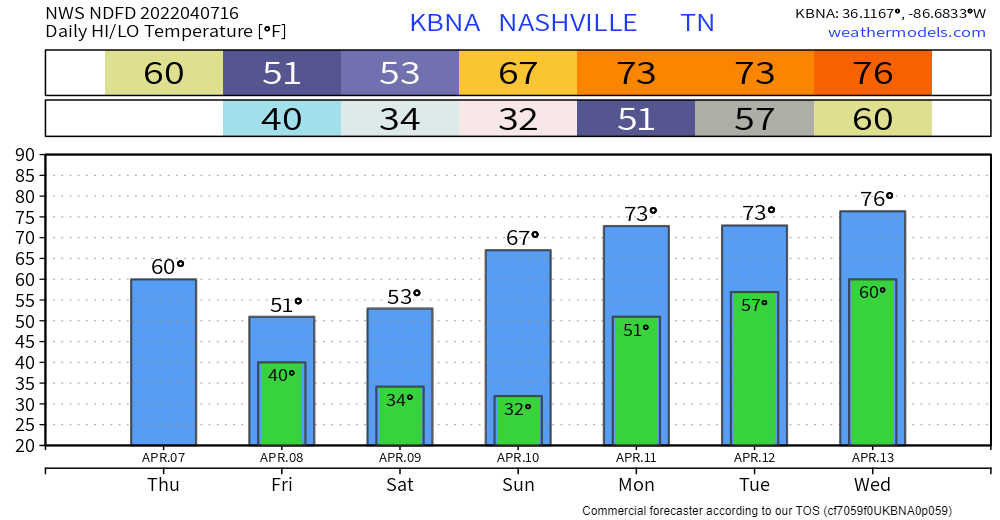
We are on the last day of the cool trend of last week. Todays temps will be in the mid 50s. Lows will be in the mid to low 40s. There was a frost advisory and it expired earlier this morning.
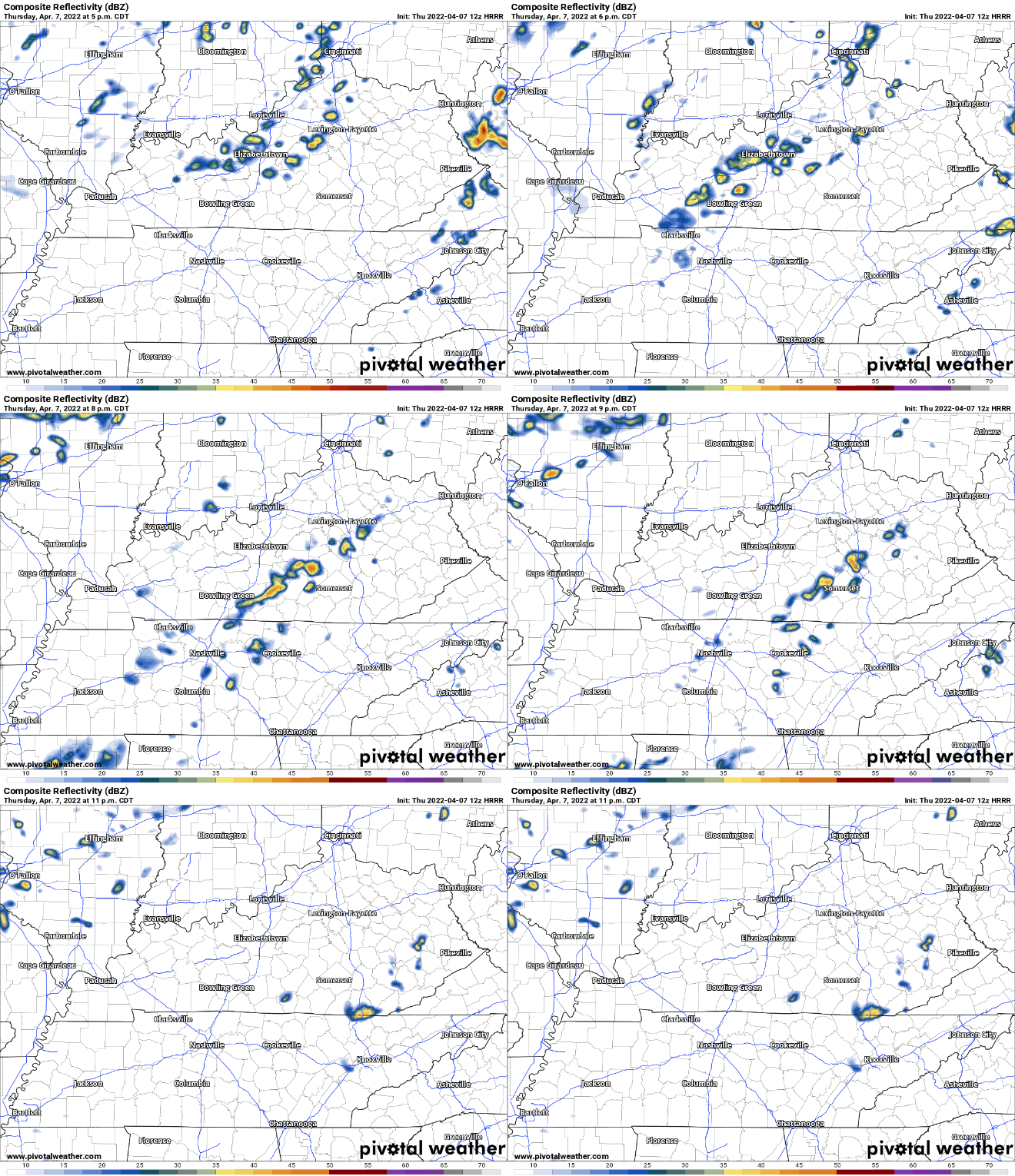
No rain expected today. It’s east of us. HRRR below:
We will continue to see scattered showers for the rest of the day. Some sleet and graupel has fallen in some part.
Some rumbles of thunder are possible with a few of these storms, but nothing to be concerned about. As temps drop, some of these showers could be a little winter-y, but this is mostly to our East
Temps down a good bit from yesterday. Mostly quiet today except for maybe an inconsequential PM shower or two.
Chances for rain go up tomorrow. Scattered showers throughout the day. No strong/severe storms expected… Can’t rule out the occasional rumble of thunder. Not much accumulation expected with this system. No flooding concerns here.
Threat of severe weather is low all-around for our area. Best chance east of I-65.
Latest SPC outlooks reflect the downward trend in severe probabilities. No more tornado/hail outlook, just wind (and barely)… 5% probability of damaging thunderstorm winds within 25 miles of you:
The rainy morning we’ve been seeing so far is almost done – for now.
The HRRR shows this system moving out of our area between 4 and 5pm, and we’ll have a rain-free rest of our evening.
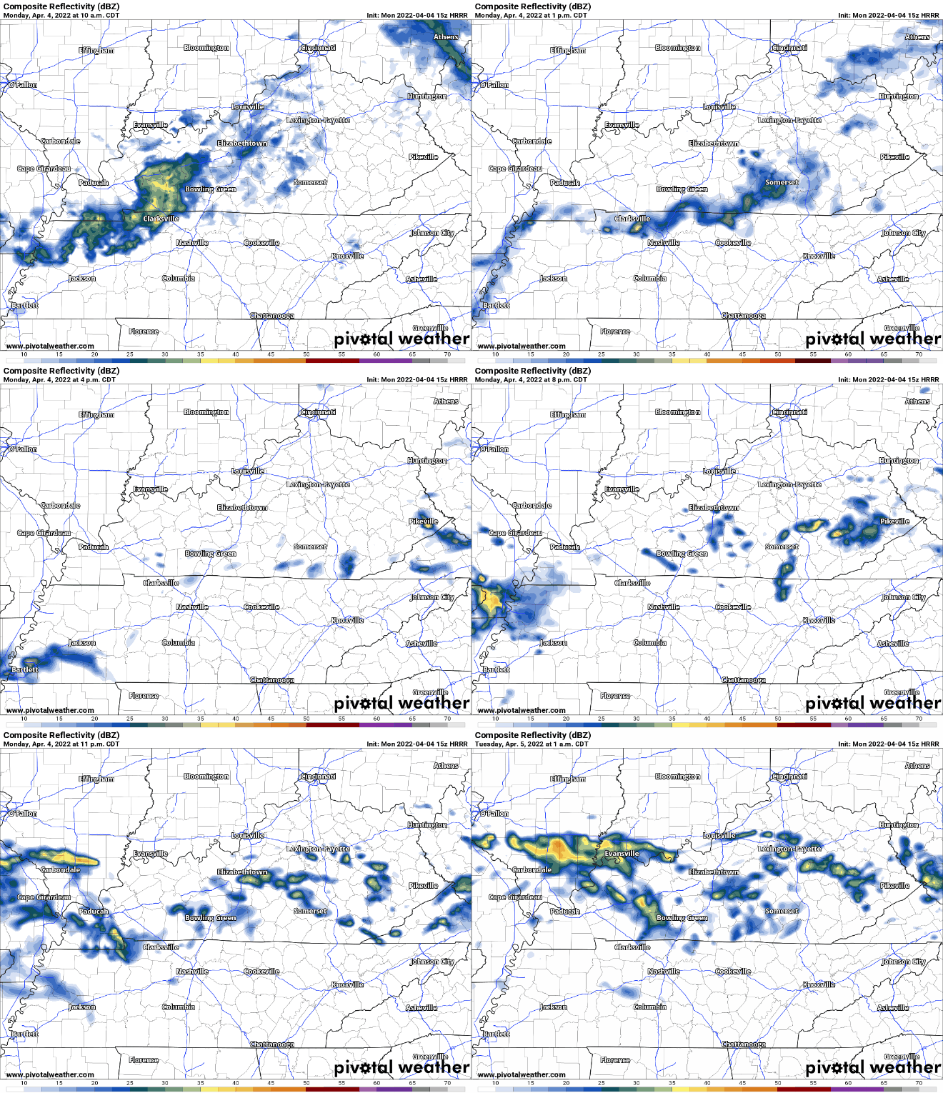
Tomorrow we’ll get round 2. HRRR shows this second system moving in around 7am. The main line will pass before lunchtime, but more pop-ups will be around for the remainder of the day. With these popups, some may be just light drizzle, others may be strong severe thunderstorms. Instability and shear are present, so these storms have the potential to be severe, and we cannot completely rule out tornadoes.
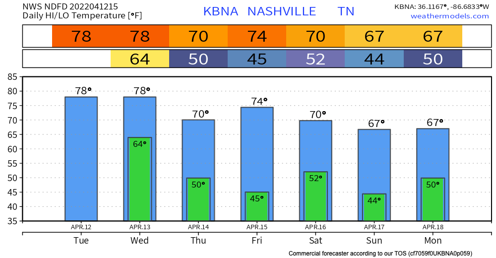
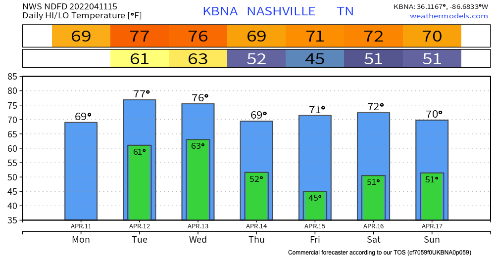
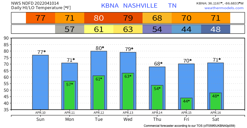
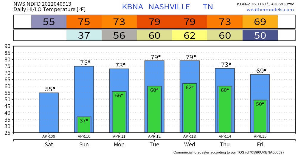
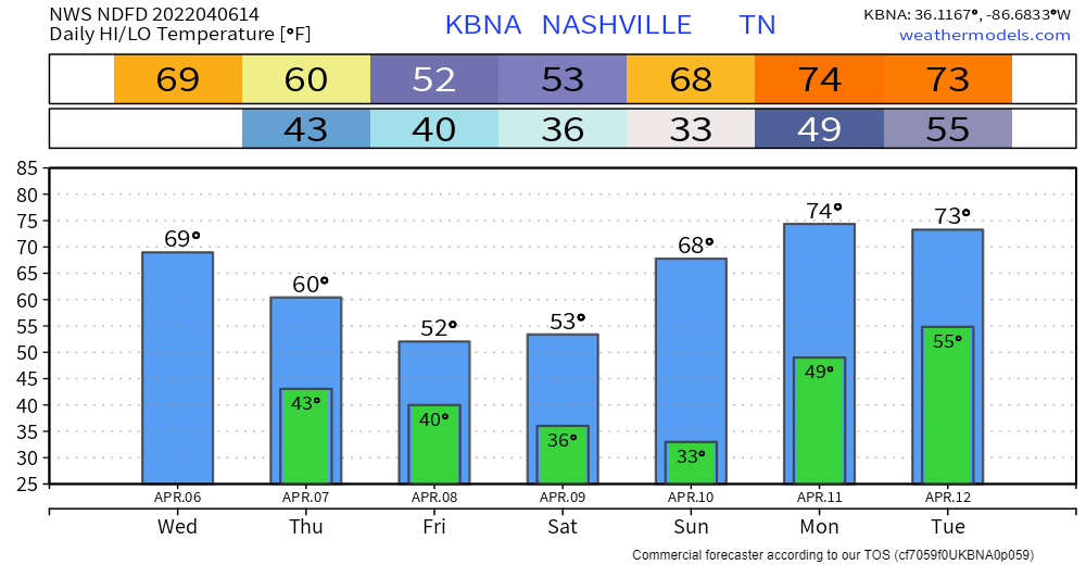
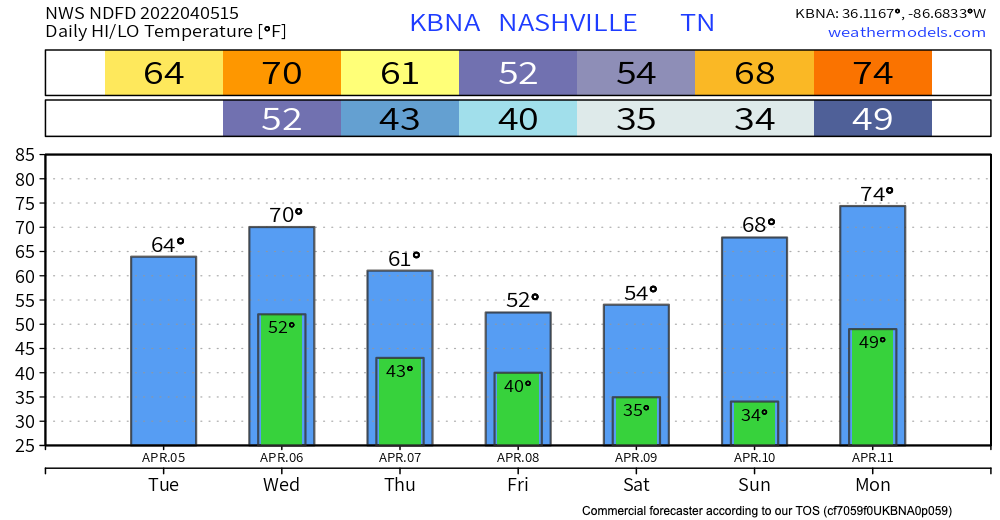
We are warming up nicely today to the low 70s. This is right around average for this time of year. These temps teeter totter in between the upper 60s and low 70s for the first half of the work week.
If you’ve been sneezing because of the yellow stuff on your car, rain is on its way. Some of us may see some light sprinkles throughout today associated with shortwave trough. No threats with these sprinkles and no need to cancel any plans.
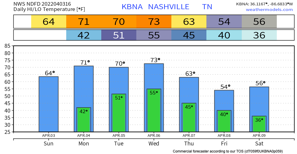
The weekend will closeout nice. Temps in the mid 60’s, sunshine, and no rain. Perfect day to get outside, unless you have allergies. Pollen = yikes.

Monday will be similar to today. Sunny with slightly warmer temps. The GFS model thinks we could get a shower or two tomorrow night. I wouldn’t count on it, but if it were to occur it will be brief and shouldn’t ruin any plans.
You must be logged in to post a comment.