
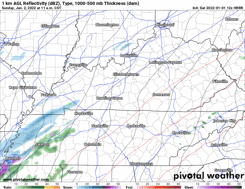
The 13z HRRR model run shows supercells and multicell storm clusters forming ahead of a cold front this afternoon.
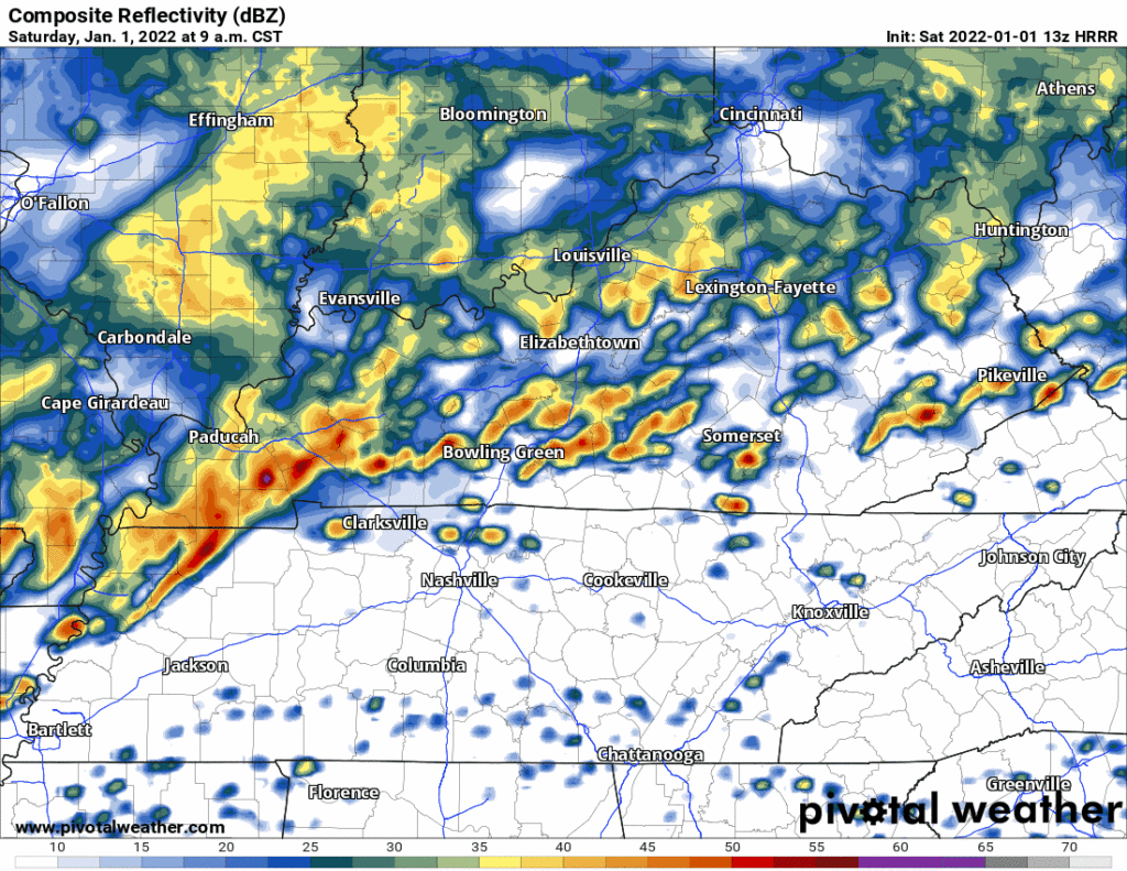
These storms will rotate. Some rotating storms will be capable of producing damaging straight line winds, tornadoes, and hail.
Not that they necessarily will produce tornadoes, but they will have that potential. SPC says these supercells may be able to make a strong tornado (EF2+ or worse).
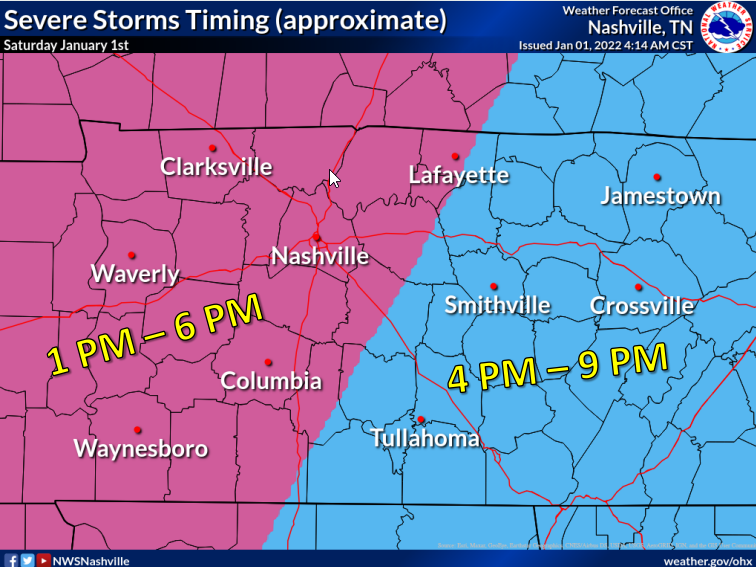
Timing range is 1 PM to 6 PM. Timing may change, stay updated.
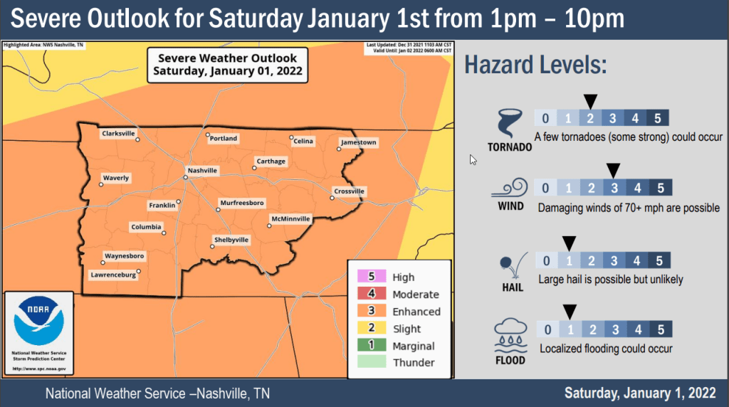
The probability of a tornado happening within 25 miles of you (that’s an area of 1,963.5 miles — that’s a big area!) is 10%.
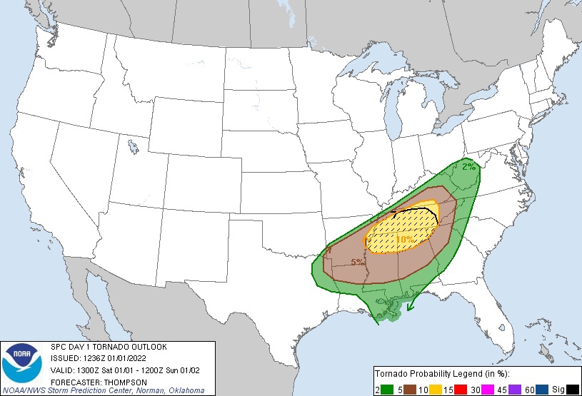
That shaded area means there’s a 10% chance of a strong tornado somewhere inside that giant area.
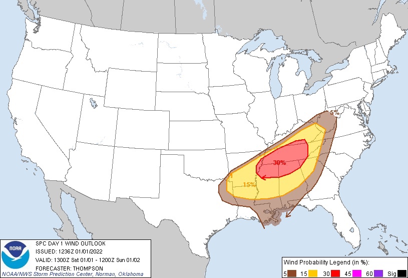
The probability of damaging straight line winds within 25 miles of you is 30%.
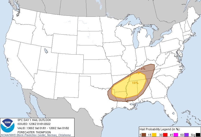
For large hail it’s 15%.
Remember these are only generalized probabilities for the entire region, these are not personal probabilities of something happening directly to you.
A Tornado Watch may have to be issued for this afternoon and early evening. If a Tornado Warning is issued for you, then you need to shelter immediately. A warning is personal and urges you to move to shelter for your safety.
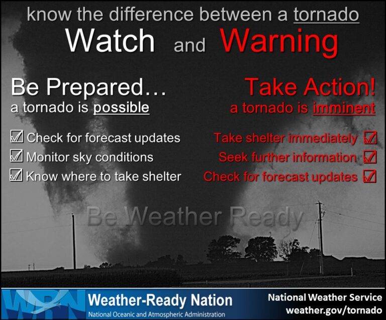
For more about tornado prep, watches, warnings, read this.
Do not leave yourself vulnerable to storms. Be sure you have access to shelter. Stay informed. We will be on Twitter and, if necessary, YouTube Live today. This information may change. We will update it on Twitter.
Davidson County is remains under a Flood Watch until 9PM tonight. Not expecting more than an inch of rain. Flooding is not our main concern.
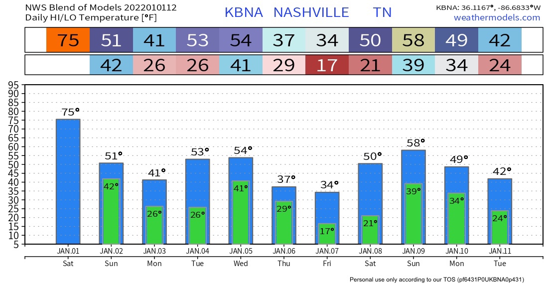
Tonight expect lingering showers as the storm threat ends. Temps will crash tonight through the 40°s into the 30°s Sunday, continuing to fall into the 20°s Monday morning. A few of the models — most surprisingly, the HRRR model, which we love — thinks there will be snow Sunday afternoon during the Titans game.
A few other models agree about this snow, others delay the snow chance until after dark Sunday, and others think it’ll be just rain or nothing at all. We think we may see a few flakes, but there should be no interruption to travel and no accumulation, except perhaps briefly on grassy areas and mailboxes. The ground is very warm and inhospitable to snowflakes. Expect anything in the air to melt almost immediately on contact.
After that, we return to more seasonal winter temps.
Categories: Forecast Blogs (Legacy)
You must be logged in to post a comment.