Cloudy Skies
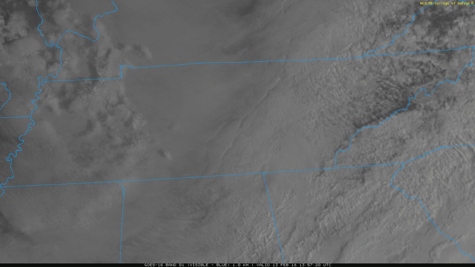
Today will be another one of those gloomy days with clouds hanging around throughout the day. Satellite imagery already shows this blanket of clouds draped across our area.
Current Satellite Imagery

Today will be another one of those gloomy days with clouds hanging around throughout the day. Satellite imagery already shows this blanket of clouds draped across our area.
Current Satellite Imagery
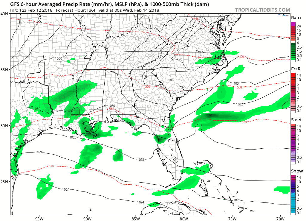
Starting tomorrow night, rain is in the forecast all the way through Sunday. Several pieces of energy are expected to traverse the Tennessee Valley, bringing us a marked increase in rain opportunities.
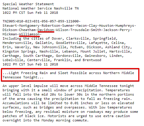
Very light freezing rain is possible tonight and overnight.
Be wary of black ice on elevated surfaces (including bridges and overpasses) tonight, overnight, and during the morning commute.
We are updating this through the evening on Twitter.
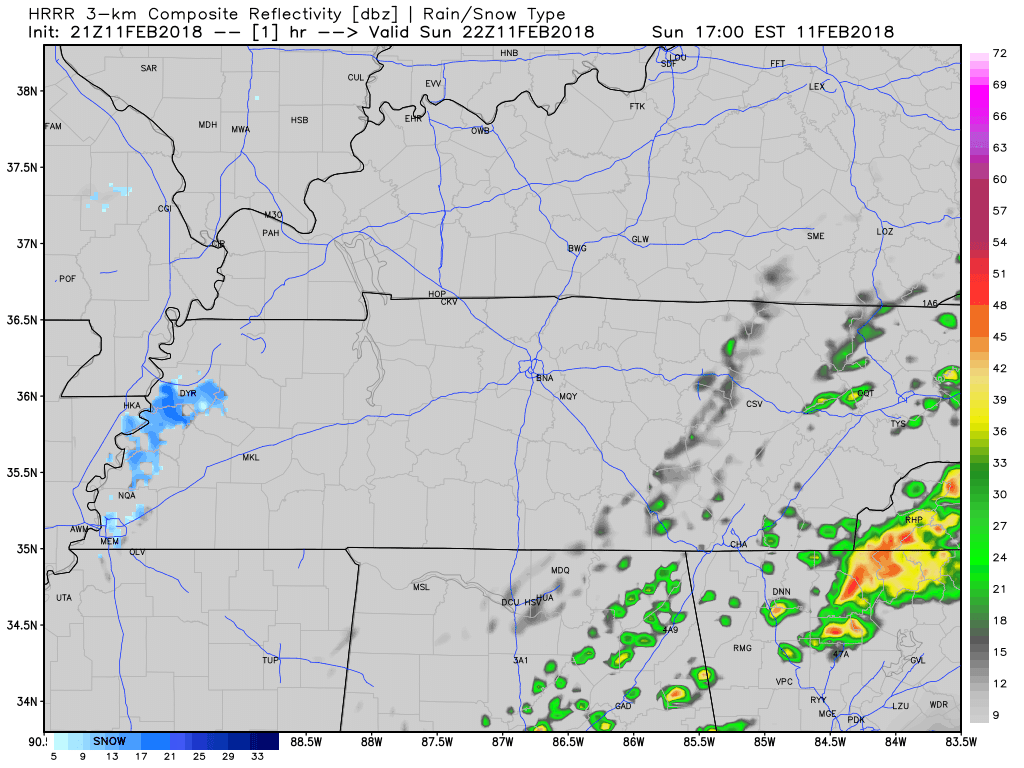
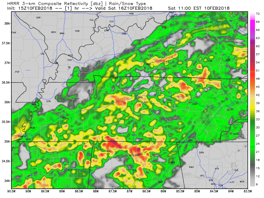
Around midnight, rain will come racing in from the west, with near-freezing temps on its tail. The HRRR model illustrates it. Notice how it turns the precip into frozen precip:
As it passes us, it should fall as rain, with a low probability of sleet mixing in.
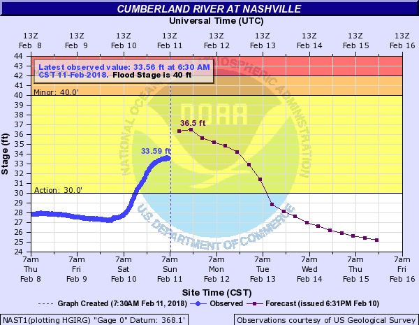
The official rain gauge has 2.55″ from yesterday’s event. While smaller rivers and creeks are dropping, larger rivers are still rising.
The Cumberland River downtown will crest this afternoon:
The rain is here and will stay over the next 24 to 48 hours. Keep the rain boots and umbrella handy.
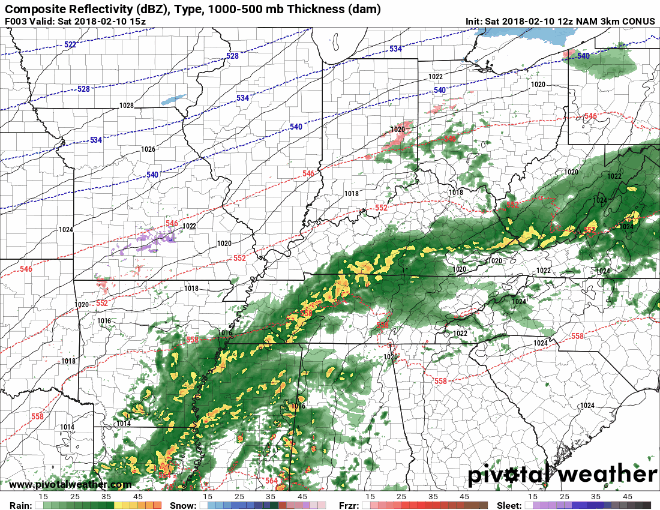
HRRR Loop Now Through 3 AM
NAM3 Loop Now Through 6 AM Monday
Impacts
We will receive a decent amount of rainfall over the course of this system. For this reason, there is a flood watch out for both Davidson and Williamson Counties through tomorrow afternoon.

Remember the scarce playground days during the winter? The one time you get a nice day in mid February, the teachers take recess outside? Today is that day.
And if you are at work, maybe you get lucky enough to have an outdoor lunch. Temperatures will push the middle 60s this afternoon!
Nothing but sunny skies over the next two days.
https://giphy.com/gifs/cmafest-xT0GqHQxfxp6GcwKbu
Highs today will stay around the normal mark, topping off in the mid-40s. Tomorrow, things look to warm up fairly quickly thanks to some southerly wind flow bringing our highs into the low-60s.

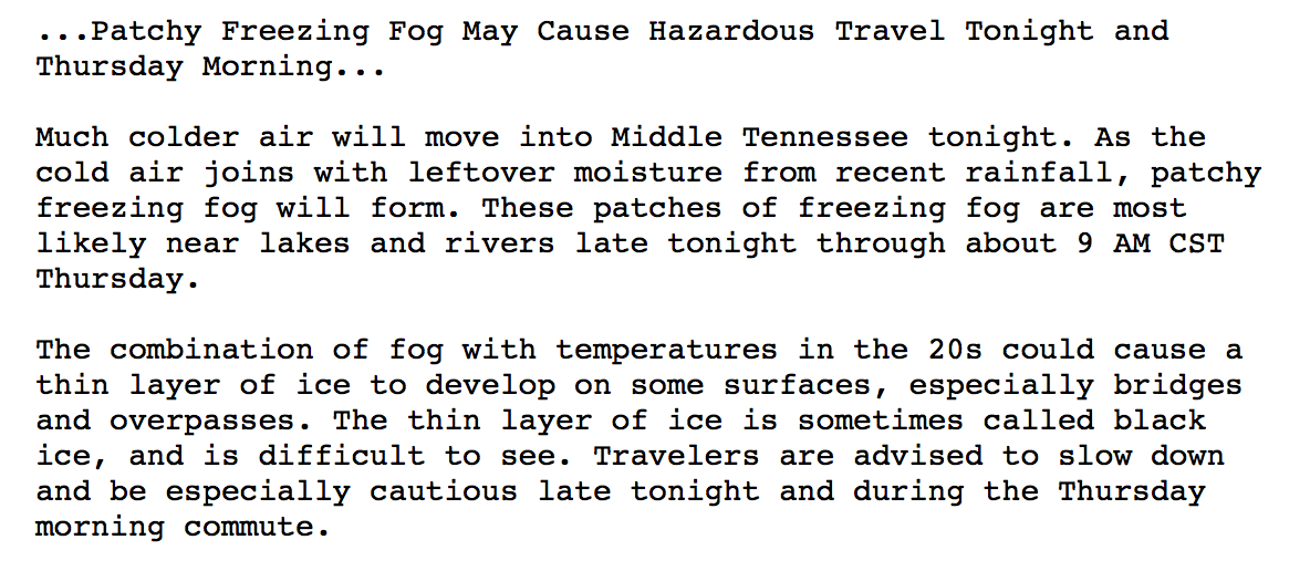
Watch out for icy roads Thursday morning…with temperatures below freezing tonight, patchy freezing fog and black ice are possible.
NWS Nashville Special Weather Statement
Friday, as we’ve been hinting at for much of the week, is the pick day of the forecast. While Thursday does bring the return of the sunshine, high temperatures will struggle to get into the 40s. Friday, a strong surge of warm air will rush in from the south…and with daytime heating, should bump us to 60ºF! Enjoy this, because…
Mostly cloudy skies are hanging over Middle Tennessee for now. Temps will stay just below average with highs in the mid-40s. If you need to get something done outside today, I would go ahead and do it this morning. After lunch, scattered showers with even heavier showers tonight will begin to arrive.
You must be logged in to post a comment.