Rain, Rain, More Rain
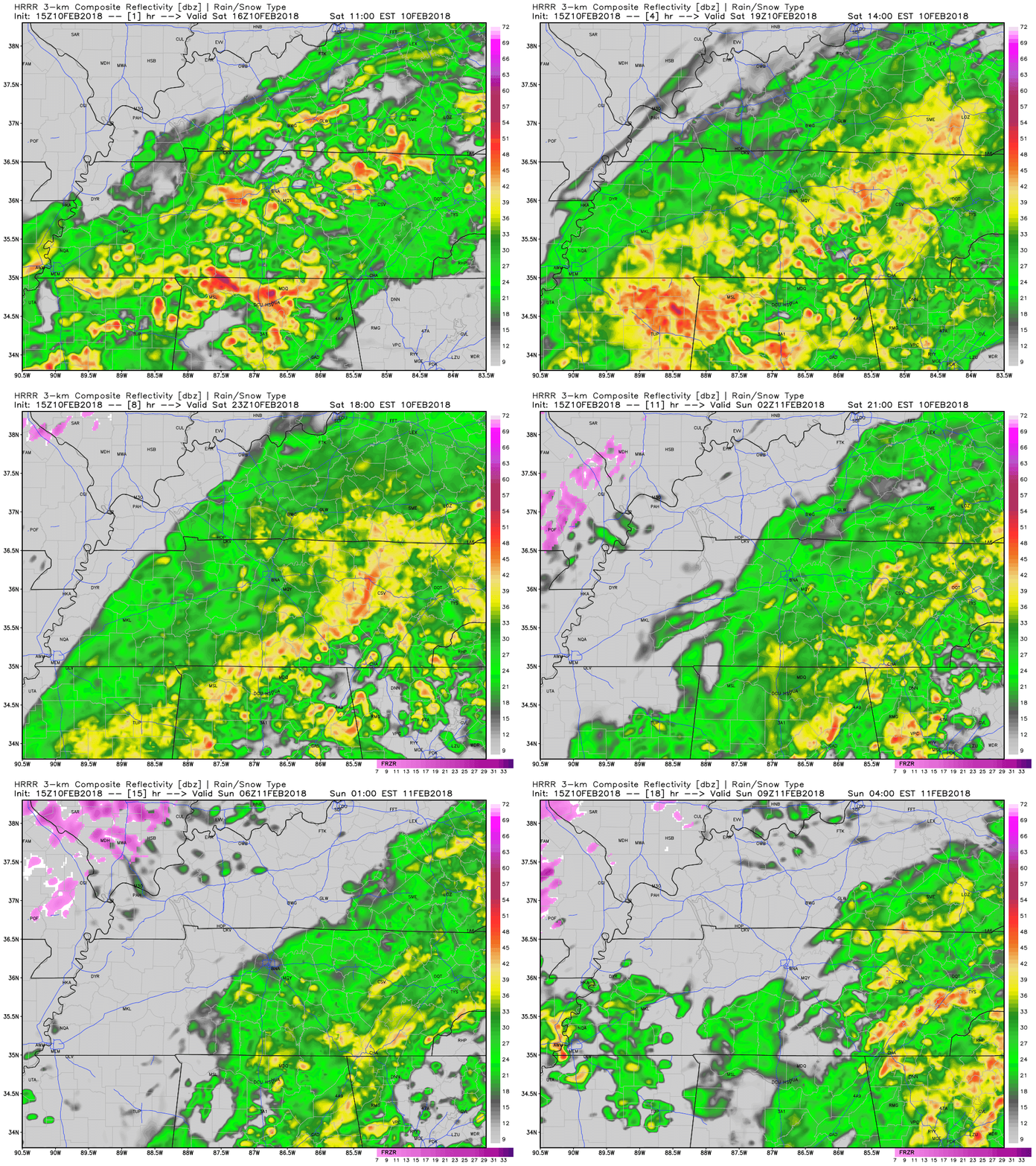
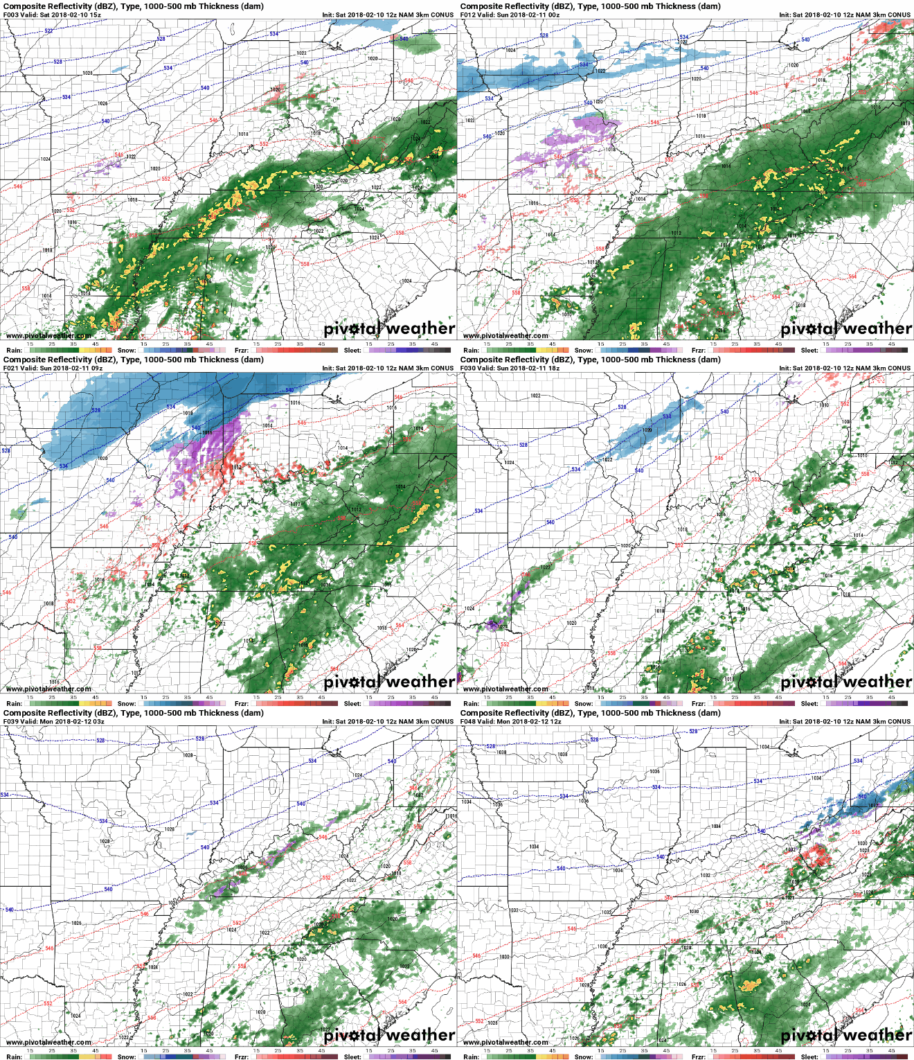
The rain is here and will stay over the next 24 to 48 hours. Keep the rain boots and umbrella handy.
HRRR Loop Now Through 3 AM
NAM3 Loop Now Through 6 AM Monday
Impacts
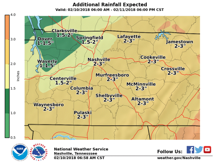
We will receive a decent amount of rainfall over the course of this system. For this reason, there is a flood watch out for both Davidson and Williamson Counties through tomorrow afternoon.
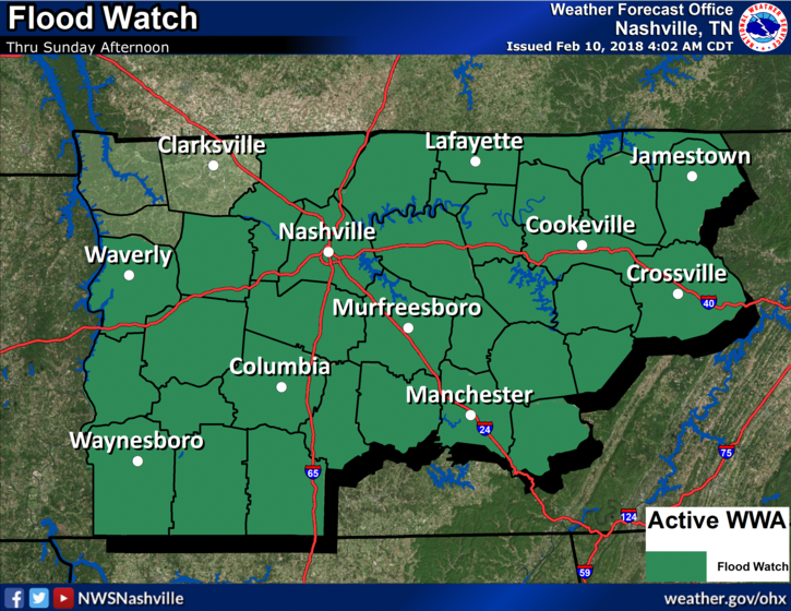
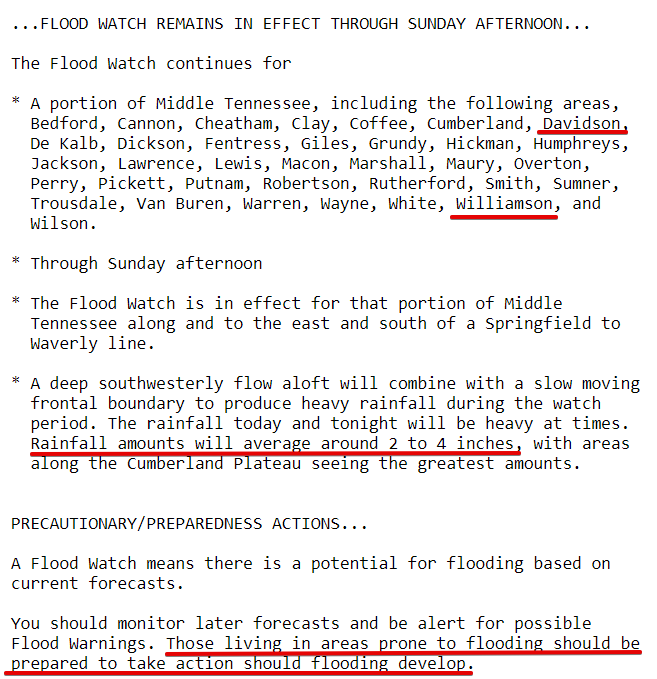
Additionally, the WPC has included us in their “slight risk” for excessive rainfall over the next 24 hours.
Currently under a Flood Watch for gradual rise of rivers and streams. Additionally there’s a 10% to 20% chance of a Flash Flood, where the water rises very quickly. Either way: Road flooded? Turn around, don’t drown. pic.twitter.com/IK4xt4RhdJ
— NashSevereWx (@NashSevereWx) February 10, 2018
Several streams have already reached flood advisory criteria including the Stones River and Richland Creek. The majority of Davidson County is under a flood advisory to reflect these rising streams.
If you happen to come across a flooded road today or tomorrow, remember turn around, don’t drown.
Forecast Rainfall Totals from the NWS
Dry Out Monday/Tuesday, Showers Look to Return by the Middle of Next Week

Monday and Tuesday we may have a few clouds in the sky, but expect for mostly sunny conditions. Temps will be on the average side on Monday topping off in the upper-40s. By Tuesday and continuing through the rest of the week, highs will jump well into the 60s.
Shower chances look to return Tuesday night into Wednesday and continue through the rest of the work week.
Categories: Forecast Blogs (Legacy)


You must be logged in to post a comment.