Headlines
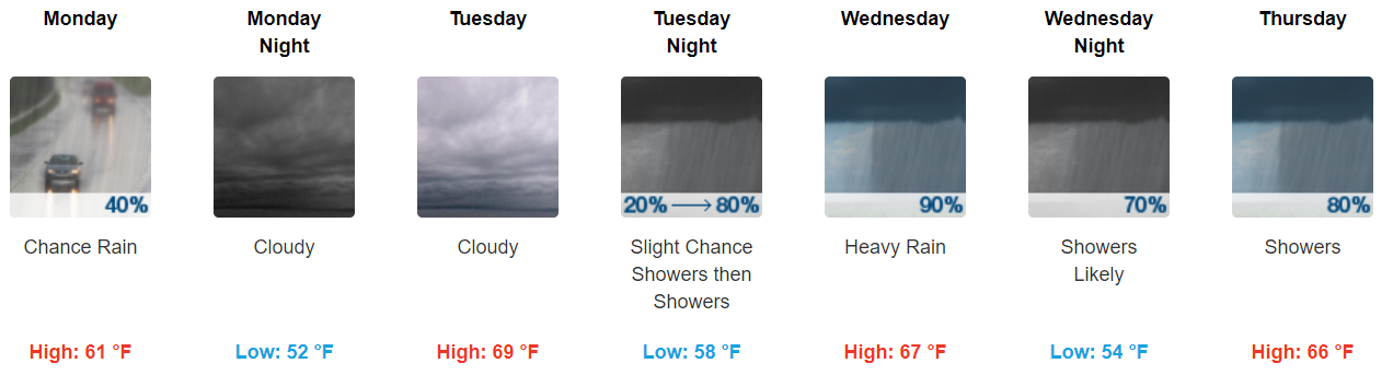
1. Heavy rain showers at times, mainly Tuesday night through Thursday, with some flooding possible.
2. Cloudy all week.
3. No severe thunderstorms expected.
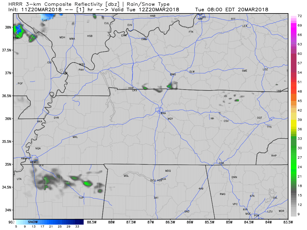
We may see a passing shower or two early this morning. HRRR model thru 8 AM:

1. Heavy rain showers at times, mainly Tuesday night through Thursday, with some flooding possible.
2. Cloudy all week.
3. No severe thunderstorms expected.
We may see a passing shower or two early this morning. HRRR model thru 8 AM:

1. Heavy rain showers at times, mainly Tuesday night through Thursday, with some flooding possible.
2. Cloudy all week.
3. No severe thunderstorms expected.

Drier and cooler air worked in behind the drizzle, rain, and (for those in Nashville) that thunderstorm last night.
It’s cloudy!

Overcast skies are currently widespread and will be hanging out all day, so don’t expect for the sun to break through.
Rain showers will be on and off throughout today and tonight.
For the first time in a few days, the official temperature in Nashville did not hit the freezing mark! We only got down to 36º at the airport.
Overall today, the HRRR model is showing a few scattered showers in the area, with a few of them coming thru this afternoon. Have an umbrella handy.
The freeze warning we’ve been under has expired as of 9 AM this morning.
Your Thursday will start off clear and crisp with temperatures in the mid 40’s. A quick warm up to 55 degrees will have you really feeling like Spring has Sprung!

Snow moved through last night, but noting accumulated here. Those to our north and east did see accumulation, especially in higher elevations. It looks like totals are varying anywhere from 0.5-3”!
Today is the first day of Spring!
https://giphy.com/gifs/spring-school-spongebob-squarepants-X4M6homF66qFq
Unfortunately, it won’t really feel too much like spring today. Chilly and cloudy conditions will prevail through the AM with showers arriving later in the afternoon. Today’s temps look to steadily fall throughout the day.
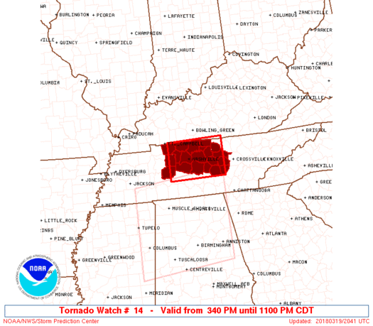
Note: The tornado watch is cancelled.
Oh boy, only in Nashville! Storms this afternoon are quickly moving east and we turn our attention to cooler air and a change in wind direction tonight.
NWS Temperature Trend
Probabilities
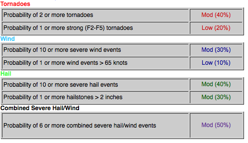

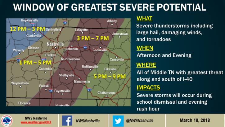
Good morning, all. We are expecting strong to severe thunderstorms today, with all hazards (large hail, damaging winds, tornadoes) possible. Latest runs of the HRRR show that between mid-afternoon and early evening will be our best opportunity for menacing storms to race across Middle Tennessee:
You must be logged in to post a comment.