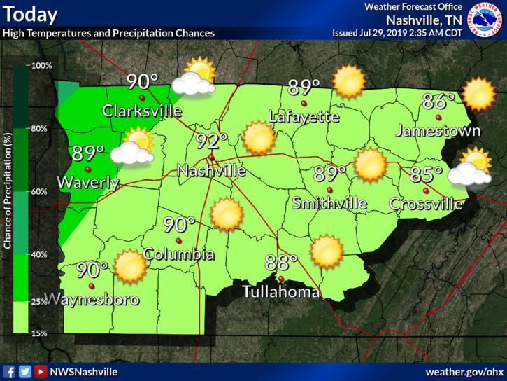
Monday
Typical late July.
Low 90°s high, with clouds building into the night.
A few late night showers may be included in the clouds moving in.
Why? A weak cold front is heading our way.
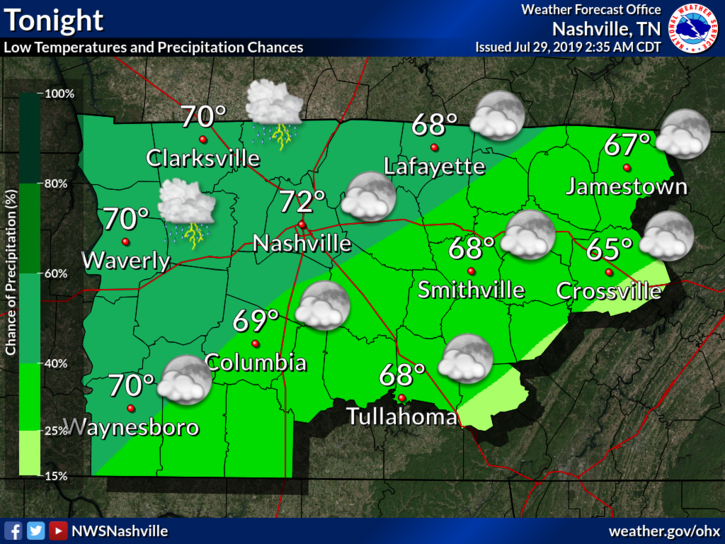
Rain chances will increase as we move into Tuesday.

Typical late July.
Low 90°s high, with clouds building into the night.
A few late night showers may be included in the clouds moving in.
Why? A weak cold front is heading our way.
Rain chances will increase as we move into Tuesday.
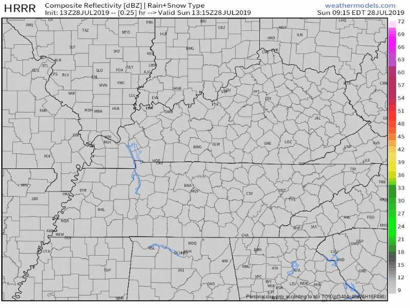
Scattered showers are possible across the region today.
Here’s the HRRR model:
The best timing for these pop-ups will be the afternoon and early evening hours.
It’s hard to say exactly where these will form, so keep an umbrella on hand just in case.

We’ve got another sunny afternoon ahead of us today! As this high pressure continues to move off to the Southwest, we’ll be in great shape to reach the low 90s this afternoon. A bit warmer than earlier this week, but near normal for this time of year. Humidity increases a bit as well along with the temperatures, into the mid 60s, or at the top of the “sticky” section of our dewpoint perception chart:
The high pressure system over the Ohio Valley that brought beautiful and pleasant weather to the Mid State region this week will slowly weaken allowing for warm, moist air to return on southerly winds. This will send our high temperature to 89 degrees today. Dew points will slowly climb into the mid 60s which will make it feel a tad stickier than it has all week.
Beautiful and sunny across the Mid State this afternoon! High temperatures will reach right around 87 degrees but it will be comfortable as dew points remain in the 50s.
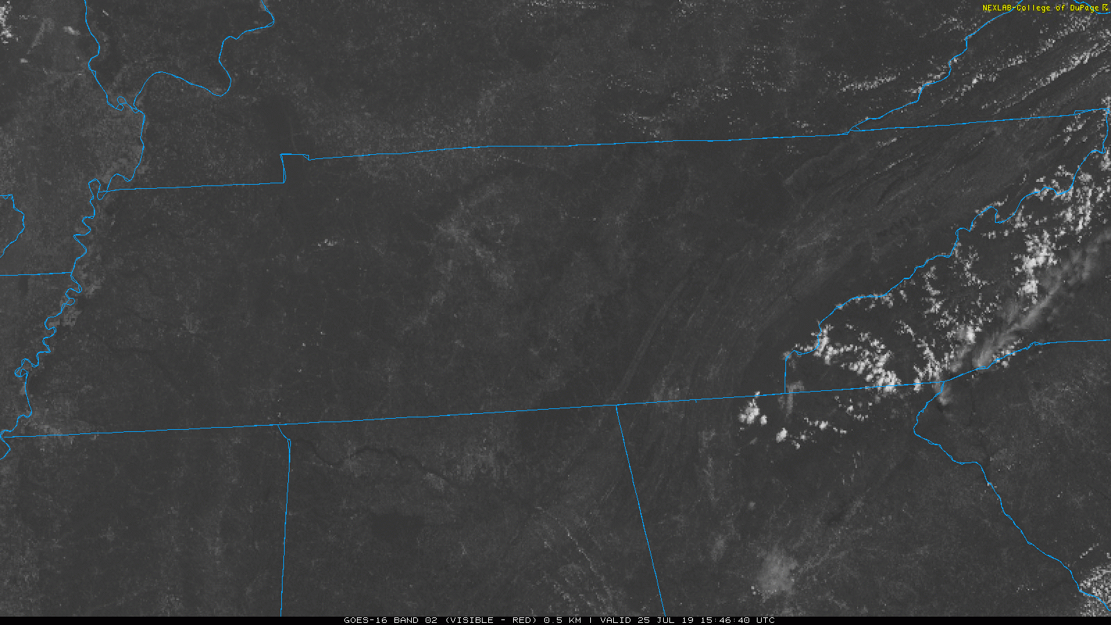
Satellite as of 12:45 pm shows a few clouds forming this afternoon, but nothing to worry about.

Another beautiful and sunny day in store for us in Middle Tennessee this afternoon!
Rain chances? None. All sun and lower temperatures? Definitely!
Today’s high will be near 84°, around 5 degrees below average for this time of year. Dewpoints also will be fairly comfortable, up to 60°.

Fortunately, I have some great news.
All the rain has finally pushed out of the area.
Today’s high temperature will reach a high of 83° (the average is 90°).
Dewpoints will be in the lower 60s and drop to the upper 50s later this evening. For reference:
Flash Flood Warnings are expiring as the rain moves east.
The nasty stuff is gone.

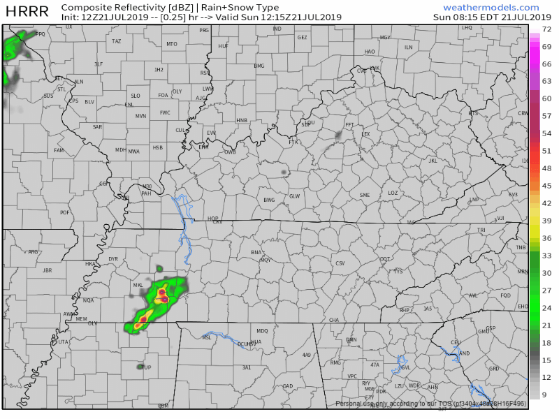
The HRRR model shows a few light showers coming thru late tonight. Clear by sunrise.
Watch the driest air (in blue) come in overnight, then go west toward Memphis, what a tease:
As of 8:41 AM CDT, the temp is 79°F with a dew point of 73°F. Tropical moisture is here, ready for a cold front to tap into it.
This afternoon, cloud cover.
Late this afternoon, the rain begins.
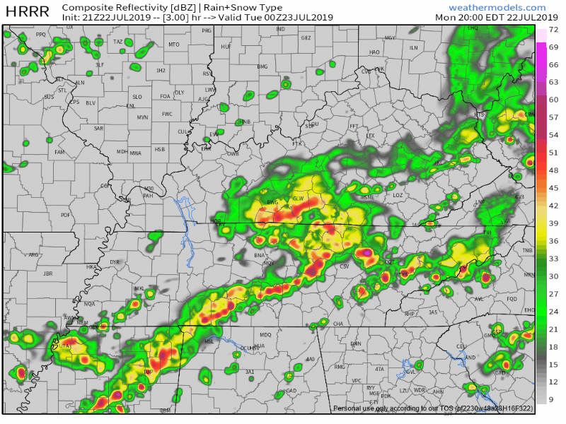
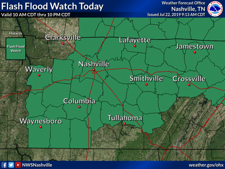
FLASH FLOOD WATCH
If you guessed more scattered showers for today, then you are correct.
Here’s the HRRR model:
Here’s the NAM3 model, which keeps us drier during the day, but gives us some sprinkles of rain tonight:
You must be logged in to post a comment.